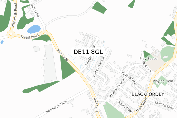
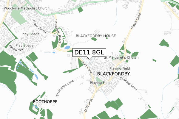
DE11 8GL is located in the Blackfordby electoral ward, within the local authority district of North West Leicestershire and the English Parliamentary constituency of North West Leicestershire. The Sub Integrated Care Board (ICB) Location is NHS Leicester, Leicestershire and Rutland ICB - 04V and the police force is Leicestershire. This postcode has been in use since May 2019.


GetTheData
Source: OS Open Zoomstack (Ordnance Survey)
Licence: Open Government Licence (requires attribution)
Attribution: Contains OS data © Crown copyright and database right 2024
Source: Open Postcode Geo
Licence: Open Government Licence (requires attribution)
Attribution: Contains OS data © Crown copyright and database right 2024; Contains Royal Mail data © Royal Mail copyright and database right 2024; Source: Office for National Statistics licensed under the Open Government Licence v.3.0
| Easting | 432646 |
| Northing | 318148 |
| Latitude | 52.759975 |
| Longitude | -1.517671 |
GetTheData
Source: Open Postcode Geo
Licence: Open Government Licence
| Country | England |
| Postcode District | DE11 |
➜ See where DE11 is on a map ➜ Where is Blackfordby? | |
GetTheData
Source: Land Registry Price Paid Data
Licence: Open Government Licence
| Ward | Blackfordby |
| Constituency | North West Leicestershire |
GetTheData
Source: ONS Postcode Database
Licence: Open Government Licence
2023 14 NOV £407,500 |
2023 9 JUN £382,500 |
2022 12 MAY £495,000 |
2021 21 DEC £280,000 |
2021 8 JUL £350,000 |
2021 18 JUN £485,000 |
2021 3 JUN £445,000 |
2021 19 MAR £358,000 |
25, PICKERING DRIVE, BLACKFORDBY, SWADLINCOTE, DE11 8GL 2020 2 OCT £452,995 |
27, PICKERING DRIVE, BLACKFORDBY, SWADLINCOTE, DE11 8GL 2020 25 AUG £446,995 |
GetTheData
Source: HM Land Registry Price Paid Data
Licence: Contains HM Land Registry data © Crown copyright and database right 2024. This data is licensed under the Open Government Licence v3.0.
| Main Street | Blackfordby | 382m |
| Main Street | Blackfordby | 402m |
| Millfield Street (Ashby Road) | Woodville | 729m |
| Millfield Street (Ashby Road) | Woodville | 739m |
| Beech Drive (Ashby Road) | Woodville | 768m |
GetTheData
Source: NaPTAN
Licence: Open Government Licence
| Percentage of properties with Next Generation Access | 100.0% |
| Percentage of properties with Superfast Broadband | 100.0% |
| Percentage of properties with Ultrafast Broadband | 69.2% |
| Percentage of properties with Full Fibre Broadband | 69.2% |
Superfast Broadband is between 30Mbps and 300Mbps
Ultrafast Broadband is > 300Mbps
| Percentage of properties unable to receive 2Mbps | 0.0% |
| Percentage of properties unable to receive 5Mbps | 0.0% |
| Percentage of properties unable to receive 10Mbps | 0.0% |
| Percentage of properties unable to receive 30Mbps | 0.0% |
GetTheData
Source: Ofcom
Licence: Ofcom Terms of Use (requires attribution)
GetTheData
Source: ONS Postcode Database
Licence: Open Government Licence


➜ Get more ratings from the Food Standards Agency
GetTheData
Source: Food Standards Agency
Licence: FSA terms & conditions
| Last Collection | |||
|---|---|---|---|
| Location | Mon-Fri | Sat | Distance |
| Strawberry Lane | 16:00 | 11:45 | 218m |
| Old Blackfordby Post Office | 16:00 | 11:30 | 378m |
| Reservoir | 16:00 | 11:45 | 776m |
GetTheData
Source: Dracos
Licence: Creative Commons Attribution-ShareAlike
The below table lists the International Territorial Level (ITL) codes (formerly Nomenclature of Territorial Units for Statistics (NUTS) codes) and Local Administrative Units (LAU) codes for DE11 8GL:
| ITL 1 Code | Name |
|---|---|
| TLF | East Midlands (England) |
| ITL 2 Code | Name |
| TLF2 | Leicestershire, Rutland and Northamptonshire |
| ITL 3 Code | Name |
| TLF22 | Leicestershire CC and Rutland |
| LAU 1 Code | Name |
| E07000134 | North West Leicestershire |
GetTheData
Source: ONS Postcode Directory
Licence: Open Government Licence
The below table lists the Census Output Area (OA), Lower Layer Super Output Area (LSOA), and Middle Layer Super Output Area (MSOA) for DE11 8GL:
| Code | Name | |
|---|---|---|
| OA | E00131686 | |
| LSOA | E01025952 | North West Leicestershire 008C |
| MSOA | E02005404 | North West Leicestershire 008 |
GetTheData
Source: ONS Postcode Directory
Licence: Open Government Licence
| DE11 8AR | Fenton Avenue | 74m |
| DE11 8AS | Parkers Close | 166m |
| DE11 8AQ | Strawberry Lane | 198m |
| DE11 8AH | Strawberry Lane | 225m |
| DE11 8AJ | Elstead Lane | 244m |
| DE11 8AG | Well Lane | 285m |
| DE11 8AP | North Close | 308m |
| DE11 8AT | Church Close | 309m |
| DE11 8BG | Butt Lane | 327m |
| DE11 8AW | South Close | 327m |
GetTheData
Source: Open Postcode Geo; Land Registry Price Paid Data
Licence: Open Government Licence