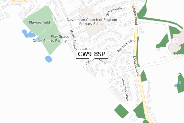
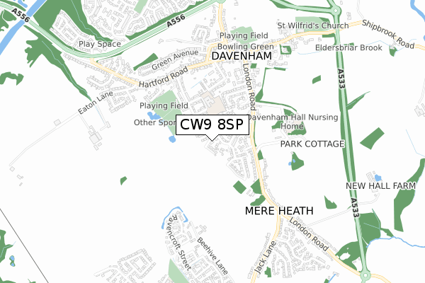
CW9 8SP is located in the Davenham, Moulton & Kingsmead electoral ward, within the unitary authority of Cheshire West and Chester and the English Parliamentary constituency of Eddisbury. The Sub Integrated Care Board (ICB) Location is NHS Cheshire and Merseyside ICB - 27D and the police force is Cheshire. This postcode has been in use since October 2018.


GetTheData
Source: OS Open Zoomstack (Ordnance Survey)
Licence: Open Government Licence (requires attribution)
Attribution: Contains OS data © Crown copyright and database right 2025
Source: Open Postcode Geo
Licence: Open Government Licence (requires attribution)
Attribution: Contains OS data © Crown copyright and database right 2025; Contains Royal Mail data © Royal Mail copyright and database right 2025; Source: Office for National Statistics licensed under the Open Government Licence v.3.0
| Easting | 365803 |
| Northing | 370594 |
| Latitude | 53.231290 |
| Longitude | -2.513748 |
GetTheData
Source: Open Postcode Geo
Licence: Open Government Licence
| Country | England |
| Postcode District | CW9 |
➜ See where CW9 is on a map ➜ Where is Davenham? | |
GetTheData
Source: Land Registry Price Paid Data
Licence: Open Government Licence
| Ward | Davenham, Moulton & Kingsmead |
| Constituency | Eddisbury |
GetTheData
Source: ONS Postcode Database
Licence: Open Government Licence
2024 14 NOV £565,000 |
2023 12 MAY £572,400 |
2022 14 DEC £535,000 |
2022 15 MAR £573,000 |
2020 18 SEP £469,995 |
5, MEREHEATH CLOSE, DAVENHAM, NORTHWICH, CW9 8SP 2020 17 SEP £499,995 |
2020 21 AUG £504,995 |
21, MEREHEATH CLOSE, DAVENHAM, NORTHWICH, CW9 8SP 2020 8 JUN £699,995 |
15, MEREHEATH CLOSE, DAVENHAM, NORTHWICH, CW9 8SP 2020 14 APR £499,995 |
2019 23 MAY £489,995 |
GetTheData
Source: HM Land Registry Price Paid Data
Licence: Contains HM Land Registry data © Crown copyright and database right 2025. This data is licensed under the Open Government Licence v3.0.
| Fountain Court (Mount Pleasant Road) | Davenham | 70m |
| Fountain Court (Mount Pleasant Road) | Davenham | 85m |
| Charles Avenue (Mount Pleasant Road) | Davenham | 215m |
| Charles Avenue (Mount Pleasant Road) | Davenham | 219m |
| Whittington Gardens (London Road) | Davenham | 261m |
| Greenbank Station | 2.6km |
| Hartford Station | 2.9km |
| Northwich Station | 3.5km |
GetTheData
Source: NaPTAN
Licence: Open Government Licence
| Percentage of properties with Next Generation Access | 100.0% |
| Percentage of properties with Superfast Broadband | 100.0% |
| Percentage of properties with Ultrafast Broadband | 100.0% |
| Percentage of properties with Full Fibre Broadband | 100.0% |
Superfast Broadband is between 30Mbps and 300Mbps
Ultrafast Broadband is > 300Mbps
| Percentage of properties unable to receive 2Mbps | 0.0% |
| Percentage of properties unable to receive 5Mbps | 0.0% |
| Percentage of properties unable to receive 10Mbps | 0.0% |
| Percentage of properties unable to receive 30Mbps | 0.0% |
GetTheData
Source: Ofcom
Licence: Ofcom Terms of Use (requires attribution)
GetTheData
Source: ONS Postcode Database
Licence: Open Government Licence


➜ Get more ratings from the Food Standards Agency
GetTheData
Source: Food Standards Agency
Licence: FSA terms & conditions
| Last Collection | |||
|---|---|---|---|
| Location | Mon-Fri | Sat | Distance |
| Moulton So | 16:45 | 11:30 | 949m |
| Whitlow Lane | 16:30 | 09:00 | 1,164m |
| Kingsmead Square | 16:00 | 11:30 | 1,355m |
GetTheData
Source: Dracos
Licence: Creative Commons Attribution-ShareAlike
The below table lists the International Territorial Level (ITL) codes (formerly Nomenclature of Territorial Units for Statistics (NUTS) codes) and Local Administrative Units (LAU) codes for CW9 8SP:
| ITL 1 Code | Name |
|---|---|
| TLD | North West (England) |
| ITL 2 Code | Name |
| TLD6 | Cheshire |
| ITL 3 Code | Name |
| TLD63 | Cheshire West and Chester |
| LAU 1 Code | Name |
| E06000050 | Cheshire West and Chester |
GetTheData
Source: ONS Postcode Directory
Licence: Open Government Licence
The below table lists the Census Output Area (OA), Lower Layer Super Output Area (LSOA), and Middle Layer Super Output Area (MSOA) for CW9 8SP:
| Code | Name | |
|---|---|---|
| OA | E00094292 | |
| LSOA | E01018682 | Cheshire West and Chester 026C |
| MSOA | E02003885 | Cheshire West and Chester 026 |
GetTheData
Source: ONS Postcode Directory
Licence: Open Government Licence
| CW9 8LT | Fountain Lane | 124m |
| CW9 8JH | Mount Pleasant Road | 154m |
| CW9 8JQ | Mount Pleasant Road | 163m |
| CW9 8TA | Whittington Gardens | 179m |
| CW9 8JN | Allen Drive | 200m |
| CW9 8LR | London Road | 204m |
| CW9 8LX | Fountain Lane | 237m |
| CW9 8JW | Charles Avenue | 248m |
| CW9 8LY | Grovemount | 297m |
| CW9 8LW | London Road | 307m |
GetTheData
Source: Open Postcode Geo; Land Registry Price Paid Data
Licence: Open Government Licence