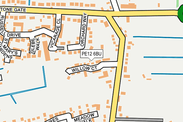
PE12 6BU is located in the Moulton, Weston and Cowbit electoral ward, within the local authority district of South Holland and the English Parliamentary constituency of South Holland and The Deepings. The Sub Integrated Care Board (ICB) Location is NHS Lincolnshire ICB - 71E and the police force is Lincolnshire. This postcode has been in use since July 2017.


GetTheData
Source: OS OpenMap – Local (Ordnance Survey)
Source: OS VectorMap District (Ordnance Survey)
Licence: Open Government Licence (requires attribution)
| Easting | 526467 |
| Northing | 317829 |
| Latitude | 52.743320 |
| Longitude | -0.128021 |
GetTheData
Source: Open Postcode Geo
Licence: Open Government Licence
| Country | England |
| Postcode District | PE12 |
➜ See where PE12 is on a map ➜ Where is Cowbit? | |
GetTheData
Source: Land Registry Price Paid Data
Licence: Open Government Licence
| Ward | Moulton, Weston And Cowbit |
| Constituency | South Holland And The Deepings |
GetTheData
Source: ONS Postcode Database
Licence: Open Government Licence
2024 25 NOV £275,000 |
2024 28 MAR £252,500 |
2024 24 MAR £390,000 |
2023 18 DEC £255,000 |
2022 21 JUN £249,000 |
2022 20 MAY £254,000 |
24, WILLOW COURT, COWBIT, SPALDING, PE12 6BU 2021 8 OCT £176,000 |
2021 16 JUN £247,500 |
2020 15 DEC £245,000 |
2019 4 DEC £241,200 |
GetTheData
Source: HM Land Registry Price Paid Data
Licence: Contains HM Land Registry data © Crown copyright and database right 2025. This data is licensed under the Open Government Licence v3.0.
| Ye Old Dun Cow Ph (Barrier Bank) | Cowbit | 326m |
| Ye Old Dun Cow Ph (Barrier Bank) | Cowbit | 328m |
| Clarkson Avenue (Stone Gate) | Cowbit | 369m |
| Clarkson Avenue (Stone Gate) | Cowbit | 370m |
| Church (Barrier Bank) | Cowbit | 522m |
GetTheData
Source: NaPTAN
Licence: Open Government Licence
| Percentage of properties with Next Generation Access | 100.0% |
| Percentage of properties with Superfast Broadband | 100.0% |
| Percentage of properties with Ultrafast Broadband | 30.2% |
| Percentage of properties with Full Fibre Broadband | 30.2% |
Superfast Broadband is between 30Mbps and 300Mbps
Ultrafast Broadband is > 300Mbps
| Median download speed | 55.0Mbps |
| Average download speed | 50.5Mbps |
| Maximum download speed | 79.84Mbps |
| Median upload speed | 12.9Mbps |
| Average upload speed | 13.1Mbps |
| Maximum upload speed | 20.00Mbps |
| Percentage of properties unable to receive 2Mbps | 0.0% |
| Percentage of properties unable to receive 5Mbps | 0.0% |
| Percentage of properties unable to receive 10Mbps | 0.0% |
| Percentage of properties unable to receive 30Mbps | 0.0% |
GetTheData
Source: Ofcom
Licence: Ofcom Terms of Use (requires attribution)
GetTheData
Source: ONS Postcode Database
Licence: Open Government Licence


➜ Get more ratings from the Food Standards Agency
GetTheData
Source: Food Standards Agency
Licence: FSA terms & conditions
| Last Collection | |||
|---|---|---|---|
| Location | Mon-Fri | Sat | Distance |
| Orchard Way | 17:15 | 10:30 | 209m |
| Backgate | 17:15 | 10:10 | 624m |
| Cowbit Post Office | 17:15 | 11:00 | 681m |
GetTheData
Source: Dracos
Licence: Creative Commons Attribution-ShareAlike
| Risk of PE12 6BU flooding from rivers and sea | Medium |
| ➜ PE12 6BU flood map | |
GetTheData
Source: Open Flood Risk by Postcode
Licence: Open Government Licence
The below table lists the International Territorial Level (ITL) codes (formerly Nomenclature of Territorial Units for Statistics (NUTS) codes) and Local Administrative Units (LAU) codes for PE12 6BU:
| ITL 1 Code | Name |
|---|---|
| TLF | East Midlands (England) |
| ITL 2 Code | Name |
| TLF3 | Lincolnshire |
| ITL 3 Code | Name |
| TLF30 | Lincolnshire CC |
| LAU 1 Code | Name |
| E07000140 | South Holland |
GetTheData
Source: ONS Postcode Directory
Licence: Open Government Licence
The below table lists the Census Output Area (OA), Lower Layer Super Output Area (LSOA), and Middle Layer Super Output Area (MSOA) for PE12 6BU:
| Code | Name | |
|---|---|---|
| OA | E00133486 | |
| LSOA | E01026284 | South Holland 011C |
| MSOA | E02005475 | South Holland 011 |
GetTheData
Source: ONS Postcode Directory
Licence: Open Government Licence
| PE12 6XW | Vicarage Close | 127m |
| PE12 6XA | Orchard Way | 131m |
| PE12 6FN | Meadow Walk | 131m |
| PE12 6XL | Glebe Walk | 159m |
| PE12 6FB | Curlew Drive | 181m |
| PE12 6FL | The Pastures | 199m |
| PE12 6XH | Russell Drive | 221m |
| PE12 6XJ | St Marys Gardens | 222m |
| PE12 6AH | Stonegate | 229m |
| PE12 6XG | Teal Grove | 238m |
GetTheData
Source: Open Postcode Geo; Land Registry Price Paid Data
Licence: Open Government Licence