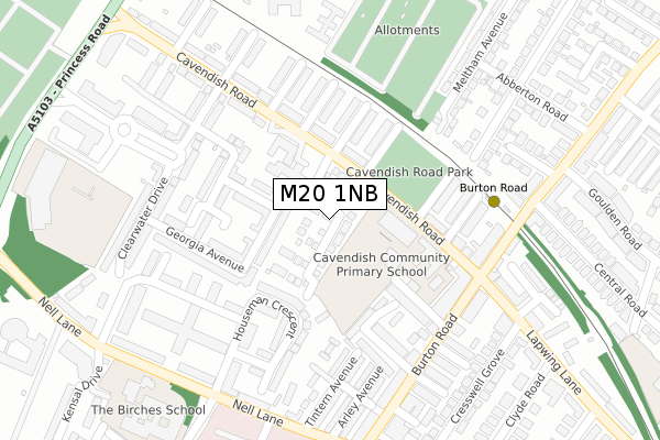
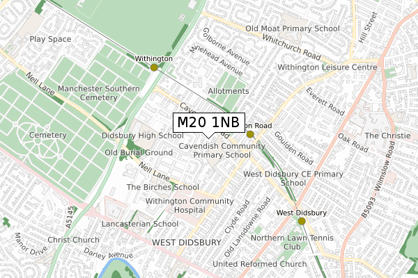
M20 1NB is located in the Didsbury West electoral ward, within the metropolitan district of Manchester and the English Parliamentary constituency of Manchester, Withington. The Sub Integrated Care Board (ICB) Location is NHS Greater Manchester ICB - 14L and the police force is Greater Manchester. This postcode has been in use since May 2018.


GetTheData
Source: OS Open Zoomstack (Ordnance Survey)
Licence: Open Government Licence (requires attribution)
Attribution: Contains OS data © Crown copyright and database right 2024
Source: Open Postcode Geo
Licence: Open Government Licence (requires attribution)
Attribution: Contains OS data © Crown copyright and database right 2024; Contains Royal Mail data © Royal Mail copyright and database right 2024; Source: Office for National Statistics licensed under the Open Government Licence v.3.0
| Easting | 383855 |
| Northing | 392488 |
| Latitude | 53.428946 |
| Longitude | -2.244447 |
GetTheData
Source: Open Postcode Geo
Licence: Open Government Licence
| Country | England |
| Postcode District | M20 |
➜ See where M20 is on a map ➜ Where is Manchester? | |
GetTheData
Source: Land Registry Price Paid Data
Licence: Open Government Licence
| Ward | Didsbury West |
| Constituency | Manchester, Withington |
GetTheData
Source: ONS Postcode Database
Licence: Open Government Licence
2023 23 AUG £800,000 |
2023 20 APR £900,500 |
2022 31 AUG £575,000 |
31, TODDBROOK CLOSE, MANCHESTER, M20 1NB 2020 23 JUL £784,995 |
2019 13 DEC £784,995 |
33, TODDBROOK CLOSE, MANCHESTER, M20 1NB 2019 7 NOV £779,995 |
34, TODDBROOK CLOSE, MANCHESTER, M20 1NB 2019 25 OCT £769,995 |
35, TODDBROOK CLOSE, MANCHESTER, M20 1NB 2019 3 OCT £759,995 |
1, TODDBROOK CLOSE, MANCHESTER, M20 1NB 2019 20 SEP £634,995 |
26, TODDBROOK CLOSE, MANCHESTER, M20 1NB 2019 26 JUL £599,995 |
GetTheData
Source: HM Land Registry Price Paid Data
Licence: Contains HM Land Registry data © Crown copyright and database right 2024. This data is licensed under the Open Government Licence v3.0.
| Cavendish Rd/Buxton Ave (Cavendish Rd) | West Didsbury | 144m |
| Burton Rd/The Metropolitan (Burton Rd) | West Didsbury | 232m |
| Burton Rd/The Metropolitan (Burton Rd) | West Didsbury | 244m |
| Lapwing Ln/Clyde Rd (Lapwing Ln) | West Didsbury | 342m |
| Burton Rd/Withington Community Hosp (Burton Road) | West Didsbury | 347m |
| Burton Road (Manchester Metrolink) (Burton Road) | West Didsbury | 250m |
| Withington (Manchester Metrolink) (Princess Road) | Withington | 542m |
| West Didsbury (Manchester Metrolink) (Lapwing Lane) | West Didsbury | 748m |
| Didsbury Village (Manchester Metrolink) (Olive Shapley Avenue) | Didsbury | 1,720m |
| St Werburgh's Road (Manchester Metrolink) (St Werburgh's Road) | Chorlton | 1,770m |
| Burnage Station | 2.1km |
| Mauldeth Road Station | 2.4km |
| East Didsbury Station | 2.6km |
GetTheData
Source: NaPTAN
Licence: Open Government Licence
| Percentage of properties with Next Generation Access | 100.0% |
| Percentage of properties with Superfast Broadband | 100.0% |
| Percentage of properties with Ultrafast Broadband | 100.0% |
| Percentage of properties with Full Fibre Broadband | 100.0% |
Superfast Broadband is between 30Mbps and 300Mbps
Ultrafast Broadband is > 300Mbps
| Percentage of properties unable to receive 2Mbps | 0.0% |
| Percentage of properties unable to receive 5Mbps | 0.0% |
| Percentage of properties unable to receive 10Mbps | 0.0% |
| Percentage of properties unable to receive 30Mbps | 0.0% |
GetTheData
Source: Ofcom
Licence: Ofcom Terms of Use (requires attribution)
GetTheData
Source: ONS Postcode Database
Licence: Open Government Licence


➜ Get more ratings from the Food Standards Agency
GetTheData
Source: Food Standards Agency
Licence: FSA terms & conditions
| Last Collection | |||
|---|---|---|---|
| Location | Mon-Fri | Sat | Distance |
| Opp 36 Cavendish Road | 17:30 | 12:00 | 98m |
| Bottesford Ave / Burton Road | 17:30 | 12:00 | 299m |
| Dermot Murphey Close | 17:30 | 12:00 | 368m |
GetTheData
Source: Dracos
Licence: Creative Commons Attribution-ShareAlike
The below table lists the International Territorial Level (ITL) codes (formerly Nomenclature of Territorial Units for Statistics (NUTS) codes) and Local Administrative Units (LAU) codes for M20 1NB:
| ITL 1 Code | Name |
|---|---|
| TLD | North West (England) |
| ITL 2 Code | Name |
| TLD3 | Greater Manchester |
| ITL 3 Code | Name |
| TLD33 | Manchester |
| LAU 1 Code | Name |
| E08000003 | Manchester |
GetTheData
Source: ONS Postcode Directory
Licence: Open Government Licence
The below table lists the Census Output Area (OA), Lower Layer Super Output Area (LSOA), and Middle Layer Super Output Area (MSOA) for M20 1NB:
| Code | Name | |
|---|---|---|
| OA | E00175889 | |
| LSOA | E01033671 | Manchester 039F |
| MSOA | E02001083 | Manchester 039 |
GetTheData
Source: ONS Postcode Directory
Licence: Open Government Licence
| M20 1LY | Georgia Avenue | 90m |
| M20 1QE | Cavendish Road | 110m |
| M20 1LX | Georgia Avenue | 116m |
| M20 1QD | Cavendish Avenue | 143m |
| M20 1JS | Matlock Avenue | 147m |
| M20 2LB | Orchard Grove | 155m |
| M20 1QB | Cavendish Road | 160m |
| M20 1LW | Robert Harrison Avenue | 170m |
| M20 1QF | Cavendish Road | 171m |
| M20 1LJ | Vicker Grove | 177m |
GetTheData
Source: Open Postcode Geo; Land Registry Price Paid Data
Licence: Open Government Licence