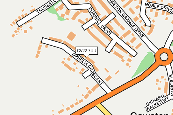
CV22 7UU is located in the Admirals and Cawston electoral ward, within the local authority district of Rugby and the English Parliamentary constituency of Kenilworth and Southam. The Sub Integrated Care Board (ICB) Location is NHS Coventry and Warwickshire ICB - B2M3M and the police force is Warwickshire. This postcode has been in use since June 2017.


GetTheData
Source: OS OpenMap – Local (Ordnance Survey)
Source: OS VectorMap District (Ordnance Survey)
Licence: Open Government Licence (requires attribution)
| Easting | 447093 |
| Northing | 273371 |
| Latitude | 52.356402 |
| Longitude | -1.309942 |
GetTheData
Source: Open Postcode Geo
Licence: Open Government Licence
| Country | England |
| Postcode District | CV22 |
➜ See where CV22 is on a map ➜ Where is Cawston? | |
GetTheData
Source: Land Registry Price Paid Data
Licence: Open Government Licence
| Ward | Admirals And Cawston |
| Constituency | Kenilworth And Southam |
GetTheData
Source: ONS Postcode Database
Licence: Open Government Licence
2023 20 APR £585,000 |
2021 26 MAR £518,000 |
2020 11 DEC £530,000 |
13A, OPHELIA CRESCENT, CAWSTON, RUGBY, CV22 7UU 2020 12 FEB £349,995 |
1, OPHELIA CRESCENT, CAWSTON, RUGBY, CV22 7UU 2019 20 DEC £459,995 |
2019 13 SEP £355,000 |
3, OPHELIA CRESCENT, CAWSTON, RUGBY, CV22 7UU 2019 20 AUG £384,995 |
13B, OPHELIA CRESCENT, CAWSTON, RUGBY, CV22 7UU 2019 26 APR £379,995 |
23, OPHELIA CRESCENT, CAWSTON, RUGBY, CV22 7UU 2019 5 APR £489,995 |
21, OPHELIA CRESCENT, CAWSTON, RUGBY, CV22 7UU 2018 14 DEC £519,995 |
GetTheData
Source: HM Land Registry Price Paid Data
Licence: Contains HM Land Registry data © Crown copyright and database right 2024. This data is licensed under the Open Government Licence v3.0.
| Cawston Lane (Coventry Road) | Cawston | 181m |
| Cawston Lane (Coventry Road) | Cawston | 200m |
| Trussell Way (Cawston Grange Drive) | Cawston | 224m |
| Edwin Close (Calvestone Road) | Cawston | 438m |
| The Crescent (Calvestone Road) | Cawston | 547m |
| Rugby Station | 4.8km |
GetTheData
Source: NaPTAN
Licence: Open Government Licence
| Percentage of properties with Next Generation Access | 100.0% |
| Percentage of properties with Superfast Broadband | 100.0% |
| Percentage of properties with Ultrafast Broadband | 78.0% |
| Percentage of properties with Full Fibre Broadband | 0.0% |
Superfast Broadband is between 30Mbps and 300Mbps
Ultrafast Broadband is > 300Mbps
| Median download speed | 55.0Mbps |
| Average download speed | 81.6Mbps |
| Maximum download speed | 350.00Mbps |
| Median upload speed | 1.1Mbps |
| Average upload speed | 7.1Mbps |
| Maximum upload speed | 20.00Mbps |
| Percentage of properties unable to receive 2Mbps | 0.0% |
| Percentage of properties unable to receive 5Mbps | 0.0% |
| Percentage of properties unable to receive 10Mbps | 0.0% |
| Percentage of properties unable to receive 30Mbps | 0.0% |
GetTheData
Source: Ofcom
Licence: Ofcom Terms of Use (requires attribution)
GetTheData
Source: ONS Postcode Database
Licence: Open Government Licence


➜ Get more ratings from the Food Standards Agency
GetTheData
Source: Food Standards Agency
Licence: FSA terms & conditions
| Last Collection | |||
|---|---|---|---|
| Location | Mon-Fri | Sat | Distance |
| Fir Tree Lane | 16:45 | 09:15 | 242m |
| Gerard Road | 16:45 | 11:00 | 523m |
| Lawford Heath | 16:30 | 11:00 | 1,102m |
GetTheData
Source: Dracos
Licence: Creative Commons Attribution-ShareAlike
The below table lists the International Territorial Level (ITL) codes (formerly Nomenclature of Territorial Units for Statistics (NUTS) codes) and Local Administrative Units (LAU) codes for CV22 7UU:
| ITL 1 Code | Name |
|---|---|
| TLG | West Midlands (England) |
| ITL 2 Code | Name |
| TLG1 | Herefordshire, Worcestershire and Warwickshire |
| ITL 3 Code | Name |
| TLG13 | Warwickshire CC |
| LAU 1 Code | Name |
| E07000220 | Rugby |
GetTheData
Source: ONS Postcode Directory
Licence: Open Government Licence
The below table lists the Census Output Area (OA), Lower Layer Super Output Area (LSOA), and Middle Layer Super Output Area (MSOA) for CV22 7UU:
| Code | Name | |
|---|---|---|
| OA | E00168324 | |
| LSOA | E01031147 | Rugby 012A |
| MSOA | E02006503 | Rugby 012 |
GetTheData
Source: ONS Postcode Directory
Licence: Open Government Licence
| CV22 7GW | Durrell Drive | 108m |
| CV22 7RZ | Coventry Road | 145m |
| CV22 7FJ | Saxon Close | 254m |
| CV22 7GL | Cave Close | 280m |
| CV22 7FL | Noble Drive | 287m |
| CV22 7FH | Clement Way | 314m |
| CV22 7RY | Coventry Road | 327m |
| CV22 7FN | Calvestone Place | 370m |
| CV22 7GN | Brudenell Close | 371m |
| CV22 7GR | Planter Close | 399m |
GetTheData
Source: Open Postcode Geo; Land Registry Price Paid Data
Licence: Open Government Licence