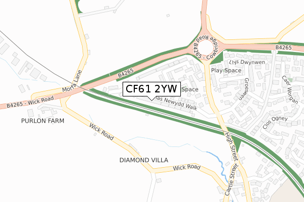
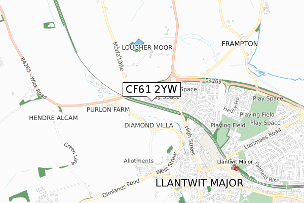
CF61 2YW is located in the Llantwit Major electoral ward, within the unitary authority of Vale of Glamorgan and the Welsh Parliamentary constituency of Vale of Glamorgan. The Local Health Board is Cardiff and Vale University and the police force is South Wales. This postcode has been in use since May 2019.


GetTheData
Source: OS Open Zoomstack (Ordnance Survey)
Licence: Open Government Licence (requires attribution)
Attribution: Contains OS data © Crown copyright and database right 2024
Source: Open Postcode Geo
Licence: Open Government Licence (requires attribution)
Attribution: Contains OS data © Crown copyright and database right 2024; Contains Royal Mail data © Royal Mail copyright and database right 2024; Source: Office for National Statistics licensed under the Open Government Licence v.3.0
| Easting | 296402 |
| Northing | 169515 |
| Latitude | 51.415155 |
| Longitude | -3.491124 |
GetTheData
Source: Open Postcode Geo
Licence: Open Government Licence
| Country | Wales |
| Postcode District | CF61 |
➜ See where CF61 is on a map ➜ Where is Llantwit Major? | |
GetTheData
Source: Land Registry Price Paid Data
Licence: Open Government Licence
| Ward | Llantwit Major |
| Constituency | Vale Of Glamorgan |
GetTheData
Source: ONS Postcode Database
Licence: Open Government Licence
2024 14 AUG £425,000 |
2023 17 NOV £425,000 |
2023 20 JUL £450,000 |
2022 18 NOV £468,000 |
2022 8 JUL £385,000 |
2022 10 JUN £299,950 |
56, PLASNEWYDD WALK, LLANTWIT MAJOR, CF61 2YW 2021 23 APR £295,000 |
1, PLASNEWYDD WALK, LLANTWIT MAJOR, CF61 2YW 2021 12 FEB £300,000 |
2, PLASNEWYDD WALK, LLANTWIT MAJOR, CF61 2YW 2020 21 DEC £331,995 |
2020 23 OCT £289,995 |
GetTheData
Source: HM Land Registry Price Paid Data
Licence: Contains HM Land Registry data © Crown copyright and database right 2024. This data is licensed under the Open Government Licence v3.0.
| Pentre Cwrt (Heol Pentre`r Cwrt) | Llantwit Major | 582m |
| St Illtyd`s Primary School (Station Road) | Llantwit Major | 764m |
| Old Swan Inn (Church Street) | Llantwit Major | 854m |
| Grange Gardens (Llanmaes Road) | Llantwit Major | 941m |
| Grange Gardens (Llanmaes Road) | Llantwit Major | 950m |
| Llantwit Major Station | 0.9km |
GetTheData
Source: NaPTAN
Licence: Open Government Licence
| Percentage of properties with Next Generation Access | 77.1% |
| Percentage of properties with Superfast Broadband | 74.3% |
| Percentage of properties with Ultrafast Broadband | 0.0% |
| Percentage of properties with Full Fibre Broadband | 0.0% |
Superfast Broadband is between 30Mbps and 300Mbps
Ultrafast Broadband is > 300Mbps
| Percentage of properties unable to receive 2Mbps | 22.9% |
| Percentage of properties unable to receive 5Mbps | 22.9% |
| Percentage of properties unable to receive 10Mbps | 22.9% |
| Percentage of properties unable to receive 30Mbps | 25.7% |
GetTheData
Source: Ofcom
Licence: Ofcom Terms of Use (requires attribution)
GetTheData
Source: ONS Postcode Database
Licence: Open Government Licence


➜ Get more ratings from the Food Standards Agency
GetTheData
Source: Food Standards Agency
Licence: FSA terms & conditions
| Last Collection | |||
|---|---|---|---|
| Location | Mon-Fri | Sat | Distance |
| Caer Worgan | 16:15 | 11:15 | 546m |
| Old School | 16:45 | 11:15 | 759m |
| Boverton Road | 16:45 | 11:15 | 1,045m |
GetTheData
Source: Dracos
Licence: Creative Commons Attribution-ShareAlike
The below table lists the International Territorial Level (ITL) codes (formerly Nomenclature of Territorial Units for Statistics (NUTS) codes) and Local Administrative Units (LAU) codes for CF61 2YW:
| ITL 1 Code | Name |
|---|---|
| TLL | Wales |
| ITL 2 Code | Name |
| TLL2 | East Wales |
| ITL 3 Code | Name |
| TLL22 | Cardiff and Vale of Glamorgan |
| LAU 1 Code | Name |
| W06000014 | Vale of Glamorgan |
GetTheData
Source: ONS Postcode Directory
Licence: Open Government Licence
The below table lists the Census Output Area (OA), Lower Layer Super Output Area (LSOA), and Middle Layer Super Output Area (MSOA) for CF61 2YW:
| Code | Name | |
|---|---|---|
| OA | W00005862 | |
| LSOA | W01001110 | The Vale of Glamorgan 011D |
| MSOA | W02000247 | The Vale of Glamorgan 011 |
GetTheData
Source: ONS Postcode Directory
Licence: Open Government Licence
| CF61 2YS | Cowbridge Road | 205m |
| CF61 2UF | Llys Steffan | 242m |
| CF61 2UA | Groeswen | 298m |
| CF61 2UH | Llys Dwynwen | 327m |
| CF61 2UB | Llys Dewi | 350m |
| CF61 2UD | Llys Teilo | 368m |
| CF61 2SQ | Caer Ty Clwyd | 426m |
| CF61 2SP | Caer Worgan | 447m |
| CF61 1YU | Wick Road | 452m |
| CF61 2SN | Clos Ogney | 456m |
GetTheData
Source: Open Postcode Geo; Land Registry Price Paid Data
Licence: Open Government Licence