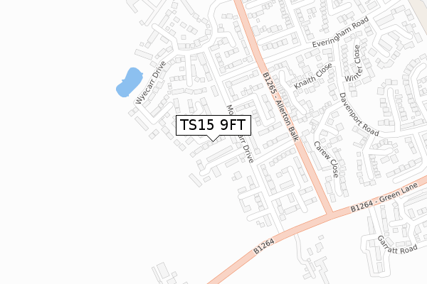
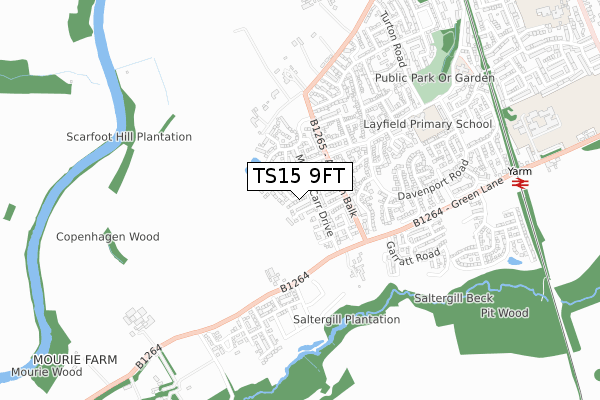
TS15 9FT is located in the Yarm electoral ward, within the unitary authority of Stockton-on-Tees and the English Parliamentary constituency of Stockton South. The Sub Integrated Care Board (ICB) Location is NHS North East and North Cumbria ICB - 16C and the police force is Cleveland. This postcode has been in use since April 2020.


GetTheData
Source: OS Open Zoomstack (Ordnance Survey)
Licence: Open Government Licence (requires attribution)
Attribution: Contains OS data © Crown copyright and database right 2024
Source: Open Postcode Geo
Licence: Open Government Licence (requires attribution)
Attribution: Contains OS data © Crown copyright and database right 2024; Contains Royal Mail data © Royal Mail copyright and database right 2024; Source: Office for National Statistics licensed under the Open Government Licence v.3.0
| Easting | 441125 |
| Northing | 511006 |
| Latitude | 54.492739 |
| Longitude | -1.366628 |
GetTheData
Source: Open Postcode Geo
Licence: Open Government Licence
| Country | England |
| Postcode District | TS15 |
➜ See where TS15 is on a map ➜ Where is Yarm? | |
GetTheData
Source: Land Registry Price Paid Data
Licence: Open Government Licence
| Ward | Yarm |
| Constituency | Stockton South |
GetTheData
Source: ONS Postcode Database
Licence: Open Government Licence
2023 24 FEB £460,000 |
19, PIT WOOD DRIVE, YARM, TS15 9FT 2021 16 NOV £471,195 |
2021 2 NOV £460,000 |
48, PIT WOOD DRIVE, YARM, TS15 9FT 2021 24 SEP £487,995 |
35, PIT WOOD DRIVE, YARM, TS15 9FT 2021 24 SEP £484,995 |
2, PIT WOOD DRIVE, YARM, TS15 9FT 2021 23 SEP £369,695 |
4, PIT WOOD DRIVE, YARM, TS15 9FT 2021 25 AUG £294,995 |
33, PIT WOOD DRIVE, YARM, TS15 9FT 2021 6 AUG £484,995 |
52, PIT WOOD DRIVE, YARM, TS15 9FT 2021 30 JUN £374,995 |
26, PIT WOOD DRIVE, YARM, TS15 9FT 2021 24 JUN £375,995 |
GetTheData
Source: HM Land Registry Price Paid Data
Licence: Contains HM Land Registry data © Crown copyright and database right 2024. This data is licensed under the Open Government Licence v3.0.
| Tall Trees Hotel (Worsall Road) | Yarm | 277m |
| Tall Trees Hotel (Worsall Road) | Yarm | 294m |
| Far End Farm (Worsall Road) | Yarm | 310m |
| Far End Farm (Worsall Road) | Yarm | 321m |
| Eskdale Close (Davenport Road) | Yarm | 403m |
| Yarm Station | 1km |
| Allens West Station | 3.6km |
| Eaglescliffe Station | 4.2km |
GetTheData
Source: NaPTAN
Licence: Open Government Licence
GetTheData
Source: ONS Postcode Database
Licence: Open Government Licence
➜ Get more ratings from the Food Standards Agency
GetTheData
Source: Food Standards Agency
Licence: FSA terms & conditions
| Last Collection | |||
|---|---|---|---|
| Location | Mon-Fri | Sat | Distance |
| Fauconberg Way | 17:00 | 10:15 | 537m |
| Davenport Road | 16:45 | 10:30 | 781m |
| Low Worsall | 16:45 | 10:15 | 1,785m |
GetTheData
Source: Dracos
Licence: Creative Commons Attribution-ShareAlike
The below table lists the International Territorial Level (ITL) codes (formerly Nomenclature of Territorial Units for Statistics (NUTS) codes) and Local Administrative Units (LAU) codes for TS15 9FT:
| ITL 1 Code | Name |
|---|---|
| TLC | North East (England) |
| ITL 2 Code | Name |
| TLC1 | Tees Valley and Durham |
| ITL 3 Code | Name |
| TLC11 | Hartlepool and Stockton-on-Tees |
| LAU 1 Code | Name |
| E06000004 | Stockton-on-Tees |
GetTheData
Source: ONS Postcode Directory
Licence: Open Government Licence
The below table lists the Census Output Area (OA), Lower Layer Super Output Area (LSOA), and Middle Layer Super Output Area (MSOA) for TS15 9FT:
| Code | Name | |
|---|---|---|
| OA | E00062036 | |
| LSOA | E01012303 | Stockton-on-Tees 024G |
| MSOA | E02002558 | Stockton-on-Tees 024 |
GetTheData
Source: ONS Postcode Directory
Licence: Open Government Licence
| TS15 9FE | Morley Carr Drive | 177m |
| TS15 9FL | Wyecarr Drive | 215m |
| TS15 9FH | Allerton View | 244m |
| TS15 9FQ | Mourie Wood Way | 255m |
| TS15 9TJ | Carew Close | 325m |
| TS15 9TL | Knaith Close | 330m |
| TS15 9TD | Latimer Close | 387m |
| TS15 9PE | Worsall Road | 393m |
| TS15 9UL | Eskdale Close | 434m |
| TS15 9TB | Atherton Way | 457m |
GetTheData
Source: Open Postcode Geo; Land Registry Price Paid Data
Licence: Open Government Licence