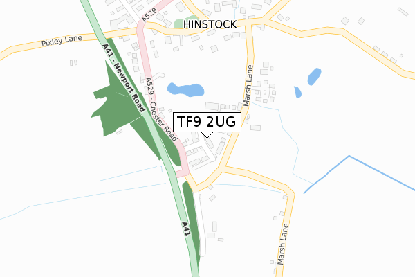
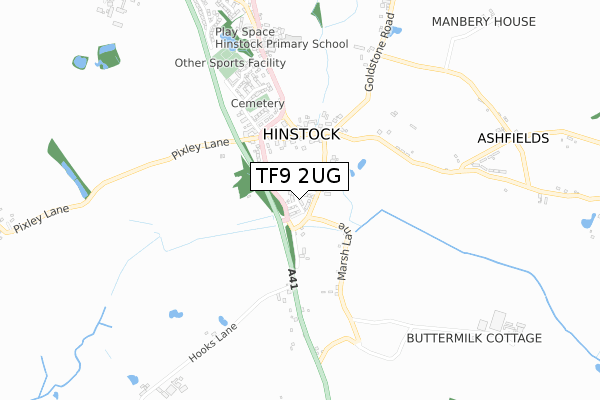
TF9 2UG is located in the Cheswardine electoral ward, within the unitary authority of Shropshire and the English Parliamentary constituency of North Shropshire. The Sub Integrated Care Board (ICB) Location is NHS Shropshire, Telford and Wrekin ICB - M2L0M and the police force is West Mercia. This postcode has been in use since October 2018.


GetTheData
Source: OS Open Zoomstack (Ordnance Survey)
Licence: Open Government Licence (requires attribution)
Attribution: Contains OS data © Crown copyright and database right 2025
Source: Open Postcode Geo
Licence: Open Government Licence (requires attribution)
Attribution: Contains OS data © Crown copyright and database right 2025; Contains Royal Mail data © Royal Mail copyright and database right 2025; Source: Office for National Statistics licensed under the Open Government Licence v.3.0
| Easting | 369469 |
| Northing | 326070 |
| Latitude | 52.831295 |
| Longitude | -2.454601 |
GetTheData
Source: Open Postcode Geo
Licence: Open Government Licence
| Country | England |
| Postcode District | TF9 |
➜ See where TF9 is on a map ➜ Where is Hinstock? | |
GetTheData
Source: Land Registry Price Paid Data
Licence: Open Government Licence
| Ward | Cheswardine |
| Constituency | North Shropshire |
GetTheData
Source: ONS Postcode Database
Licence: Open Government Licence
2023 3 JUL £310,000 |
2022 5 OCT £265,000 |
2022 6 JAN £330,000 |
2021 20 SEP £270,000 |
2021 9 AUG £335,000 |
2021 19 MAR £246,000 |
17, DAMSON WAY, MARKET DRAYTON, TF9 2UG 2020 20 NOV £325,000 |
3, DAMSON WAY, MARKET DRAYTON, TF9 2UG 2020 6 NOV £246,950 |
21, DAMSON WAY, MARKET DRAYTON, TF9 2UG 2020 23 OCT £276,000 |
34, DAMSON WAY, MARKET DRAYTON, TF9 2UG 2020 9 OCT £299,995 |
GetTheData
Source: HM Land Registry Price Paid Data
Licence: Contains HM Land Registry data © Crown copyright and database right 2025. This data is licensed under the Open Government Licence v3.0.
| T'junction (Marsh Lane) | Hinstock | 100m |
| The Marsh (Marsh Lane) | Hinstock | 106m |
| Church (Church Street) | Hinstock | 270m |
| Church (Church Street) | Hinstock | 287m |
| Links Green (Church Street) | Hinstock | 449m |
GetTheData
Source: NaPTAN
Licence: Open Government Licence
| Percentage of properties with Next Generation Access | 100.0% |
| Percentage of properties with Superfast Broadband | 100.0% |
| Percentage of properties with Ultrafast Broadband | 92.6% |
| Percentage of properties with Full Fibre Broadband | 92.6% |
Superfast Broadband is between 30Mbps and 300Mbps
Ultrafast Broadband is > 300Mbps
| Percentage of properties unable to receive 2Mbps | 0.0% |
| Percentage of properties unable to receive 5Mbps | 0.0% |
| Percentage of properties unable to receive 10Mbps | 0.0% |
| Percentage of properties unable to receive 30Mbps | 0.0% |
GetTheData
Source: Ofcom
Licence: Ofcom Terms of Use (requires attribution)
GetTheData
Source: ONS Postcode Database
Licence: Open Government Licence


➜ Get more ratings from the Food Standards Agency
GetTheData
Source: Food Standards Agency
Licence: FSA terms & conditions
| Last Collection | |||
|---|---|---|---|
| Location | Mon-Fri | Sat | Distance |
| Hinstock Post Office | 16:15 | 11:15 | 688m |
| Wistanswick | 16:45 | 10:30 | 3,801m |
| Great Soudley | 11:30 | 11:30 | 4,216m |
GetTheData
Source: Dracos
Licence: Creative Commons Attribution-ShareAlike
The below table lists the International Territorial Level (ITL) codes (formerly Nomenclature of Territorial Units for Statistics (NUTS) codes) and Local Administrative Units (LAU) codes for TF9 2UG:
| ITL 1 Code | Name |
|---|---|
| TLG | West Midlands (England) |
| ITL 2 Code | Name |
| TLG2 | Shropshire and Staffordshire |
| ITL 3 Code | Name |
| TLG22 | Shropshire |
| LAU 1 Code | Name |
| E06000051 | Shropshire |
GetTheData
Source: ONS Postcode Directory
Licence: Open Government Licence
The below table lists the Census Output Area (OA), Lower Layer Super Output Area (LSOA), and Middle Layer Super Output Area (MSOA) for TF9 2UG:
| Code | Name | |
|---|---|---|
| OA | E00147028 | |
| LSOA | E01028869 | Shropshire 009B |
| MSOA | E02006020 | Shropshire 009 |
GetTheData
Source: ONS Postcode Directory
Licence: Open Government Licence
| TF9 2TL | Newport Road | 217m |
| TF9 2TG | Marsh Lane | 239m |
| TF9 2UB | Barley Meadow | 244m |
| TF9 2TF | Church Street | 254m |
| TF9 2UA | Pixley Lane | 313m |
| TF9 2TZ | Manor Close | 400m |
| TF9 2SN | Manor Farm Drive | 437m |
| TF9 2TH | Newport Road | 456m |
| TF9 2NH | Links Green | 460m |
| TF9 2NX | Bearcroft Grange | 510m |
GetTheData
Source: Open Postcode Geo; Land Registry Price Paid Data
Licence: Open Government Licence