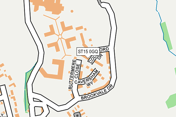
ST15 0GQ is located in the Swynnerton & Oulton electoral ward, within the local authority district of Stafford and the English Parliamentary constituency of Stone. The Sub Integrated Care Board (ICB) Location is NHS Staffordshire and Stoke-on-Trent ICB - 05V and the police force is Staffordshire. This postcode has been in use since June 2017.


GetTheData
Source: OS OpenMap – Local (Ordnance Survey)
Source: OS VectorMap District (Ordnance Survey)
Licence: Open Government Licence (requires attribution)
| Easting | 386807 |
| Northing | 333099 |
| Latitude | 52.895189 |
| Longitude | -2.197549 |
GetTheData
Source: Open Postcode Geo
Licence: Open Government Licence
| Country | England |
| Postcode District | ST15 |
➜ See where ST15 is on a map ➜ Where is Yarnfield? | |
GetTheData
Source: Land Registry Price Paid Data
Licence: Open Government Licence
| Ward | Swynnerton & Oulton |
| Constituency | Stone |
GetTheData
Source: ONS Postcode Database
Licence: Open Government Licence
2023 3 MAR £375,000 |
2022 12 AUG £280,000 |
2021 15 JAN £280,000 |
2020 17 MAR £320,000 |
15, COLLIFORD DRIVE, YARNFIELD, STONE, ST15 0GQ 2018 27 SEP £285,995 |
10, COLLIFORD DRIVE, YARNFIELD, STONE, ST15 0GQ 2018 7 MAR £289,995 |
12, COLLIFORD DRIVE, YARNFIELD, STONE, ST15 0GQ 2017 15 DEC £322,495 |
14, COLLIFORD DRIVE, YARNFIELD, STONE, ST15 0GQ 2017 15 DEC £284,995 |
1, COLLIFORD DRIVE, YARNFIELD, STONE, ST15 0GQ 2017 8 DEC £269,995 |
2, COLLIFORD DRIVE, YARNFIELD, STONE, ST15 0GQ 2017 1 DEC £299,995 |
GetTheData
Source: HM Land Registry Price Paid Data
Licence: Contains HM Land Registry data © Crown copyright and database right 2025. This data is licensed under the Open Government Licence v3.0.
| Labour-in-vain Ph (Yarnfield Lane) | Yarnfield | 520m |
| Labour-in-vain Ph (Yarnfield Lane) | Yarnfield | 562m |
| South Road (Meece Rd) | Coldmeece | 1,188m |
| South Road (Meece Rd) | Coldmeece | 1,200m |
| Norton Bridge Station | 3.2km |
| Stone Station | 3.2km |
GetTheData
Source: NaPTAN
Licence: Open Government Licence
| Percentage of properties with Next Generation Access | 100.0% |
| Percentage of properties with Superfast Broadband | 100.0% |
| Percentage of properties with Ultrafast Broadband | 100.0% |
| Percentage of properties with Full Fibre Broadband | 100.0% |
Superfast Broadband is between 30Mbps and 300Mbps
Ultrafast Broadband is > 300Mbps
| Percentage of properties unable to receive 2Mbps | 0.0% |
| Percentage of properties unable to receive 5Mbps | 0.0% |
| Percentage of properties unable to receive 10Mbps | 0.0% |
| Percentage of properties unable to receive 30Mbps | 0.0% |
GetTheData
Source: Ofcom
Licence: Ofcom Terms of Use (requires attribution)
GetTheData
Source: ONS Postcode Database
Licence: Open Government Licence


➜ Get more ratings from the Food Standards Agency
GetTheData
Source: Food Standards Agency
Licence: FSA terms & conditions
| Last Collection | |||
|---|---|---|---|
| Location | Mon-Fri | Sat | Distance |
| Yarnfield Lane | 17:00 | 07:00 | 457m |
| Yarnfield Post Office | 17:00 | 10:45 | 554m |
| Grove Road | 17:30 | 09:15 | 2,854m |
GetTheData
Source: Dracos
Licence: Creative Commons Attribution-ShareAlike
The below table lists the International Territorial Level (ITL) codes (formerly Nomenclature of Territorial Units for Statistics (NUTS) codes) and Local Administrative Units (LAU) codes for ST15 0GQ:
| ITL 1 Code | Name |
|---|---|
| TLG | West Midlands (England) |
| ITL 2 Code | Name |
| TLG2 | Shropshire and Staffordshire |
| ITL 3 Code | Name |
| TLG24 | Staffordshire CC |
| LAU 1 Code | Name |
| E07000197 | Stafford |
GetTheData
Source: ONS Postcode Directory
Licence: Open Government Licence
The below table lists the Census Output Area (OA), Lower Layer Super Output Area (LSOA), and Middle Layer Super Output Area (MSOA) for ST15 0GQ:
| Code | Name | |
|---|---|---|
| OA | E00151577 | |
| LSOA | E01029747 | Stafford 005E |
| MSOA | E02006192 | Stafford 005 |
GetTheData
Source: ONS Postcode Directory
Licence: Open Government Licence
| ST15 0NL | 122m | |
| ST15 0TN | Boothstone Gardens | 255m |
| ST15 0TH | Potters Avenue | 303m |
| ST15 0GT | Hayeswater Grove | 316m |
| ST15 0TF | The Paddocks | 350m |
| ST15 0RJ | Timberfields | 354m |
| ST15 0TG | College Fields | 364m |
| ST15 0RL | Hollyfields | 369m |
| ST15 0TQ | Calveley Close | 375m |
| ST15 0GW | Kielder Drive | 376m |
GetTheData
Source: Open Postcode Geo; Land Registry Price Paid Data
Licence: Open Government Licence