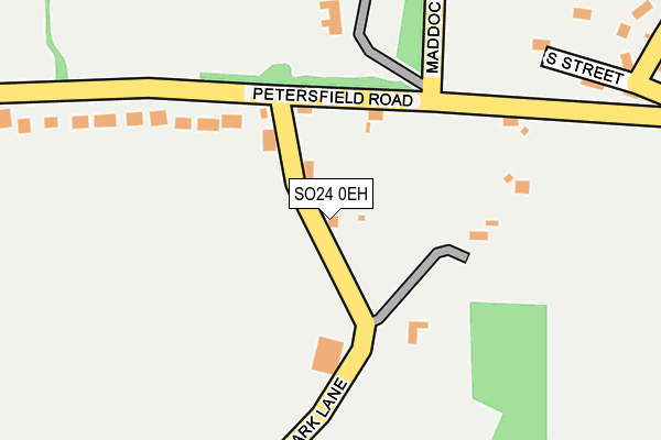
SO24 0EH lies on Park Lane in Ropley, Alresford. SO24 0EH is located in the Ropley, Hawkley & Hangers electoral ward, within the local authority district of East Hampshire and the English Parliamentary constituency of East Hampshire. The Sub Integrated Care Board (ICB) Location is NHS Hampshire and Isle of Wight ICB - D9Y0V and the police force is Hampshire. This postcode has been in use since January 1980.


GetTheData
Source: OS OpenMap – Local (Ordnance Survey)
Source: OS VectorMap District (Ordnance Survey)
Licence: Open Government Licence (requires attribution)
| Easting | 463863 |
| Northing | 131542 |
| Latitude | 51.079655 |
| Longitude | -1.089710 |
GetTheData
Source: Open Postcode Geo
Licence: Open Government Licence
| Street | Park Lane |
| Locality | Ropley |
| Town/City | Alresford |
| Country | England |
| Postcode District | SO24 |
➜ See where SO24 is on a map ➜ Where is Ropley? | |
GetTheData
Source: Land Registry Price Paid Data
Licence: Open Government Licence
Elevation or altitude of SO24 0EH as distance above sea level:
| Metres | Feet | |
|---|---|---|
| Elevation | 110m | 361ft |
Elevation is measured from the approximate centre of the postcode, to the nearest point on an OS contour line from OS Terrain 50, which has contour spacing of ten vertical metres.
➜ How high above sea level am I? Find the elevation of your current position using your device's GPS.
GetTheData
Source: Open Postcode Elevation
Licence: Open Government Licence
| Ward | Ropley, Hawkley & Hangers |
| Constituency | East Hampshire |
GetTheData
Source: ONS Postcode Database
Licence: Open Government Licence
PARK PLACE, PARK LANE, ROPLEY, ALRESFORD, SO24 0EH 2024 12 DEC £960,000 |
2021 21 JUL £900,000 |
OAKLEIGH, PARK LANE, ROPLEY, ALRESFORD, SO24 0EH 2019 18 OCT £807,000 |
THE SUMMER HOUSE, PARK LANE, ROPLEY, ALRESFORD, SO24 0EH 2018 9 APR £263,333 |
2016 18 MAY £850,000 |
2004 12 NOV £690,000 |
2002 4 SEP £450,000 |
2002 28 MAR £170,000 |
1999 25 OCT £210,000 |
1996 28 NOV £115,000 |
GetTheData
Source: HM Land Registry Price Paid Data
Licence: Contains HM Land Registry data © Crown copyright and database right 2025. This data is licensed under the Open Government Licence v3.0.
| Village Hall (Vicarage Lane) | Ropley | 585m |
| Village Hall (Vicarage Lane) | Ropley | 589m |
| Gascoigne Lane (Winchester Road) | Ropley Dean | 934m |
| Darvill Road (The Dene) | Ropley Dean | 939m |
| Gascoigne Lane (Winchester Road) | Ropley Dean | 957m |
| Ropley (Mid-hants Railway) | Ropley Dean | 1,250m |
GetTheData
Source: NaPTAN
Licence: Open Government Licence
| Percentage of properties with Next Generation Access | 75.0% |
| Percentage of properties with Superfast Broadband | 75.0% |
| Percentage of properties with Ultrafast Broadband | 0.0% |
| Percentage of properties with Full Fibre Broadband | 0.0% |
Superfast Broadband is between 30Mbps and 300Mbps
Ultrafast Broadband is > 300Mbps
| Percentage of properties unable to receive 2Mbps | 0.0% |
| Percentage of properties unable to receive 5Mbps | 0.0% |
| Percentage of properties unable to receive 10Mbps | 0.0% |
| Percentage of properties unable to receive 30Mbps | 25.0% |
GetTheData
Source: Ofcom
Licence: Ofcom Terms of Use (requires attribution)
GetTheData
Source: ONS Postcode Database
Licence: Open Government Licence


➜ Get more ratings from the Food Standards Agency
GetTheData
Source: Food Standards Agency
Licence: FSA terms & conditions
| Last Collection | |||
|---|---|---|---|
| Location | Mon-Fri | Sat | Distance |
| Petersfield Road | 16:45 | 09:30 | 106m |
| Hammonds Lane | 16:45 | 10:30 | 549m |
| The Dene | 16:45 | 10:00 | 968m |
GetTheData
Source: Dracos
Licence: Creative Commons Attribution-ShareAlike
The below table lists the International Territorial Level (ITL) codes (formerly Nomenclature of Territorial Units for Statistics (NUTS) codes) and Local Administrative Units (LAU) codes for SO24 0EH:
| ITL 1 Code | Name |
|---|---|
| TLJ | South East (England) |
| ITL 2 Code | Name |
| TLJ3 | Hampshire and Isle of Wight |
| ITL 3 Code | Name |
| TLJ36 | Central Hampshire |
| LAU 1 Code | Name |
| E07000085 | East Hampshire |
GetTheData
Source: ONS Postcode Directory
Licence: Open Government Licence
The below table lists the Census Output Area (OA), Lower Layer Super Output Area (LSOA), and Middle Layer Super Output Area (MSOA) for SO24 0EH:
| Code | Name | |
|---|---|---|
| OA | E00115036 | |
| LSOA | E01022627 | East Hampshire 007F |
| MSOA | E02004703 | East Hampshire 007 |
GetTheData
Source: ONS Postcode Directory
Licence: Open Government Licence
| SO24 0EQ | Petersfield Road | 241m |
| SO24 0DY | South Street | 303m |
| SO24 0DX | Petersfield Road | 364m |
| SO24 0DU | Vicarage Lane | 418m |
| SO24 0EG | Petersfield Road | 478m |
| SO24 0DZ | Hammonds Lane | 506m |
| SO24 0EJ | Petersfield Road | 581m |
| SO24 0BE | Park Lane | 647m |
| SO24 0DS | Church Street | 699m |
| SO24 0EF | Petersfield Road | 708m |
GetTheData
Source: Open Postcode Geo; Land Registry Price Paid Data
Licence: Open Government Licence