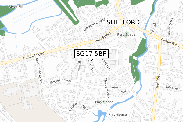
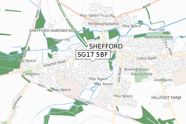
SG17 5BF is located in the Shefford electoral ward, within the unitary authority of Central Bedfordshire and the English Parliamentary constituency of Mid Bedfordshire. The Sub Integrated Care Board (ICB) Location is NHS Bedfordshire, Luton and Milton Keynes ICB - M1J4Y and the police force is Bedfordshire. This postcode has been in use since June 2019.


GetTheData
Source: OS Open Zoomstack (Ordnance Survey)
Licence: Open Government Licence (requires attribution)
Attribution: Contains OS data © Crown copyright and database right 2025
Source: Open Postcode Geo
Licence: Open Government Licence (requires attribution)
Attribution: Contains OS data © Crown copyright and database right 2025; Contains Royal Mail data © Royal Mail copyright and database right 2025; Source: Office for National Statistics licensed under the Open Government Licence v.3.0
| Easting | 514195 |
| Northing | 238908 |
| Latitude | 52.036836 |
| Longitude | -0.336589 |
GetTheData
Source: Open Postcode Geo
Licence: Open Government Licence
| Country | England |
| Postcode District | SG17 |
➜ See where SG17 is on a map ➜ Where is Shefford? | |
GetTheData
Source: Land Registry Price Paid Data
Licence: Open Government Licence
| Ward | Shefford |
| Constituency | Mid Bedfordshire |
GetTheData
Source: ONS Postcode Database
Licence: Open Government Licence
2021 17 DEC £373,000 |
28, SHEPHERDS PLACE, SHEFFORD, SG17 5BF 2020 27 MAR £365,000 |
2020 19 FEB £370,000 |
31, SHEPHERDS PLACE, SHEFFORD, SG17 5BF 2020 27 JAN £365,000 |
21, SHEPHERDS PLACE, SHEFFORD, SG17 5BF 2019 19 DEC £345,000 |
22, SHEPHERDS PLACE, SHEFFORD, SG17 5BF 2019 19 DEC £350,000 |
33, SHEPHERDS PLACE, SHEFFORD, SG17 5BF 2019 11 DEC £335,000 |
35, SHEPHERDS PLACE, SHEFFORD, SG17 5BF 2019 25 OCT £345,000 |
24, SHEPHERDS PLACE, SHEFFORD, SG17 5BF 2019 18 OCT £360,000 |
20, SHEPHERDS PLACE, SHEFFORD, SG17 5BF 2019 17 OCT £350,000 |
GetTheData
Source: HM Land Registry Price Paid Data
Licence: Contains HM Land Registry data © Crown copyright and database right 2025. This data is licensed under the Open Government Licence v3.0.
| Morrison Supermarket (St Francis Way) | Shefford | 139m |
| High Street | Shefford | 151m |
| J R Ford (Ampthill Road) | Shefford | 216m |
| High Street | Shefford | 221m |
| J R Ford (Ampthill Road) | Shefford | 231m |
| Arlesey Station | 5km |
GetTheData
Source: NaPTAN
Licence: Open Government Licence
GetTheData
Source: ONS Postcode Database
Licence: Open Government Licence


➜ Get more ratings from the Food Standards Agency
GetTheData
Source: Food Standards Agency
Licence: FSA terms & conditions
| Last Collection | |||
|---|---|---|---|
| Location | Mon-Fri | Sat | Distance |
| Ampthill Road | 16:45 | 10:00 | 229m |
| Shefford Post Office | 17:15 | 12:15 | 278m |
| Ivel Road | 16:15 | 10:45 | 364m |
GetTheData
Source: Dracos
Licence: Creative Commons Attribution-ShareAlike
The below table lists the International Territorial Level (ITL) codes (formerly Nomenclature of Territorial Units for Statistics (NUTS) codes) and Local Administrative Units (LAU) codes for SG17 5BF:
| ITL 1 Code | Name |
|---|---|
| TLH | East |
| ITL 2 Code | Name |
| TLH2 | Bedfordshire and Hertfordshire |
| ITL 3 Code | Name |
| TLH25 | Central Bedfordshire |
| LAU 1 Code | Name |
| E06000056 | Central Bedfordshire |
GetTheData
Source: ONS Postcode Directory
Licence: Open Government Licence
The below table lists the Census Output Area (OA), Lower Layer Super Output Area (LSOA), and Middle Layer Super Output Area (MSOA) for SG17 5BF:
| Code | Name | |
|---|---|---|
| OA | E00088062 | |
| LSOA | E01017439 | Central Bedfordshire 011C |
| MSOA | E02003609 | Central Bedfordshire 011 |
GetTheData
Source: ONS Postcode Directory
Licence: Open Government Licence
| SG17 5BW | New Street | 93m |
| SG17 5AX | High Street | 98m |
| SG17 5DZ | St Francis Way | 125m |
| SG17 5YF | Midland Gardens | 127m |
| SG17 5HQ | Old Bridge Way | 134m |
| SG17 5RU | St Francis Court | 137m |
| SG17 5YD | Midland Close | 143m |
| SG17 5TU | The Maltings | 160m |
| SG17 5BT | Osborn Crescent | 174m |
| SG17 5BP | George Street | 174m |
GetTheData
Source: Open Postcode Geo; Land Registry Price Paid Data
Licence: Open Government Licence