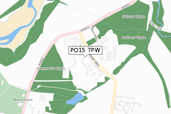
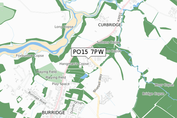
PO15 7PW is located in the Whiteley and Shedfield electoral ward, within the local authority district of Winchester and the English Parliamentary constituency of Meon Valley. The Sub Integrated Care Board (ICB) Location is NHS Hampshire and Isle of Wight ICB - D9Y0V and the police force is Hampshire. This postcode has been in use since April 2020.


GetTheData
Source: OS Open Zoomstack (Ordnance Survey)
Licence: Open Government Licence (requires attribution)
Attribution: Contains OS data © Crown copyright and database right 2025
Source: Open Postcode Geo
Licence: Open Government Licence (requires attribution)
Attribution: Contains OS data © Crown copyright and database right 2025; Contains Royal Mail data © Royal Mail copyright and database right 2025; Source: Office for National Statistics licensed under the Open Government Licence v.3.0
| Easting | 452286 |
| Northing | 111024 |
| Latitude | 50.896328 |
| Longitude | -1.257894 |
GetTheData
Source: Open Postcode Geo
Licence: Open Government Licence
| Country | England |
| Postcode District | PO15 |
➜ See where PO15 is on a map ➜ Where is Whiteley? | |
GetTheData
Source: Land Registry Price Paid Data
Licence: Open Government Licence
| Ward | Whiteley And Shedfield |
| Constituency | Meon Valley |
GetTheData
Source: ONS Postcode Database
Licence: Open Government Licence
2023 18 AUG £386,000 |
45, BRUNEL WAY, WHITELEY, FAREHAM, PO15 7PW 2022 6 MAY £460,000 |
2022 31 MAR £391,000 |
2022 17 MAR £375,000 |
2022 10 MAR £342,000 |
34, BRUNEL WAY, WHITELEY, FAREHAM, PO15 7PW 2022 25 FEB £445,000 |
41, BRUNEL WAY, WHITELEY, FAREHAM, PO15 7PW 2022 18 FEB £444,000 |
2021 30 SEP £372,000 |
47, BRUNEL WAY, WHITELEY, FAREHAM, PO15 7PW 2021 24 SEP £459,000 |
2021 24 SEP £342,000 |
GetTheData
Source: HM Land Registry Price Paid Data
Licence: Contains HM Land Registry data © Crown copyright and database right 2025. This data is licensed under the Open Government Licence v3.0.
| Bury Farm (A3051 Botley Road) | Burridge | 268m |
| Bury Farm (A3051 Botley Road) | Burridge | 297m |
| Sports & Social Club (Botley Road) | Burridge | 405m |
| Sports & Social Club (Botley Road) | Burridge | 409m |
| Curbridge (A3051 Botley Road) | Burridge | 571m |
| Botley Station | 2.2km |
| Swanwick Station | 2.4km |
| Bursledon Station | 3.6km |
GetTheData
Source: NaPTAN
Licence: Open Government Licence
GetTheData
Source: ONS Postcode Database
Licence: Open Government Licence


➜ Get more ratings from the Food Standards Agency
GetTheData
Source: Food Standards Agency
Licence: FSA terms & conditions
| Last Collection | |||
|---|---|---|---|
| Location | Mon-Fri | Sat | Distance |
| Burridge Post Office | 16:30 | 12:00 | 750m |
| Horse & Jockey Public House | 16:45 | 07:15 | 887m |
| Oldenburg | 16:45 | 08:30 | 1,201m |
GetTheData
Source: Dracos
Licence: Creative Commons Attribution-ShareAlike
The below table lists the International Territorial Level (ITL) codes (formerly Nomenclature of Territorial Units for Statistics (NUTS) codes) and Local Administrative Units (LAU) codes for PO15 7PW:
| ITL 1 Code | Name |
|---|---|
| TLJ | South East (England) |
| ITL 2 Code | Name |
| TLJ3 | Hampshire and Isle of Wight |
| ITL 3 Code | Name |
| TLJ36 | Central Hampshire |
| LAU 1 Code | Name |
| E07000094 | Winchester |
GetTheData
Source: ONS Postcode Directory
Licence: Open Government Licence
The below table lists the Census Output Area (OA), Lower Layer Super Output Area (LSOA), and Middle Layer Super Output Area (MSOA) for PO15 7PW:
| Code | Name | |
|---|---|---|
| OA | E00118107 | |
| LSOA | E01023245 | Winchester 013A |
| MSOA | E02004841 | Winchester 013 |
GetTheData
Source: ONS Postcode Directory
Licence: Open Government Licence
| SO31 1BR | Whiteley Lane | 520m |
| SO31 1BQ | Botley Road | 530m |
| PO15 7FS | Dumas Drive | 617m |
| SO31 1BS | Botley Road | 621m |
| PO15 7NZ | Milne Street | 638m |
| PO15 7FZ | Carroll Close | 649m |
| PO15 7PB | Yeats Close | 659m |
| PO15 7LU | Dumas Drive | 724m |
| PO15 7NN | Coleridge Drive | 731m |
| PO15 7NG | Verne Close | 792m |
GetTheData
Source: Open Postcode Geo; Land Registry Price Paid Data
Licence: Open Government Licence