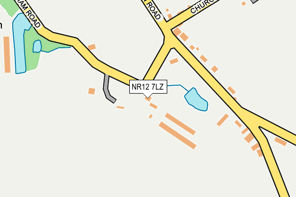
NR12 7LZ lies on Frettenham Road in Frettenham, Norwich. NR12 7LZ is located in the Buxton electoral ward, within the local authority district of Broadland and the English Parliamentary constituency of Broadland. The Sub Integrated Care Board (ICB) Location is NHS Norfolk and Waveney ICB - 26A and the police force is Norfolk. This postcode has been in use since December 1994.


GetTheData
Source: OS OpenMap – Local (Ordnance Survey)
Source: OS VectorMap District (Ordnance Survey)
Licence: Open Government Licence (requires attribution)
| Easting | 623859 |
| Northing | 317644 |
| Latitude | 52.710131 |
| Longitude | 1.312489 |
GetTheData
Source: Open Postcode Geo
Licence: Open Government Licence
| Street | Frettenham Road |
| Locality | Frettenham |
| Town/City | Norwich |
| Country | England |
| Postcode District | NR12 |
➜ See where NR12 is on a map ➜ Where is Frettenham? | |
GetTheData
Source: Land Registry Price Paid Data
Licence: Open Government Licence
Elevation or altitude of NR12 7LZ as distance above sea level:
| Metres | Feet | |
|---|---|---|
| Elevation | 20m | 66ft |
Elevation is measured from the approximate centre of the postcode, to the nearest point on an OS contour line from OS Terrain 50, which has contour spacing of ten vertical metres.
➜ How high above sea level am I? Find the elevation of your current position using your device's GPS.
GetTheData
Source: Open Postcode Elevation
Licence: Open Government Licence
| Ward | Buxton |
| Constituency | Broadland |
GetTheData
Source: ONS Postcode Database
Licence: Open Government Licence
2023 15 JUN £975,000 |
CASA MIA, FRETTENHAM ROAD, FRETTENHAM, NORWICH, NR12 7LZ 2020 18 DEC £350,000 |
2018 4 MAY £785,000 |
2012 9 NOV £285,000 |
2011 27 MAY £369,995 |
2009 13 AUG £305,000 |
2007 26 OCT £460,000 |
2005 1 JUL £450,000 |
2000 22 SEP £235,000 |
1997 2 JUN £158,000 |
GetTheData
Source: HM Land Registry Price Paid Data
Licence: Contains HM Land Registry data © Crown copyright and database right 2025. This data is licensed under the Open Government Licence v3.0.
| Rose & Crown (Buxton Road) | Frettenham | 157m |
| Rose & Crown (Buxton Road) | Frettenham | 162m |
| Mill Road (Buxton Road) | Frettenham | 485m |
| Mill Road (Buxton Road) | Frettenham | 496m |
| Post Office Road (Mill Road) | Frettenham | 556m |
GetTheData
Source: NaPTAN
Licence: Open Government Licence
| Percentage of properties with Next Generation Access | 100.0% |
| Percentage of properties with Superfast Broadband | 100.0% |
| Percentage of properties with Ultrafast Broadband | 0.0% |
| Percentage of properties with Full Fibre Broadband | 0.0% |
Superfast Broadband is between 30Mbps and 300Mbps
Ultrafast Broadband is > 300Mbps
| Percentage of properties unable to receive 2Mbps | 0.0% |
| Percentage of properties unable to receive 5Mbps | 0.0% |
| Percentage of properties unable to receive 10Mbps | 0.0% |
| Percentage of properties unable to receive 30Mbps | 0.0% |
GetTheData
Source: Ofcom
Licence: Ofcom Terms of Use (requires attribution)
GetTheData
Source: ONS Postcode Database
Licence: Open Government Licence


➜ Get more ratings from the Food Standards Agency
GetTheData
Source: Food Standards Agency
Licence: FSA terms & conditions
| Last Collection | |||
|---|---|---|---|
| Location | Mon-Fri | Sat | Distance |
| Hainford Post Office | 16:30 | 09:00 | 1,408m |
| Stratton Road / Waterloo Road | 16:30 | 07:15 | 2,305m |
| Longe Arms Ph Spixworth Road | 16:15 | 08:00 | 2,499m |
GetTheData
Source: Dracos
Licence: Creative Commons Attribution-ShareAlike
The below table lists the International Territorial Level (ITL) codes (formerly Nomenclature of Territorial Units for Statistics (NUTS) codes) and Local Administrative Units (LAU) codes for NR12 7LZ:
| ITL 1 Code | Name |
|---|---|
| TLH | East |
| ITL 2 Code | Name |
| TLH1 | East Anglia |
| ITL 3 Code | Name |
| TLH15 | Norwich and East Norfolk |
| LAU 1 Code | Name |
| E07000144 | Broadland |
GetTheData
Source: ONS Postcode Directory
Licence: Open Government Licence
The below table lists the Census Output Area (OA), Lower Layer Super Output Area (LSOA), and Middle Layer Super Output Area (MSOA) for NR12 7LZ:
| Code | Name | |
|---|---|---|
| OA | E00134738 | |
| LSOA | E01026515 | Broadland 003B |
| MSOA | E02005522 | Broadland 003 |
GetTheData
Source: ONS Postcode Directory
Licence: Open Government Licence
| NR12 7NJ | Buxton Road | 136m |
| NR12 7NH | Buxton Road | 250m |
| NR12 7NN | Cedar Cottages | 298m |
| NR10 3BW | Frettenham Road | 480m |
| NR12 7AD | Pound Hill | 522m |
| NR12 7NG | Buxton Road | 555m |
| NR10 3BX | Spixworth Road | 577m |
| NR12 7ND | Harbord Road | 603m |
| NR12 7AB | Post Office Road | 746m |
| NR12 7LQ | Mill Road | 752m |
GetTheData
Source: Open Postcode Geo; Land Registry Price Paid Data
Licence: Open Government Licence