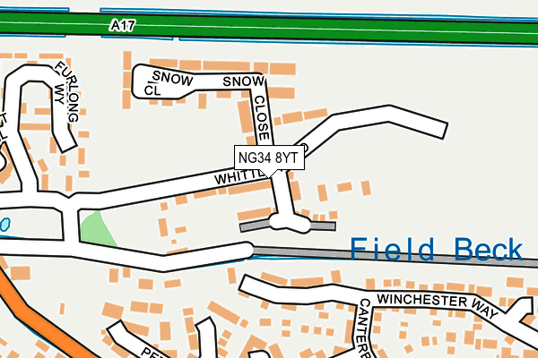
NG34 8YT is located in the Sleaford Holdingham electoral ward, within the local authority district of North Kesteven and the English Parliamentary constituency of Sleaford and North Hykeham. The Sub Integrated Care Board (ICB) Location is NHS Lincolnshire ICB - 71E and the police force is Lincolnshire. This postcode has been in use since April 2017.


GetTheData
Source: OS OpenMap – Local (Ordnance Survey)
Source: OS VectorMap District (Ordnance Survey)
Licence: Open Government Licence (requires attribution)
| Easting | 506194 |
| Northing | 347303 |
| Latitude | 53.012532 |
| Longitude | -0.418599 |
GetTheData
Source: Open Postcode Geo
Licence: Open Government Licence
| Country | England |
| Postcode District | NG34 |
➜ See where NG34 is on a map ➜ Where is Sleaford? | |
GetTheData
Source: Land Registry Price Paid Data
Licence: Open Government Licence
| Ward | Sleaford Holdingham |
| Constituency | Sleaford And North Hykeham |
GetTheData
Source: ONS Postcode Database
Licence: Open Government Licence
2024 28 JUN £235,000 |
2023 24 NOV £235,000 |
2022 4 MAR £175,000 |
2021 27 SEP £242,500 |
26, SNOW CLOSE, HOLDINGHAM, SLEAFORD, NG34 8YT 2019 29 NOV £189,995 |
58, SNOW CLOSE, HOLDINGHAM, SLEAFORD, NG34 8YT 2018 22 JUN £184,995 |
14, SNOW CLOSE, HOLDINGHAM, SLEAFORD, NG34 8YT 2018 30 MAY £189,995 |
56, SNOW CLOSE, HOLDINGHAM, SLEAFORD, NG34 8YT 2018 29 MAR £239,995 |
64, SNOW CLOSE, HOLDINGHAM, SLEAFORD, NG34 8YT 2018 16 MAR £215,995 |
54, SNOW CLOSE, HOLDINGHAM, SLEAFORD, NG34 8YT 2018 16 MAR £189,995 |
GetTheData
Source: HM Land Registry Price Paid Data
Licence: Contains HM Land Registry data © Crown copyright and database right 2024. This data is licensed under the Open Government Licence v3.0.
| Holdingham Mead (Lincoln Road) | Holdingham | 256m |
| The Jolly Scotchman Ph (Lincoln Road) | Holdingham | 321m |
| The Jolly Scotchman Ph (Lincoln Road) | Holdingham | 348m |
| 2 Covel Road (Covel Road) | Sleaford | 386m |
| Exeter Drive (York Road) | Sleaford | 487m |
| Sleaford Station | 2km |
| Rauceby Station | 4km |
| Ruskington Station | 4.1km |
GetTheData
Source: NaPTAN
Licence: Open Government Licence
| Percentage of properties with Next Generation Access | 100.0% |
| Percentage of properties with Superfast Broadband | 100.0% |
| Percentage of properties with Ultrafast Broadband | 100.0% |
| Percentage of properties with Full Fibre Broadband | 100.0% |
Superfast Broadband is between 30Mbps and 300Mbps
Ultrafast Broadband is > 300Mbps
| Median download speed | 360.0Mbps |
| Average download speed | 350.2Mbps |
| Maximum download speed | 360.00Mbps |
| Median upload speed | 360.0Mbps |
| Average upload speed | 350.0Mbps |
| Maximum upload speed | 360.00Mbps |
| Percentage of properties unable to receive 2Mbps | 0.0% |
| Percentage of properties unable to receive 5Mbps | 0.0% |
| Percentage of properties unable to receive 10Mbps | 0.0% |
| Percentage of properties unable to receive 30Mbps | 0.0% |
GetTheData
Source: Ofcom
Licence: Ofcom Terms of Use (requires attribution)
GetTheData
Source: ONS Postcode Database
Licence: Open Government Licence


➜ Get more ratings from the Food Standards Agency
GetTheData
Source: Food Standards Agency
Licence: FSA terms & conditions
| Last Collection | |||
|---|---|---|---|
| Location | Mon-Fri | Sat | Distance |
| Licoln Road Post Office | 17:00 | 11:30 | 599m |
| Tennyson Avenue | 17:45 | 11:15 | 1,100m |
| Tesco | 17:30 | 11:15 | 1,295m |
GetTheData
Source: Dracos
Licence: Creative Commons Attribution-ShareAlike
The below table lists the International Territorial Level (ITL) codes (formerly Nomenclature of Territorial Units for Statistics (NUTS) codes) and Local Administrative Units (LAU) codes for NG34 8YT:
| ITL 1 Code | Name |
|---|---|
| TLF | East Midlands (England) |
| ITL 2 Code | Name |
| TLF3 | Lincolnshire |
| ITL 3 Code | Name |
| TLF30 | Lincolnshire CC |
| LAU 1 Code | Name |
| E07000139 | North Kesteven |
GetTheData
Source: ONS Postcode Directory
Licence: Open Government Licence
The below table lists the Census Output Area (OA), Lower Layer Super Output Area (LSOA), and Middle Layer Super Output Area (MSOA) for NG34 8YT:
| Code | Name | |
|---|---|---|
| OA | E00133201 | |
| LSOA | E01026229 | North Kesteven 011B |
| MSOA | E02005463 | North Kesteven 011 |
GetTheData
Source: ONS Postcode Directory
Licence: Open Government Licence
| NG34 8SQ | Furlong Way | 205m |
| NG34 8NS | 228m | |
| NG34 8WJ | Winchester Way | 233m |
| NG34 8WG | Winchester Way | 276m |
| NG34 8TE | Gloucester Close | 277m |
| NG34 8WN | Norwich Close | 278m |
| NG34 8TP | Hereford Close | 310m |
| NG34 8TW | Peterborough Way | 315m |
| NG34 8TN | Canterbury Drive | 324m |
| NG34 8UZ | Truro Close | 355m |
GetTheData
Source: Open Postcode Geo; Land Registry Price Paid Data
Licence: Open Government Licence