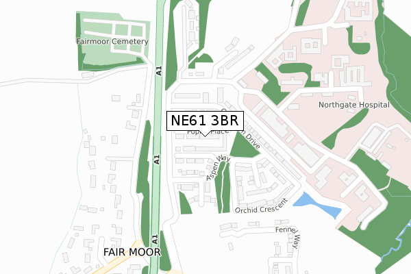
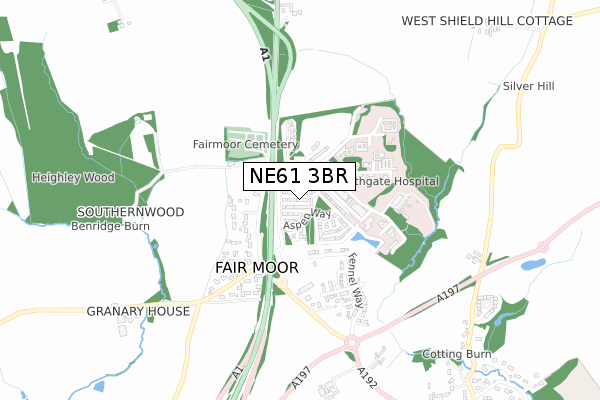
NE61 3BR is located in the Pegswood electoral ward, within the unitary authority of Northumberland and the English Parliamentary constituency of Wansbeck. The Sub Integrated Care Board (ICB) Location is NHS North East and North Cumbria ICB - 00L and the police force is Northumbria. This postcode has been in use since February 2019.


GetTheData
Source: OS Open Zoomstack (Ordnance Survey)
Licence: Open Government Licence (requires attribution)
Attribution: Contains OS data © Crown copyright and database right 2025
Source: Open Postcode Geo
Licence: Open Government Licence (requires attribution)
Attribution: Contains OS data © Crown copyright and database right 2025; Contains Royal Mail data © Royal Mail copyright and database right 2025; Source: Office for National Statistics licensed under the Open Government Licence v.3.0
| Easting | 418308 |
| Northing | 587819 |
| Latitude | 55.184327 |
| Longitude | -1.714040 |
GetTheData
Source: Open Postcode Geo
Licence: Open Government Licence
| Country | England |
| Postcode District | NE61 |
➜ See where NE61 is on a map ➜ Where is Fair Moor? | |
GetTheData
Source: Land Registry Price Paid Data
Licence: Open Government Licence
| Ward | Pegswood |
| Constituency | Wansbeck |
GetTheData
Source: ONS Postcode Database
Licence: Open Government Licence
2023 21 DEC £315,000 |
2022 28 OCT £330,000 |
2022 25 FEB £315,000 |
2020 27 MAR £269,995 |
17, POPLAR PLACE, MORPETH, NE61 3BR 2019 20 DEC £118,669 |
2019 20 DEC £277,141 |
19, POPLAR PLACE, MORPETH, NE61 3BR 2019 20 DEC £282,736 |
21, POPLAR PLACE, MORPETH, NE61 3BR 2019 20 DEC £292,006 |
14, POPLAR PLACE, MORPETH, NE61 3BR 2019 20 DEC £278,101 |
6, POPLAR PLACE, MORPETH, NE61 3BR 2019 12 NOV £294,495 |
GetTheData
Source: HM Land Registry Price Paid Data
Licence: Contains HM Land Registry data © Crown copyright and database right 2025. This data is licensed under the Open Government Licence v3.0.
| Fairmoor (A192) | Northgate Hospital | 291m |
| Fairmoor (A192) | Northgate Hospital | 375m |
| Warreners House (A1) | Fair Moor | 748m |
| Warreners House (A1) | Fair Moor | 831m |
| East Benridge (Road To Netherwitton) | Benridge | 851m |
| Morpeth Station | 3.1km |
| Pegswood Station | 4.5km |
GetTheData
Source: NaPTAN
Licence: Open Government Licence
| Percentage of properties with Next Generation Access | 100.0% |
| Percentage of properties with Superfast Broadband | 100.0% |
| Percentage of properties with Ultrafast Broadband | 0.0% |
| Percentage of properties with Full Fibre Broadband | 0.0% |
Superfast Broadband is between 30Mbps and 300Mbps
Ultrafast Broadband is > 300Mbps
| Percentage of properties unable to receive 2Mbps | 0.0% |
| Percentage of properties unable to receive 5Mbps | 0.0% |
| Percentage of properties unable to receive 10Mbps | 0.0% |
| Percentage of properties unable to receive 30Mbps | 0.0% |
GetTheData
Source: Ofcom
Licence: Ofcom Terms of Use (requires attribution)
GetTheData
Source: ONS Postcode Database
Licence: Open Government Licence


➜ Get more ratings from the Food Standards Agency
GetTheData
Source: Food Standards Agency
Licence: FSA terms & conditions
| Last Collection | |||
|---|---|---|---|
| Location | Mon-Fri | Sat | Distance |
| Northgate Hospital Grounds | 17:15 | 08:00 | 149m |
| East Benridge | 17:15 | 12:00 | 916m |
| Fulbeck House | 17:45 | 10:15 | 1,134m |
GetTheData
Source: Dracos
Licence: Creative Commons Attribution-ShareAlike
The below table lists the International Territorial Level (ITL) codes (formerly Nomenclature of Territorial Units for Statistics (NUTS) codes) and Local Administrative Units (LAU) codes for NE61 3BR:
| ITL 1 Code | Name |
|---|---|
| TLC | North East (England) |
| ITL 2 Code | Name |
| TLC2 | Northumberland, and Tyne and Wear |
| ITL 3 Code | Name |
| TLC21 | Northumberland |
| LAU 1 Code | Name |
| E06000057 | Northumberland |
GetTheData
Source: ONS Postcode Directory
Licence: Open Government Licence
The below table lists the Census Output Area (OA), Lower Layer Super Output Area (LSOA), and Middle Layer Super Output Area (MSOA) for NE61 3BR:
| Code | Name | |
|---|---|---|
| OA | E00139695 | |
| LSOA | E01027448 | Northumberland 015B |
| MSOA | E02005722 | Northumberland 015 |
GetTheData
Source: ONS Postcode Directory
Licence: Open Government Licence
| NE61 3BT | West View | 273m |
| NE61 3JL | Fairmoor | 320m |
| NE61 3JN | Fairmoor | 416m |
| NE61 3JJ | Fairmoor | 444m |
| NE61 3JW | 736m | |
| NE61 3BX | 802m | |
| NE61 3BU | 851m | |
| NE61 3RZ | 916m | |
| NE61 3JU | 973m | |
| NE61 3JS | East Lane End | 1011m |
GetTheData
Source: Open Postcode Geo; Land Registry Price Paid Data
Licence: Open Government Licence