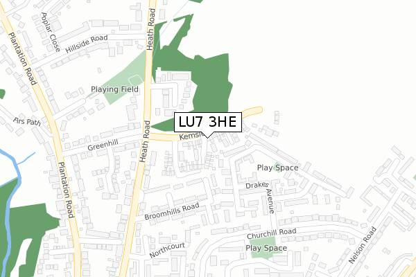
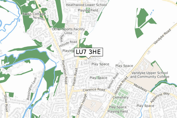
LU7 3HE is located in the Leighton-Linslade North electoral ward, within the unitary authority of Central Bedfordshire and the English Parliamentary constituency of South West Bedfordshire. The Sub Integrated Care Board (ICB) Location is NHS Bedfordshire, Luton and Milton Keynes ICB - M1J4Y and the police force is Bedfordshire. This postcode has been in use since November 2019.


GetTheData
Source: OS Open Zoomstack (Ordnance Survey)
Licence: Open Government Licence (requires attribution)
Attribution: Contains OS data © Crown copyright and database right 2025
Source: Open Postcode Geo
Licence: Open Government Licence (requires attribution)
Attribution: Contains OS data © Crown copyright and database right 2025; Contains Royal Mail data © Royal Mail copyright and database right 2025; Source: Office for National Statistics licensed under the Open Government Licence v.3.0
| Easting | 492708 |
| Northing | 226439 |
| Latitude | 51.928766 |
| Longitude | -0.653099 |
GetTheData
Source: Open Postcode Geo
Licence: Open Government Licence
| Country | England |
| Postcode District | LU7 |
➜ See where LU7 is on a map ➜ Where is Leighton Buzzard? | |
GetTheData
Source: Land Registry Price Paid Data
Licence: Open Government Licence
| Ward | Leighton-linslade North |
| Constituency | South West Bedfordshire |
GetTheData
Source: ONS Postcode Database
Licence: Open Government Licence
2023 30 AUG £462,500 |
2023 18 MAY £445,000 |
2023 12 JAN £506,000 |
66, KEMSLEY DRIVE, LEIGHTON BUZZARD, LU7 3HE 2022 12 AUG £542,950 |
87, KEMSLEY DRIVE, LEIGHTON BUZZARD, LU7 3HE 2022 1 AUG £489,950 |
60, KEMSLEY DRIVE, LEIGHTON BUZZARD, LU7 3HE 2022 8 JUL £442,950 |
68, KEMSLEY DRIVE, LEIGHTON BUZZARD, LU7 3HE 2022 8 JUL £442,950 |
58, KEMSLEY DRIVE, LEIGHTON BUZZARD, LU7 3HE 2022 27 MAY £485,950 |
89, KEMSLEY DRIVE, LEIGHTON BUZZARD, LU7 3HE 2022 28 APR £452,950 |
83, KEMSLEY DRIVE, LEIGHTON BUZZARD, LU7 3HE 2022 1 APR £438,950 |
➜ Leighton Buzzard house prices
GetTheData
Source: HM Land Registry Price Paid Data
Licence: Contains HM Land Registry data © Crown copyright and database right 2025. This data is licensed under the Open Government Licence v3.0.
| Churchill Road | Leighton Buzzard | 314m |
| Churchill Road | Leighton Buzzard | 332m |
| Hillside Road (Heath Road) | Leighton Buzzard | 380m |
| Plummer Haven (Heath Road) | Leighton Buzzard | 390m |
| Plummer Haven (Heath Road) | Leighton Buzzard | 406m |
| Leighton Buzzard Station | 2.1km |
GetTheData
Source: NaPTAN
Licence: Open Government Licence
GetTheData
Source: ONS Postcode Database
Licence: Open Government Licence


➜ Get more ratings from the Food Standards Agency
GetTheData
Source: Food Standards Agency
Licence: FSA terms & conditions
| Last Collection | |||
|---|---|---|---|
| Location | Mon-Fri | Sat | Distance |
| Nelson Road | 17:00 | 12:00 | 331m |
| Broomshill Road | 17:00 | 12:00 | 448m |
| Clarence Road | 17:30 | 12:30 | 483m |
GetTheData
Source: Dracos
Licence: Creative Commons Attribution-ShareAlike
The below table lists the International Territorial Level (ITL) codes (formerly Nomenclature of Territorial Units for Statistics (NUTS) codes) and Local Administrative Units (LAU) codes for LU7 3HE:
| ITL 1 Code | Name |
|---|---|
| TLH | East |
| ITL 2 Code | Name |
| TLH2 | Bedfordshire and Hertfordshire |
| ITL 3 Code | Name |
| TLH25 | Central Bedfordshire |
| LAU 1 Code | Name |
| E06000056 | Central Bedfordshire |
GetTheData
Source: ONS Postcode Directory
Licence: Open Government Licence
The below table lists the Census Output Area (OA), Lower Layer Super Output Area (LSOA), and Middle Layer Super Output Area (MSOA) for LU7 3HE:
| Code | Name | |
|---|---|---|
| OA | E00088886 | |
| LSOA | E01017606 | Central Bedfordshire 020D |
| MSOA | E02003638 | Central Bedfordshire 020 |
GetTheData
Source: ONS Postcode Directory
Licence: Open Government Licence
| LU7 3DZ | Blenheim Road | 147m |
| LU7 3BX | Drakes Avenue | 174m |
| LU7 3BY | Wellington Way | 184m |
| LU7 3AF | Drakes Avenue | 222m |
| LU7 3EB | Churchill Road | 257m |
| LU7 3AP | Chamberlains Gardens | 291m |
| LU7 3ED | Churchill Road | 308m |
| LU7 3ET | Churchill Road | 318m |
| LU7 3EP | Broomhills Road | 340m |
| LU7 3EF | Nelson Road | 350m |
GetTheData
Source: Open Postcode Geo; Land Registry Price Paid Data
Licence: Open Government Licence