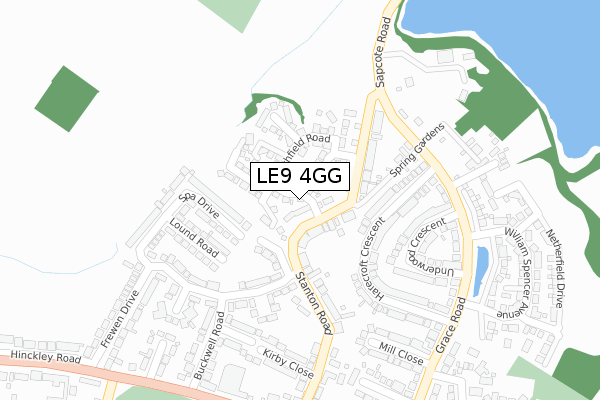
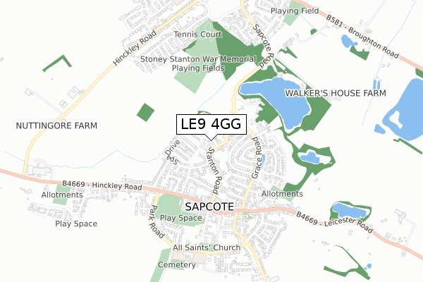
LE9 4GG is located in the Fosse Highcross electoral ward, within the local authority district of Blaby and the English Parliamentary constituency of South Leicestershire. The Sub Integrated Care Board (ICB) Location is NHS Leicester, Leicestershire and Rutland ICB - 04V and the police force is Leicestershire. This postcode has been in use since October 2017.


GetTheData
Source: OS Open Zoomstack (Ordnance Survey)
Licence: Open Government Licence (requires attribution)
Attribution: Contains OS data © Crown copyright and database right 2025
Source: Open Postcode Geo
Licence: Open Government Licence (requires attribution)
Attribution: Contains OS data © Crown copyright and database right 2025; Contains Royal Mail data © Royal Mail copyright and database right 2025; Source: Office for National Statistics licensed under the Open Government Licence v.3.0
| Easting | 448897 |
| Northing | 293819 |
| Latitude | 52.540059 |
| Longitude | -1.280469 |
GetTheData
Source: Open Postcode Geo
Licence: Open Government Licence
| Country | England |
| Postcode District | LE9 |
➜ See where LE9 is on a map ➜ Where is Sapcote? | |
GetTheData
Source: Land Registry Price Paid Data
Licence: Open Government Licence
| Ward | Fosse Highcross |
| Constituency | South Leicestershire |
GetTheData
Source: ONS Postcode Database
Licence: Open Government Licence
2024 21 OCT £280,000 |
2022 15 DEC £455,000 |
2021 24 SEP £400,000 |
8, RYE HILL DRIVE, SAPCOTE, LEICESTER, LE9 4GG 2020 18 DEC £279,950 |
12, RYE HILL DRIVE, SAPCOTE, LEICESTER, LE9 4GG 2018 24 OCT £239,950 |
16, RYE HILL DRIVE, SAPCOTE, LEICESTER, LE9 4GG 2018 31 MAY £254,950 |
14, RYE HILL DRIVE, SAPCOTE, LEICESTER, LE9 4GG 2018 25 MAY £254,950 |
2018 27 APR £254,950 |
5, RYE HILL DRIVE, SAPCOTE, LEICESTER, LE9 4GG 2017 27 OCT £329,950 |
9, RYE HILL DRIVE, SAPCOTE, LEICESTER, LE9 4GG 2017 27 OCT £244,950 |
GetTheData
Source: HM Land Registry Price Paid Data
Licence: Contains HM Land Registry data © Crown copyright and database right 2025. This data is licensed under the Open Government Licence v3.0.
| Grace Road (Sapcote Road) | Sapcote | 111m |
| Grace Road (Sapcote Road) | Sapcote | 136m |
| Spa Drive (Sapcote Road) | Sapcote | 149m |
| Spa Drive (Stanton Road) | Sapcote | 177m |
| The Square (Leicester Road) | Sapcote | 399m |
GetTheData
Source: NaPTAN
Licence: Open Government Licence
| Percentage of properties with Next Generation Access | 100.0% |
| Percentage of properties with Superfast Broadband | 100.0% |
| Percentage of properties with Ultrafast Broadband | 0.0% |
| Percentage of properties with Full Fibre Broadband | 0.0% |
Superfast Broadband is between 30Mbps and 300Mbps
Ultrafast Broadband is > 300Mbps
| Median download speed | 39.1Mbps |
| Average download speed | 36.5Mbps |
| Maximum download speed | 60.75Mbps |
| Median upload speed | 9.8Mbps |
| Average upload speed | 6.7Mbps |
| Maximum upload speed | 11.87Mbps |
| Percentage of properties unable to receive 2Mbps | 0.0% |
| Percentage of properties unable to receive 5Mbps | 0.0% |
| Percentage of properties unable to receive 10Mbps | 0.0% |
| Percentage of properties unable to receive 30Mbps | 0.0% |
GetTheData
Source: Ofcom
Licence: Ofcom Terms of Use (requires attribution)
GetTheData
Source: ONS Postcode Database
Licence: Open Government Licence


➜ Get more ratings from the Food Standards Agency
GetTheData
Source: Food Standards Agency
Licence: FSA terms & conditions
| Last Collection | |||
|---|---|---|---|
| Location | Mon-Fri | Sat | Distance |
| Sharnford Rso | 16:45 | 10:00 | 2,042m |
| Foxhollies | 16:00 | 10:00 | 2,273m |
| Sparkenhoe | 16:30 | 10:00 | 2,769m |
GetTheData
Source: Dracos
Licence: Creative Commons Attribution-ShareAlike
The below table lists the International Territorial Level (ITL) codes (formerly Nomenclature of Territorial Units for Statistics (NUTS) codes) and Local Administrative Units (LAU) codes for LE9 4GG:
| ITL 1 Code | Name |
|---|---|
| TLF | East Midlands (England) |
| ITL 2 Code | Name |
| TLF2 | Leicestershire, Rutland and Northamptonshire |
| ITL 3 Code | Name |
| TLF22 | Leicestershire CC and Rutland |
| LAU 1 Code | Name |
| E07000129 | Blaby |
GetTheData
Source: ONS Postcode Directory
Licence: Open Government Licence
The below table lists the Census Output Area (OA), Lower Layer Super Output Area (LSOA), and Middle Layer Super Output Area (MSOA) for LE9 4GG:
| Code | Name | |
|---|---|---|
| OA | E00130217 | |
| LSOA | E01025665 | Blaby 012E |
| MSOA | E02005344 | Blaby 012 |
GetTheData
Source: ONS Postcode Directory
Licence: Open Government Licence
| LE9 4FN | Spa Drive | 114m |
| LE9 4FP | Spa Drive | 137m |
| LE9 4FR | Stanton Road | 140m |
| LE9 4FX | Harecroft Crescent | 149m |
| LE9 4FH | Lound Road | 199m |
| LE9 4FY | Underwood Crescent | 223m |
| LE9 4FQ | Stanton Road | 253m |
| LE9 4EZ | Kirby Close | 257m |
| LE9 4FJ | Manor Road | 267m |
| LE9 4FW | Mill Close | 282m |
GetTheData
Source: Open Postcode Geo; Land Registry Price Paid Data
Licence: Open Government Licence