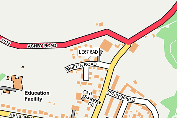
LE67 8AD is located in the Thringstone electoral ward, within the local authority district of North West Leicestershire and the English Parliamentary constituency of North West Leicestershire. The Sub Integrated Care Board (ICB) Location is NHS Leicester, Leicestershire and Rutland ICB - 04V and the police force is Leicestershire. This postcode has been in use since June 2017.


GetTheData
Source: OS OpenMap – Local (Ordnance Survey)
Source: OS VectorMap District (Ordnance Survey)
Licence: Open Government Licence (requires attribution)
| Easting | 442937 |
| Northing | 318001 |
| Latitude | 52.757937 |
| Longitude | -1.365202 |
GetTheData
Source: Open Postcode Geo
Licence: Open Government Licence
| Country | England |
| Postcode District | LE67 |
➜ See where LE67 is on a map ➜ Where is Thringstone? | |
GetTheData
Source: Land Registry Price Paid Data
Licence: Open Government Licence
| Ward | Thringstone |
| Constituency | North West Leicestershire |
GetTheData
Source: ONS Postcode Database
Licence: Open Government Licence
2021 26 FEB £325,000 |
2018 20 JUL £257,000 |
2017 28 JUL £244,995 |
8, RENNOCKS PLACE, THRINGSTONE, COALVILLE, LE67 8AD 2017 28 JUL £291,995 |
2017 10 JUL £316,995 |
7, RENNOCKS PLACE, THRINGSTONE, COALVILLE, LE67 8AD 2017 30 JUN £291,995 |
3, RENNOCKS PLACE, THRINGSTONE, COALVILLE, LE67 8AD 2017 26 MAY £286,995 |
1, RENNOCKS PLACE, THRINGSTONE, COALVILLE, LE67 8AD 2017 13 APR £295,995 |
GetTheData
Source: HM Land Registry Price Paid Data
Licence: Contains HM Land Registry data © Crown copyright and database right 2025. This data is licensed under the Open Government Licence v3.0.
| Loughborough Road (Hensons Lane) | Thringstone | 165m |
| Melrose Road (Loughborough Road) | Thringstone | 238m |
| Melrose Road | Thringstone | 276m |
| Melrose Road (Loughborough Road) | Thringstone | 290m |
| Main Street (Hensons Lane) | Thringstone | 303m |
GetTheData
Source: NaPTAN
Licence: Open Government Licence
| Percentage of properties with Next Generation Access | 76.9% |
| Percentage of properties with Superfast Broadband | 76.9% |
| Percentage of properties with Ultrafast Broadband | 0.0% |
| Percentage of properties with Full Fibre Broadband | 0.0% |
Superfast Broadband is between 30Mbps and 300Mbps
Ultrafast Broadband is > 300Mbps
| Median download speed | 100.0Mbps |
| Average download speed | 105.2Mbps |
| Maximum download speed | 200.00Mbps |
| Median upload speed | 1.0Mbps |
| Average upload speed | 1.0Mbps |
| Maximum upload speed | 1.16Mbps |
| Percentage of properties unable to receive 2Mbps | 0.0% |
| Percentage of properties unable to receive 5Mbps | 0.0% |
| Percentage of properties unable to receive 10Mbps | 0.0% |
| Percentage of properties unable to receive 30Mbps | 23.1% |
GetTheData
Source: Ofcom
Licence: Ofcom Terms of Use (requires attribution)
GetTheData
Source: ONS Postcode Database
Licence: Open Government Licence


➜ Get more ratings from the Food Standards Agency
GetTheData
Source: Food Standards Agency
Licence: FSA terms & conditions
| Last Collection | |||
|---|---|---|---|
| Location | Mon-Fri | Sat | Distance |
| New Swannington | 16:45 | 11:30 | 2,090m |
| Thornborough Road | 16:45 | 11:30 | 2,688m |
| Blackbrook A512 | 16:30 | 09:30 | 3,118m |
GetTheData
Source: Dracos
Licence: Creative Commons Attribution-ShareAlike
The below table lists the International Territorial Level (ITL) codes (formerly Nomenclature of Territorial Units for Statistics (NUTS) codes) and Local Administrative Units (LAU) codes for LE67 8AD:
| ITL 1 Code | Name |
|---|---|
| TLF | East Midlands (England) |
| ITL 2 Code | Name |
| TLF2 | Leicestershire, Rutland and Northamptonshire |
| ITL 3 Code | Name |
| TLF22 | Leicestershire CC and Rutland |
| LAU 1 Code | Name |
| E07000134 | North West Leicestershire |
GetTheData
Source: ONS Postcode Directory
Licence: Open Government Licence
The below table lists the Census Output Area (OA), Lower Layer Super Output Area (LSOA), and Middle Layer Super Output Area (MSOA) for LE67 8AD:
| Code | Name | |
|---|---|---|
| OA | E00131737 | |
| LSOA | E01025962 | North West Leicestershire 004C |
| MSOA | E02005400 | North West Leicestershire 004 |
GetTheData
Source: ONS Postcode Directory
Licence: Open Government Licence
| LE67 8AB | Old Bakery Close | 78m |
| LE67 8LS | Loughborough Road | 86m |
| LE67 8AL | The Orchards | 110m |
| LE67 8LU | Heathfield | 150m |
| LE67 8LT | Springfield | 221m |
| LE67 8LR | Loughborough Road | 243m |
| LE67 8LJ | Hensons Lane | 258m |
| LE67 8LH | Hensons Lane | 267m |
| LE67 8NH | Melrose Road | 290m |
| LE67 8LL | Homestead Road | 331m |
GetTheData
Source: Open Postcode Geo; Land Registry Price Paid Data
Licence: Open Government Licence