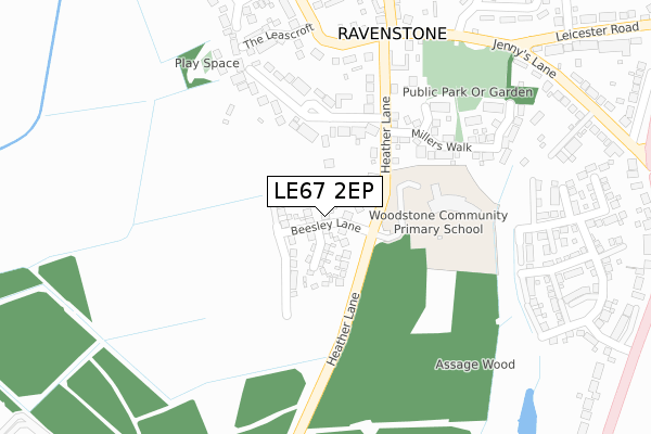
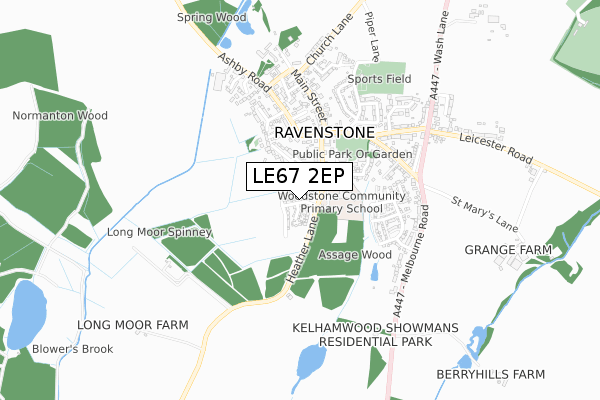
LE67 2EP is located in the Ravenstone & Packington electoral ward, within the local authority district of North West Leicestershire and the English Parliamentary constituency of North West Leicestershire. The Sub Integrated Care Board (ICB) Location is NHS Leicester, Leicestershire and Rutland ICB - 04V and the police force is Leicestershire. This postcode has been in use since April 2018.


GetTheData
Source: OS Open Zoomstack (Ordnance Survey)
Licence: Open Government Licence (requires attribution)
Attribution: Contains OS data © Crown copyright and database right 2025
Source: Open Postcode Geo
Licence: Open Government Licence (requires attribution)
Attribution: Contains OS data © Crown copyright and database right 2025; Contains Royal Mail data © Royal Mail copyright and database right 2025; Source: Office for National Statistics licensed under the Open Government Licence v.3.0
| Easting | 440218 |
| Northing | 313323 |
| Latitude | 52.716094 |
| Longitude | -1.406061 |
GetTheData
Source: Open Postcode Geo
Licence: Open Government Licence
| Country | England |
| Postcode District | LE67 |
➜ See where LE67 is on a map ➜ Where is Ravenstone? | |
GetTheData
Source: Land Registry Price Paid Data
Licence: Open Government Licence
| Ward | Ravenstone & Packington |
| Constituency | North West Leicestershire |
GetTheData
Source: ONS Postcode Database
Licence: Open Government Licence
2023 26 OCT £440,000 |
2023 11 SEP £425,000 |
2021 19 FEB £524,950 |
7, BEESLEY LANE, RAVENSTONE, COALVILLE, LE67 2EP 2020 2 OCT £389,950 |
9, BEESLEY LANE, RAVENSTONE, COALVILLE, LE67 2EP 2020 1 SEP £499,950 |
5, BEESLEY LANE, RAVENSTONE, COALVILLE, LE67 2EP 2020 4 AUG £387,450 |
1, BEESLEY LANE, RAVENSTONE, COALVILLE, LE67 2EP 2020 3 JUL £385,000 |
3, BEESLEY LANE, RAVENSTONE, COALVILLE, LE67 2EP 2020 21 FEB £309,950 |
11, BEESLEY LANE, RAVENSTONE, COALVILLE, LE67 2EP 2019 18 NOV £409,950 |
2019 5 JUL £382,950 |
GetTheData
Source: HM Land Registry Price Paid Data
Licence: Contains HM Land Registry data © Crown copyright and database right 2025. This data is licensed under the Open Government Licence v3.0.
| Beech Avenue (Ashby Road) | Ravenstone | 349m |
| The Plough (Leicester Road) | Ravenstone | 361m |
| Beech Avenue (Ashby Road) | Ravenstone | 376m |
| Church Lane (Main Street) | Ravenstone | 381m |
| The Plough (Leicester Road) | Ravenstone | 388m |
GetTheData
Source: NaPTAN
Licence: Open Government Licence
| Percentage of properties with Next Generation Access | 100.0% |
| Percentage of properties with Superfast Broadband | 100.0% |
| Percentage of properties with Ultrafast Broadband | 100.0% |
| Percentage of properties with Full Fibre Broadband | 100.0% |
Superfast Broadband is between 30Mbps and 300Mbps
Ultrafast Broadband is > 300Mbps
| Percentage of properties unable to receive 2Mbps | 0.0% |
| Percentage of properties unable to receive 5Mbps | 0.0% |
| Percentage of properties unable to receive 10Mbps | 0.0% |
| Percentage of properties unable to receive 30Mbps | 0.0% |
GetTheData
Source: Ofcom
Licence: Ofcom Terms of Use (requires attribution)
GetTheData
Source: ONS Postcode Database
Licence: Open Government Licence


➜ Get more ratings from the Food Standards Agency
GetTheData
Source: Food Standards Agency
Licence: FSA terms & conditions
| Last Collection | |||
|---|---|---|---|
| Location | Mon-Fri | Sat | Distance |
| Church Lane/Beadmans Close | 16:45 | 12:00 | 1,202m |
| Ashburton Road | 17:15 | 12:15 | 1,928m |
| Central Road/Fairfield Road | 17:15 | 12:00 | 1,995m |
GetTheData
Source: Dracos
Licence: Creative Commons Attribution-ShareAlike
The below table lists the International Territorial Level (ITL) codes (formerly Nomenclature of Territorial Units for Statistics (NUTS) codes) and Local Administrative Units (LAU) codes for LE67 2EP:
| ITL 1 Code | Name |
|---|---|
| TLF | East Midlands (England) |
| ITL 2 Code | Name |
| TLF2 | Leicestershire, Rutland and Northamptonshire |
| ITL 3 Code | Name |
| TLF22 | Leicestershire CC and Rutland |
| LAU 1 Code | Name |
| E07000134 | North West Leicestershire |
GetTheData
Source: ONS Postcode Directory
Licence: Open Government Licence
The below table lists the Census Output Area (OA), Lower Layer Super Output Area (LSOA), and Middle Layer Super Output Area (MSOA) for LE67 2EP:
| Code | Name | |
|---|---|---|
| OA | E00131718 | |
| LSOA | E01025955 | North West Leicestershire 005A |
| MSOA | E02005401 | North West Leicestershire 005 |
GetTheData
Source: ONS Postcode Directory
Licence: Open Government Licence
| LE67 2AH | Heather Lane | 143m |
| LE67 2AG | Creswell Drive | 168m |
| LE67 2BZ | Millers Walk | 238m |
| LE67 2BY | Kelham Grove | 259m |
| LE67 2BL | The Leascroft | 300m |
| LE67 2BJ | Windmill Close | 310m |
| LE67 2AB | Fosbrooke Close | 400m |
| LE67 2AD | Beech Avenue | 402m |
| LE67 2AP | Jennys Lane | 424m |
| LE67 2AS | Main Street | 460m |
GetTheData
Source: Open Postcode Geo; Land Registry Price Paid Data
Licence: Open Government Licence