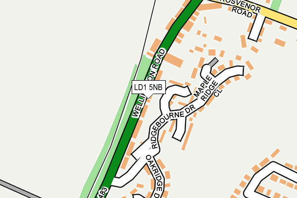
LD1 5NB lies on Wellington Road in Llandrindod Wells. LD1 5NB is located in the Llandrindod South electoral ward, within the unitary authority of Powys and the Welsh Parliamentary constituency of Brecon and Radnorshire. The Local Health Board is Powys Teaching and the police force is Dyfed-Powys. This postcode has been in use since January 1980.


GetTheData
Source: OS OpenMap – Local (Ordnance Survey)
Source: OS VectorMap District (Ordnance Survey)
Licence: Open Government Licence (requires attribution)
| Easting | 305705 |
| Northing | 260282 |
| Latitude | 52.232631 |
| Longitude | -3.382131 |
GetTheData
Source: Open Postcode Geo
Licence: Open Government Licence
| Street | Wellington Road |
| Town/City | Llandrindod Wells |
| Country | Wales |
| Postcode District | LD1 |
➜ See where LD1 is on a map ➜ Where is Llandrindod Wells? | |
GetTheData
Source: Land Registry Price Paid Data
Licence: Open Government Licence
Elevation or altitude of LD1 5NB as distance above sea level:
| Metres | Feet | |
|---|---|---|
| Elevation | 220m | 722ft |
Elevation is measured from the approximate centre of the postcode, to the nearest point on an OS contour line from OS Terrain 50, which has contour spacing of ten vertical metres.
➜ How high above sea level am I? Find the elevation of your current position using your device's GPS.
GetTheData
Source: Open Postcode Elevation
Licence: Open Government Licence
| Ward | Llandrindod South |
| Constituency | Brecon And Radnorshire |
GetTheData
Source: ONS Postcode Database
Licence: Open Government Licence
2021 30 SEP £280,000 |
2020 19 JUN £230,000 |
2019 29 AUG £220,000 |
2005 14 FEB £140,000 |
2003 17 JUL £87,000 |
WESTLAND, WELLINGTON ROAD, LLANDRINDOD WELLS, LD1 5NB 1996 29 JUL £52,000 |
1995 8 DEC £35,000 |
➜ Llandrindod Wells house prices
GetTheData
Source: HM Land Registry Price Paid Data
Licence: Contains HM Land Registry data © Crown copyright and database right 2025. This data is licensed under the Open Government Licence v3.0.
| Ridgebourne (Wellington Road) | Llandrindod Wells | 83m |
| Ridgebourne (Wellington Road) | Llandrindod Wells | 100m |
| Grosvenor Stores (Temple Street) | Llandrindod Wells | 249m |
| Grosvenor Stores (Temple Street) | Llandrindod Wells | 271m |
| Lakeside Avenue | Llandrindod Wells | 284m |
| Llandrindod Station | 1.1km |
| Pen-y-Bont Station | 6.2km |
GetTheData
Source: NaPTAN
Licence: Open Government Licence
| Percentage of properties with Next Generation Access | 39.0% |
| Percentage of properties with Superfast Broadband | 39.0% |
| Percentage of properties with Ultrafast Broadband | 39.0% |
| Percentage of properties with Full Fibre Broadband | 39.0% |
Superfast Broadband is between 30Mbps and 300Mbps
Ultrafast Broadband is > 300Mbps
| Median download speed | 14.3Mbps |
| Average download speed | 13.0Mbps |
| Maximum download speed | 18.07Mbps |
| Median upload speed | 1.1Mbps |
| Average upload speed | 1.0Mbps |
| Maximum upload speed | 1.27Mbps |
| Percentage of properties unable to receive 2Mbps | 0.0% |
| Percentage of properties unable to receive 5Mbps | 0.0% |
| Percentage of properties unable to receive 10Mbps | 0.0% |
| Percentage of properties unable to receive 30Mbps | 61.0% |
GetTheData
Source: Ofcom
Licence: Ofcom Terms of Use (requires attribution)
Estimated total energy consumption in LD1 5NB by fuel type, 2015.
| Consumption (kWh) | 623,314 |
|---|---|
| Meter count | 34 |
| Mean (kWh/meter) | 18,333 |
| Median (kWh/meter) | 16,899 |
| Consumption (kWh) | 261,870 |
|---|---|
| Meter count | 59 |
| Mean (kWh/meter) | 4,438 |
| Median (kWh/meter) | 4,440 |
GetTheData
Source: Postcode level gas estimates: 2015 (experimental)
Source: Postcode level electricity estimates: 2015 (experimental)
Licence: Open Government Licence
GetTheData
Source: ONS Postcode Database
Licence: Open Government Licence


➜ Get more ratings from the Food Standards Agency
GetTheData
Source: Food Standards Agency
Licence: FSA terms & conditions
| Last Collection | |||
|---|---|---|---|
| Location | Mon-Fri | Sat | Distance |
| Ridgebourne | 17:45 | 12:00 | 228m |
| Lakeside | 17:45 | 12:00 | 492m |
| Wellfield | 18:15 | 12:00 | 658m |
GetTheData
Source: Dracos
Licence: Creative Commons Attribution-ShareAlike
The below table lists the International Territorial Level (ITL) codes (formerly Nomenclature of Territorial Units for Statistics (NUTS) codes) and Local Administrative Units (LAU) codes for LD1 5NB:
| ITL 1 Code | Name |
|---|---|
| TLL | Wales |
| ITL 2 Code | Name |
| TLL2 | East Wales |
| ITL 3 Code | Name |
| TLL24 | Powys |
| LAU 1 Code | Name |
| W06000023 | Powys |
GetTheData
Source: ONS Postcode Directory
Licence: Open Government Licence
The below table lists the Census Output Area (OA), Lower Layer Super Output Area (LSOA), and Middle Layer Super Output Area (MSOA) for LD1 5NB:
| Code | Name | |
|---|---|---|
| OA | W00009779 | |
| LSOA | W01000456 | Powys 013C |
| MSOA | W02000109 | Powys 013 |
GetTheData
Source: ONS Postcode Directory
Licence: Open Government Licence
| LD1 5NS | Ashridge Close | 54m |
| LD1 5NQ | Ridgebourne Close | 76m |
| LD1 5TS | Ridgebourne Drive | 97m |
| LD1 5EX | Cedar Ridge | 120m |
| LD1 5NX | Maple Ridge Close | 141m |
| LD1 5NH | Denham Terrace | 147m |
| LD1 5EW | Oakridge Drive | 192m |
| LD1 5NG | Wellington Road | 202m |
| LD1 5NE | Grosvenor Close | 247m |
| LD1 5NA | Grosvenor Road | 270m |
GetTheData
Source: Open Postcode Geo; Land Registry Price Paid Data
Licence: Open Government Licence