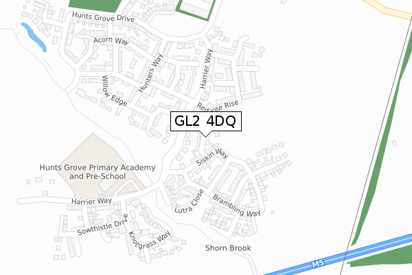
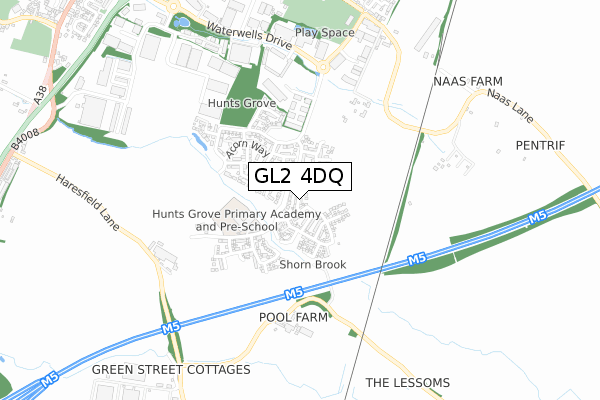
GL2 4DQ is located in the Hardwicke electoral ward, within the local authority district of Stroud and the English Parliamentary constituency of Stroud. The Sub Integrated Care Board (ICB) Location is NHS Gloucestershire ICB - 11M and the police force is Gloucestershire. This postcode has been in use since February 2019.


GetTheData
Source: OS Open Zoomstack (Ordnance Survey)
Licence: Open Government Licence (requires attribution)
Attribution: Contains OS data © Crown copyright and database right 2025
Source: Open Postcode Geo
Licence: Open Government Licence (requires attribution)
Attribution: Contains OS data © Crown copyright and database right 2025; Contains Royal Mail data © Royal Mail copyright and database right 2025; Source: Office for National Statistics licensed under the Open Government Licence v.3.0
| Easting | 381515 |
| Northing | 212066 |
| Latitude | 51.806929 |
| Longitude | -2.269503 |
GetTheData
Source: Open Postcode Geo
Licence: Open Government Licence
| Country | England |
| Postcode District | GL2 |
➜ See where GL2 is on a map ➜ Where is Hardwicke? | |
GetTheData
Source: Land Registry Price Paid Data
Licence: Open Government Licence
| Ward | Hardwicke |
| Constituency | Stroud |
GetTheData
Source: ONS Postcode Database
Licence: Open Government Licence
2022 4 MAY £400,000 |
13, GREENFINCH CLOSE, HARDWICKE, GLOUCESTER, GL2 4DQ 2019 29 APR £335,000 |
8, GREENFINCH CLOSE, HARDWICKE, GLOUCESTER, GL2 4DQ 2019 23 APR £338,000 |
2019 18 APR £340,000 |
11, GREENFINCH CLOSE, HARDWICKE, GLOUCESTER, GL2 4DQ 2019 8 APR £345,000 |
2019 15 MAR £270,000 |
GetTheData
Source: HM Land Registry Price Paid Data
Licence: Contains HM Land Registry data © Crown copyright and database right 2025. This data is licensed under the Open Government Licence v3.0.
| Business Park (Waterwells Drive) | Quedgeley | 602m |
| Business Park (Waterwells Drive) | Quedgeley | 610m |
| Needham Avenue (Naas Lane) | Quedgeley | 852m |
| Bypass Bridge (B4008) | Hardwicke | 1,139m |
| Waterwells Park & Ride Site (Telford Way) | Quedgeley | 1,170m |
GetTheData
Source: NaPTAN
Licence: Open Government Licence
| Percentage of properties with Next Generation Access | 84.6% |
| Percentage of properties with Superfast Broadband | 84.6% |
| Percentage of properties with Ultrafast Broadband | 84.6% |
| Percentage of properties with Full Fibre Broadband | 84.6% |
Superfast Broadband is between 30Mbps and 300Mbps
Ultrafast Broadband is > 300Mbps
| Percentage of properties unable to receive 2Mbps | 0.0% |
| Percentage of properties unable to receive 5Mbps | 0.0% |
| Percentage of properties unable to receive 10Mbps | 0.0% |
| Percentage of properties unable to receive 30Mbps | 15.4% |
GetTheData
Source: Ofcom
Licence: Ofcom Terms of Use (requires attribution)
GetTheData
Source: ONS Postcode Database
Licence: Open Government Licence


➜ Get more ratings from the Food Standards Agency
GetTheData
Source: Food Standards Agency
Licence: FSA terms & conditions
| Last Collection | |||
|---|---|---|---|
| Location | Mon-Fri | Sat | Distance |
| Munitions Quedgeley | 17:00 | 08:00 | 856m |
| Four Mile Elm Hardwicke | 16:50 | 09:15 | 1,324m |
| Mount Lane | 16:30 | 08:30 | 1,399m |
GetTheData
Source: Dracos
Licence: Creative Commons Attribution-ShareAlike
The below table lists the International Territorial Level (ITL) codes (formerly Nomenclature of Territorial Units for Statistics (NUTS) codes) and Local Administrative Units (LAU) codes for GL2 4DQ:
| ITL 1 Code | Name |
|---|---|
| TLK | South West (England) |
| ITL 2 Code | Name |
| TLK1 | Gloucestershire, Wiltshire and Bath/Bristol area |
| ITL 3 Code | Name |
| TLK13 | Gloucestershire CC |
| LAU 1 Code | Name |
| E07000082 | Stroud |
GetTheData
Source: ONS Postcode Directory
Licence: Open Government Licence
The below table lists the Census Output Area (OA), Lower Layer Super Output Area (LSOA), and Middle Layer Super Output Area (MSOA) for GL2 4DQ:
| Code | Name | |
|---|---|---|
| OA | E00113770 | |
| LSOA | E01022380 | Stroud 001C |
| MSOA | E02004651 | Stroud 001 |
GetTheData
Source: ONS Postcode Directory
Licence: Open Government Licence
| GL2 4AR | Hawthorn Close | 126m |
| GL2 4AQ | Whitstone Rise | 183m |
| GL2 4AP | Hunters Way | 222m |
| GL2 4AU | Lime Tree Avenue | 232m |
| GL2 4AS | Lime Tree Avenue | 234m |
| GL2 4BJ | Willow Edge | 239m |
| GL2 4AW | Lime Tree Avenue | 271m |
| GL2 4AZ | Colethrop Way | 290m |
| GL2 4AY | Acorn Way | 319m |
| GL2 2AP | The Glenmore Centre | 356m |
GetTheData
Source: Open Postcode Geo; Land Registry Price Paid Data
Licence: Open Government Licence