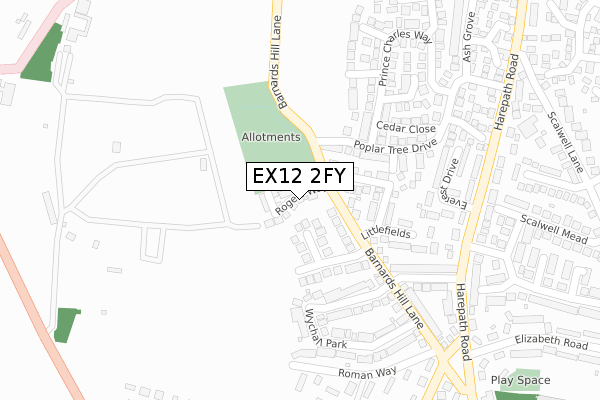
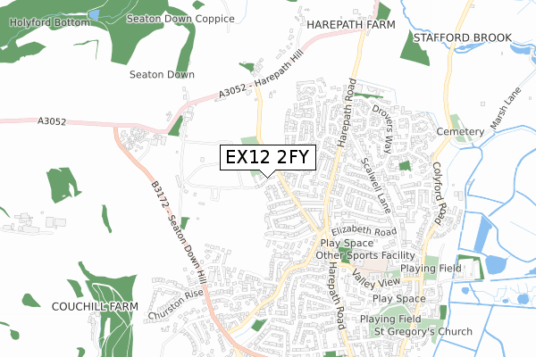
EX12 2FY is located in the Seaton electoral ward, within the local authority district of East Devon and the English Parliamentary constituency of Tiverton and Honiton. The Sub Integrated Care Board (ICB) Location is NHS Devon ICB - 15N and the police force is Devon & Cornwall. This postcode has been in use since July 2019.


GetTheData
Source: OS Open Zoomstack (Ordnance Survey)
Licence: Open Government Licence (requires attribution)
Attribution: Contains OS data © Crown copyright and database right 2024
Source: Open Postcode Geo
Licence: Open Government Licence (requires attribution)
Attribution: Contains OS data © Crown copyright and database right 2024; Contains Royal Mail data © Royal Mail copyright and database right 2024; Source: Office for National Statistics licensed under the Open Government Licence v.3.0
| Easting | 323944 |
| Northing | 91264 |
| Latitude | 50.715997 |
| Longitude | -3.078679 |
GetTheData
Source: Open Postcode Geo
Licence: Open Government Licence
| Country | England |
| Postcode District | EX12 |
➜ See where EX12 is on a map ➜ Where is Seaton? | |
GetTheData
Source: Land Registry Price Paid Data
Licence: Open Government Licence
| Ward | Seaton |
| Constituency | Tiverton And Honiton |
GetTheData
Source: ONS Postcode Database
Licence: Open Government Licence
14, ROGERS WAY, SEATON, EX12 2FY 2020 5 MAR £399,995 |
2020 5 MAR £450,000 |
2020 18 FEB £424,995 |
8, ROGERS WAY, SEATON, EX12 2FY 2019 13 DEC £424,995 |
15, ROGERS WAY, SEATON, EX12 2FY 2019 29 NOV £450,000 |
13, ROGERS WAY, SEATON, EX12 2FY 2019 26 NOV £439,500 |
10, ROGERS WAY, SEATON, EX12 2FY 2019 31 OCT £424,995 |
2019 18 OCT £430,000 |
6, ROGERS WAY, SEATON, EX12 2FY 2019 2 OCT £310,000 |
11, ROGERS WAY, SEATON, EX12 2FY 2019 30 SEP £425,000 |
GetTheData
Source: HM Land Registry Price Paid Data
Licence: Contains HM Land Registry data © Crown copyright and database right 2024. This data is licensed under the Open Government Licence v3.0.
| Barnards Hill Lane | Seaton | 126m |
| Maple Close (Poplar Tree Drive) | Seaton | 282m |
| Everest Drive (Harepath Road) | Seaton | 295m |
| Everest Drive (Harepath Road) | Seaton | 302m |
| Scalwell Lane (Harepath Road) | Seaton | 384m |
| Seaton Terminus (Seaton Tramway) (Underfleet) | Seaton | 1,425m |
| Colyford Station (Seaton Tramway) (Swan Hill Road) | Colyford | 2,042m |
GetTheData
Source: NaPTAN
Licence: Open Government Licence
| Percentage of properties with Next Generation Access | 100.0% |
| Percentage of properties with Superfast Broadband | 100.0% |
| Percentage of properties with Ultrafast Broadband | 0.0% |
| Percentage of properties with Full Fibre Broadband | 0.0% |
Superfast Broadband is between 30Mbps and 300Mbps
Ultrafast Broadband is > 300Mbps
| Percentage of properties unable to receive 2Mbps | 0.0% |
| Percentage of properties unable to receive 5Mbps | 0.0% |
| Percentage of properties unable to receive 10Mbps | 0.0% |
| Percentage of properties unable to receive 30Mbps | 0.0% |
GetTheData
Source: Ofcom
Licence: Ofcom Terms of Use (requires attribution)
GetTheData
Source: ONS Postcode Database
Licence: Open Government Licence


➜ Get more ratings from the Food Standards Agency
GetTheData
Source: Food Standards Agency
Licence: FSA terms & conditions
| Last Collection | |||
|---|---|---|---|
| Location | Mon-Fri | Sat | Distance |
| New Beer Road | 17:15 | 11:30 | 1,361m |
| The Square | 17:30 | 11:30 | 1,395m |
| Esplanade | 17:30 | 11:30 | 1,581m |
GetTheData
Source: Dracos
Licence: Creative Commons Attribution-ShareAlike
The below table lists the International Territorial Level (ITL) codes (formerly Nomenclature of Territorial Units for Statistics (NUTS) codes) and Local Administrative Units (LAU) codes for EX12 2FY:
| ITL 1 Code | Name |
|---|---|
| TLK | South West (England) |
| ITL 2 Code | Name |
| TLK4 | Devon |
| ITL 3 Code | Name |
| TLK43 | Devon CC |
| LAU 1 Code | Name |
| E07000040 | East Devon |
GetTheData
Source: ONS Postcode Directory
Licence: Open Government Licence
The below table lists the Census Output Area (OA), Lower Layer Super Output Area (LSOA), and Middle Layer Super Output Area (MSOA) for EX12 2FY:
| Code | Name | |
|---|---|---|
| OA | E00100979 | |
| LSOA | E01019949 | East Devon 010D |
| MSOA | E02004138 | East Devon 010 |
GetTheData
Source: ONS Postcode Directory
Licence: Open Government Licence
| EX12 2EQ | Barnards Hill Lane | 73m |
| EX12 2JT | Axeview Road | 76m |
| EX12 2TG | Barnards Hill Lane | 96m |
| EX12 2UT | Armada Close | 104m |
| EX12 2JS | Axeview Road | 134m |
| EX12 2BJ | Hawksdown View | 159m |
| EX12 2BZ | Littlefields | 193m |
| EX12 2EL | Wychall Park | 204m |
| EX12 2TW | Poplar Tree Drive | 210m |
| EX12 2UA | Lime Way | 221m |
GetTheData
Source: Open Postcode Geo; Land Registry Price Paid Data
Licence: Open Government Licence