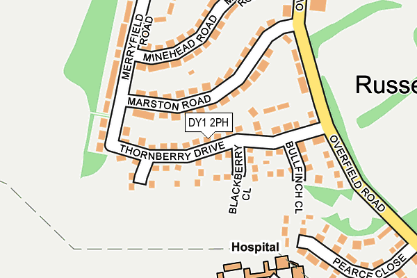
DY1 2PH is located in the St James's electoral ward, within the metropolitan district of Dudley and the English Parliamentary constituency of Dudley North. The Sub Integrated Care Board (ICB) Location is NHS Black Country ICB - D2P2L and the police force is West Midlands. This postcode has been in use since April 2018.


GetTheData
Source: OS OpenMap – Local (Ordnance Survey)
Source: OS VectorMap District (Ordnance Survey)
Licence: Open Government Licence (requires attribution)
| Easting | 392558 |
| Northing | 290135 |
| Latitude | 52.509070 |
| Longitude | -2.111073 |
GetTheData
Source: Open Postcode Geo
Licence: Open Government Licence
| Country | England |
| Postcode District | DY1 |
➜ See where DY1 is on a map ➜ Where is Dudley? | |
GetTheData
Source: Land Registry Price Paid Data
Licence: Open Government Licence
| Ward | St James's |
| Constituency | Dudley North |
GetTheData
Source: ONS Postcode Database
Licence: Open Government Licence
2023 20 OCT £318,000 |
2023 24 APR £225,000 |
2021 16 JUL £212,000 |
2020 6 AUG £248,000 |
11, SPRING POOL MEADOW, DUDLEY, DY1 2PH 2019 25 JUL £238,950 |
25, SPRING POOL MEADOW, DUDLEY, DY1 2PH 2019 19 JUL £210,000 |
2019 12 JUL £174,000 |
23, SPRING POOL MEADOW, DUDLEY, DY1 2PH 2019 28 JUN £238,950 |
33, SPRING POOL MEADOW, DUDLEY, DY1 2PH 2019 28 JUN £174,000 |
9, SPRING POOL MEADOW, DUDLEY, DY1 2PH 2019 31 MAY £209,500 |
GetTheData
Source: HM Land Registry Price Paid Data
Licence: Contains HM Land Registry data © Crown copyright and database right 2025. This data is licensed under the Open Government Licence v3.0.
| Post Office (Russells Hall Rd) | Russell's Hall | 107m |
| Post Office (Russells Hall Rd) | Russell's Hall | 119m |
| Hinbrook Rd (Russells Hall Rd) | Russell's Hall | 138m |
| St Barnabus Church (Middlepark Rd) | Russell's Hall | 143m |
| Hinbrook Rd (Russells Hall Rd) | Russell's Hall | 148m |
| Tipton Station | 3.9km |
| Coseley Station | 4.4km |
| Dudley Port Station | 4.5km |
GetTheData
Source: NaPTAN
Licence: Open Government Licence
| Percentage of properties with Next Generation Access | 98.0% |
| Percentage of properties with Superfast Broadband | 98.0% |
| Percentage of properties with Ultrafast Broadband | 98.0% |
| Percentage of properties with Full Fibre Broadband | 98.0% |
Superfast Broadband is between 30Mbps and 300Mbps
Ultrafast Broadband is > 300Mbps
| Percentage of properties unable to receive 2Mbps | 0.0% |
| Percentage of properties unable to receive 5Mbps | 0.0% |
| Percentage of properties unable to receive 10Mbps | 0.0% |
| Percentage of properties unable to receive 30Mbps | 0.0% |
GetTheData
Source: Ofcom
Licence: Ofcom Terms of Use (requires attribution)
GetTheData
Source: ONS Postcode Database
Licence: Open Government Licence


➜ Get more ratings from the Food Standards Agency
GetTheData
Source: Food Standards Agency
Licence: FSA terms & conditions
| Last Collection | |||
|---|---|---|---|
| Location | Mon-Fri | Sat | Distance |
| Waverley Street | 17:30 | 11:00 | 988m |
| Woodside Road | 17:30 | 11:00 | 1,060m |
| Wood Street | 17:30 | 11:00 | 1,496m |
GetTheData
Source: Dracos
Licence: Creative Commons Attribution-ShareAlike
The below table lists the International Territorial Level (ITL) codes (formerly Nomenclature of Territorial Units for Statistics (NUTS) codes) and Local Administrative Units (LAU) codes for DY1 2PH:
| ITL 1 Code | Name |
|---|---|
| TLG | West Midlands (England) |
| ITL 2 Code | Name |
| TLG3 | West Midlands |
| ITL 3 Code | Name |
| TLG36 | Dudley |
| LAU 1 Code | Name |
| E08000027 | Dudley |
GetTheData
Source: ONS Postcode Directory
Licence: Open Government Licence
The below table lists the Census Output Area (OA), Lower Layer Super Output Area (LSOA), and Middle Layer Super Output Area (MSOA) for DY1 2PH:
| Code | Name | |
|---|---|---|
| OA | E00049976 | |
| LSOA | E01009883 | Dudley 013C |
| MSOA | E02002012 | Dudley 013 |
GetTheData
Source: ONS Postcode Directory
Licence: Open Government Licence
| DY1 2NW | Russells Hall Road | 96m |
| DY1 2NN | Russells Hall Road | 152m |
| DY1 2NG | Hinbrook Road | 161m |
| DY1 2JW | Russells Hall Road | 176m |
| DY1 2NL | Langstone Road | 178m |
| DY1 2LH | Middlepark Road | 178m |
| DY1 2NJ | Langstone Road | 196m |
| DY1 2GP | Red Kite Drive | 225m |
| DY1 2GR | Red Kite Drive | 225m |
| DY1 2GS | Red Kite Drive | 225m |
GetTheData
Source: Open Postcode Geo; Land Registry Price Paid Data
Licence: Open Government Licence