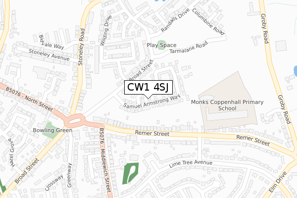
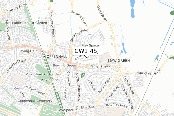
CW1 4SJ is located in the Crewe East electoral ward, within the unitary authority of Cheshire East and the English Parliamentary constituency of Crewe and Nantwich. The Sub Integrated Care Board (ICB) Location is NHS Cheshire and Merseyside ICB - 27D and the police force is Cheshire. This postcode has been in use since May 2019.


GetTheData
Source: OS Open Zoomstack (Ordnance Survey)
Licence: Open Government Licence (requires attribution)
Attribution: Contains OS data © Crown copyright and database right 2025
Source: Open Postcode Geo
Licence: Open Government Licence (requires attribution)
Attribution: Contains OS data © Crown copyright and database right 2025; Contains Royal Mail data © Royal Mail copyright and database right 2025; Source: Office for National Statistics licensed under the Open Government Licence v.3.0
| Easting | 370891 |
| Northing | 357340 |
| Latitude | 53.112460 |
| Longitude | -2.436321 |
GetTheData
Source: Open Postcode Geo
Licence: Open Government Licence
| Country | England |
| Postcode District | CW1 |
➜ See where CW1 is on a map ➜ Where is Crewe? | |
GetTheData
Source: Land Registry Price Paid Data
Licence: Open Government Licence
| Ward | Crewe East |
| Constituency | Crewe And Nantwich |
GetTheData
Source: ONS Postcode Database
Licence: Open Government Licence
2024 15 NOV £300,000 |
2023 31 MAR £265,000 |
45, SAMUEL ARMSTRONG WAY, CREWE, CW1 4SJ 2020 19 NOV £236,995 |
65, SAMUEL ARMSTRONG WAY, CREWE, CW1 4SJ 2020 9 NOV £208,995 |
33, SAMUEL ARMSTRONG WAY, CREWE, CW1 4SJ 2020 21 SEP £259,995 |
2020 18 SEP £255,995 |
31, SAMUEL ARMSTRONG WAY, CREWE, CW1 4SJ 2020 3 JUL £222,995 |
29, SAMUEL ARMSTRONG WAY, CREWE, CW1 4SJ 2020 26 MAR £208,995 |
19, SAMUEL ARMSTRONG WAY, CREWE, CW1 4SJ 2019 30 DEC £186,000 |
2019 6 SEP £214,995 |
GetTheData
Source: HM Land Registry Price Paid Data
Licence: Contains HM Land Registry data © Crown copyright and database right 2025. This data is licensed under the Open Government Licence v3.0.
| Acer Avenue (Remer Street) | Coppenhall | 195m |
| Middlewich Street (Remer Street) | Coppenhall | 196m |
| The Haven (Middlewich Street) | Coppenhall | 286m |
| Post Office (North Street) | Coppenhall | 368m |
| North Street (Broad Street) | Coppenhall | 379m |
| Crewe Station | 2.5km |
| Sandbach Station | 5.1km |
GetTheData
Source: NaPTAN
Licence: Open Government Licence
GetTheData
Source: ONS Postcode Database
Licence: Open Government Licence


➜ Get more ratings from the Food Standards Agency
GetTheData
Source: Food Standards Agency
Licence: FSA terms & conditions
| Last Collection | |||
|---|---|---|---|
| Location | Mon-Fri | Sat | Distance |
| Ford Lane | 17:30 | 12:00 | 1,502m |
| Tollemache Drive | 17:10 | 11:30 | 1,558m |
| Earle Street | 17:30 | 13:00 | 1,598m |
GetTheData
Source: Dracos
Licence: Creative Commons Attribution-ShareAlike
The below table lists the International Territorial Level (ITL) codes (formerly Nomenclature of Territorial Units for Statistics (NUTS) codes) and Local Administrative Units (LAU) codes for CW1 4SJ:
| ITL 1 Code | Name |
|---|---|
| TLD | North West (England) |
| ITL 2 Code | Name |
| TLD6 | Cheshire |
| ITL 3 Code | Name |
| TLD62 | Cheshire East |
| LAU 1 Code | Name |
| E06000049 | Cheshire East |
GetTheData
Source: ONS Postcode Directory
Licence: Open Government Licence
The below table lists the Census Output Area (OA), Lower Layer Super Output Area (LSOA), and Middle Layer Super Output Area (MSOA) for CW1 4SJ:
| Code | Name | |
|---|---|---|
| OA | E00093249 | |
| LSOA | E01018478 | Cheshire East 035D |
| MSOA | E02003826 | Cheshire East 035 |
GetTheData
Source: ONS Postcode Directory
Licence: Open Government Licence
| CW1 4LT | Remer Street | 142m |
| CW1 4LU | Remer Street | 183m |
| CW1 4GT | Broad Street | 184m |
| CW1 4HR | Hawthorn Grove | 231m |
| CW1 4NQ | Stoneley Road | 237m |
| CW1 4LS | Remer Street | 274m |
| CW1 4NG | Stoneley Road | 276m |
| CW1 4HN | Lime Tree Avenue | 285m |
| CW1 4DP | Middlewich Street | 307m |
| CW1 4HW | Lime Tree Avenue | 323m |
GetTheData
Source: Open Postcode Geo; Land Registry Price Paid Data
Licence: Open Government Licence