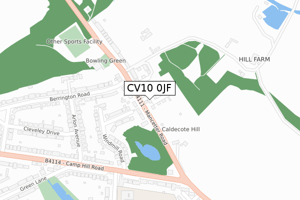
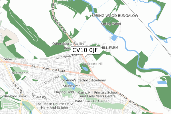
CV10 0JF is located in the Camp Hill electoral ward, within the local authority district of Nuneaton and Bedworth and the English Parliamentary constituency of Nuneaton. The Sub Integrated Care Board (ICB) Location is NHS Coventry and Warwickshire ICB - B2M3M and the police force is Warwickshire. This postcode has been in use since September 2019.


GetTheData
Source: OS Open Zoomstack (Ordnance Survey)
Licence: Open Government Licence (requires attribution)
Attribution: Contains OS data © Crown copyright and database right 2025
Source: Open Postcode Geo
Licence: Open Government Licence (requires attribution)
Attribution: Contains OS data © Crown copyright and database right 2025; Contains Royal Mail data © Royal Mail copyright and database right 2025; Source: Office for National Statistics licensed under the Open Government Licence v.3.0
| Easting | 433971 |
| Northing | 293439 |
| Latitude | 52.537775 |
| Longitude | -1.500572 |
GetTheData
Source: Open Postcode Geo
Licence: Open Government Licence
| Country | England |
| Postcode District | CV10 |
➜ See where CV10 is on a map ➜ Where is Nuneaton? | |
GetTheData
Source: Land Registry Price Paid Data
Licence: Open Government Licence
| Ward | Camp Hill |
| Constituency | Nuneaton |
GetTheData
Source: ONS Postcode Database
Licence: Open Government Licence
2023 25 JUL £360,000 |
2023 24 FEB £310,000 |
2022 14 JAN £299,950 |
2, MILLERS WAY, NUNEATON, CV10 0JF 2020 6 NOV £340,000 |
4, MILLERS WAY, NUNEATON, CV10 0JF 2020 31 JUL £250,000 |
8, MILLERS WAY, NUNEATON, CV10 0JF 2019 6 DEC £318,000 |
14, MILLERS WAY, NUNEATON, CV10 0JF 2019 3 DEC £305,000 |
2019 31 OCT £245,000 |
2019 11 OCT £255,000 |
2019 24 JUL £310,000 |
GetTheData
Source: HM Land Registry Price Paid Data
Licence: Contains HM Land Registry data © Crown copyright and database right 2025. This data is licensed under the Open Government Licence v3.0.
| Camp Hill Drive (Camp Hill Road) | Nuneaton | 255m |
| Mancetter Road (Camp Hill Road) | Nuneaton | 256m |
| Tuttle Hill (Camp Hill Road) | Nuneaton | 273m |
| Arlon Avenue (Camp Hill Road) | Nuneaton | 317m |
| Walnut Close (Tuttle Hill) | Nuneaton | 452m |
| Nuneaton Station | 2.8km |
| Bermuda Park Station | 4.5km |
| Atherstone Station | 5.8km |
GetTheData
Source: NaPTAN
Licence: Open Government Licence
| Percentage of properties with Next Generation Access | 100.0% |
| Percentage of properties with Superfast Broadband | 100.0% |
| Percentage of properties with Ultrafast Broadband | 62.5% |
| Percentage of properties with Full Fibre Broadband | 62.5% |
Superfast Broadband is between 30Mbps and 300Mbps
Ultrafast Broadband is > 300Mbps
| Percentage of properties unable to receive 2Mbps | 0.0% |
| Percentage of properties unable to receive 5Mbps | 0.0% |
| Percentage of properties unable to receive 10Mbps | 0.0% |
| Percentage of properties unable to receive 30Mbps | 0.0% |
GetTheData
Source: Ofcom
Licence: Ofcom Terms of Use (requires attribution)
GetTheData
Source: ONS Postcode Database
Licence: Open Government Licence


➜ Get more ratings from the Food Standards Agency
GetTheData
Source: Food Standards Agency
Licence: FSA terms & conditions
| Last Collection | |||
|---|---|---|---|
| Location | Mon-Fri | Sat | Distance |
| Hartshill Post Office | 16:45 | 11:45 | 1,435m |
| School Hill | 16:45 | 11:45 | 1,534m |
| Earls Road | 17:15 | 11:45 | 2,026m |
GetTheData
Source: Dracos
Licence: Creative Commons Attribution-ShareAlike
The below table lists the International Territorial Level (ITL) codes (formerly Nomenclature of Territorial Units for Statistics (NUTS) codes) and Local Administrative Units (LAU) codes for CV10 0JF:
| ITL 1 Code | Name |
|---|---|
| TLG | West Midlands (England) |
| ITL 2 Code | Name |
| TLG1 | Herefordshire, Worcestershire and Warwickshire |
| ITL 3 Code | Name |
| TLG13 | Warwickshire CC |
| LAU 1 Code | Name |
| E07000219 | Nuneaton and Bedworth |
GetTheData
Source: ONS Postcode Directory
Licence: Open Government Licence
The below table lists the Census Output Area (OA), Lower Layer Super Output Area (LSOA), and Middle Layer Super Output Area (MSOA) for CV10 0JF:
| Code | Name | |
|---|---|---|
| OA | E00158416 | |
| LSOA | E01031073 | Nuneaton and Bedworth 002C |
| MSOA | E02006476 | Nuneaton and Bedworth 002 |
GetTheData
Source: ONS Postcode Directory
Licence: Open Government Licence
| CV10 0HN | Mancetter Road | 54m |
| CV10 0HW | Mancetter Road | 139m |
| CV10 0HL | Windmill Road | 161m |
| CV10 0LE | Berrington Road | 190m |
| CV10 0HP | Mancetter Road | 232m |
| CV10 0JY | Arlon Avenue | 244m |
| CV10 0JW | Camp Hill Road | 269m |
| CV10 0JU | Camp Hill Road | 272m |
| CV10 0RS | Mancetter Road | 323m |
| CV10 0JT | Camp Hill Road | 324m |
GetTheData
Source: Open Postcode Geo; Land Registry Price Paid Data
Licence: Open Government Licence