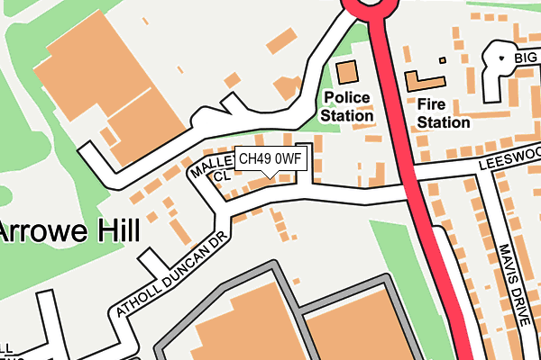
CH49 0WF is located in the Greasby, Frankby and Irby electoral ward, within the metropolitan district of Wirral and the English Parliamentary constituency of Wirral West. The Sub Integrated Care Board (ICB) Location is NHS Cheshire and Merseyside ICB - 12F and the police force is Merseyside. This postcode has been in use since February 2017.


GetTheData
Source: OS OpenMap – Local (Ordnance Survey)
Source: OS VectorMap District (Ordnance Survey)
Licence: Open Government Licence (requires attribution)
| Easting | 326756 |
| Northing | 387339 |
| Latitude | 53.377822 |
| Longitude | -3.102481 |
GetTheData
Source: Open Postcode Geo
Licence: Open Government Licence
| Country | England |
| Postcode District | CH49 |
➜ See where CH49 is on a map ➜ Where is Birkenhead? | |
GetTheData
Source: Land Registry Price Paid Data
Licence: Open Government Licence
| Ward | Greasby, Frankby And Irby |
| Constituency | Wirral West |
GetTheData
Source: ONS Postcode Database
Licence: Open Government Licence
2022 1 JUL £473,000 |
2022 29 APR £420,000 |
2022 25 MAR £335,000 |
2022 8 FEB £350,000 |
2021 11 JUN £320,000 |
2020 28 FEB £300,000 |
78, ATHOLL DUNCAN DRIVE, WIRRAL, CH49 0WF 2019 27 SEP £394,950 |
38, ATHOLL DUNCAN DRIVE, WIRRAL, CH49 0WF 2019 11 JUL £384,950 |
66, ATHOLL DUNCAN DRIVE, WIRRAL, CH49 0WF 2019 24 JUN £334,950 |
68, ATHOLL DUNCAN DRIVE, WIRRAL, CH49 0WF 2019 15 MAY £289,950 |
GetTheData
Source: HM Land Registry Price Paid Data
Licence: Contains HM Land Registry data © Crown copyright and database right 2025. This data is licensed under the Open Government Licence v3.0.
| Arrowebrook Road | Arrowe Hill | 309m |
| Leeswood Road (Arrowe Park Road) | Arrowe Hill | 327m |
| Leeswood Road (Arrowe Park Road) | Arrowe Hill | 333m |
| Arrowe Park Road (Arrowe Brook Road) | Arrowe Park | 400m |
| Arrowe Brook Road (Arrowe Park Road) | Arrowe Hill | 409m |
| Upton Station | 1.6km |
| Moreton (Merseyside) Station | 3.4km |
| Leasowe Station | 3.4km |
GetTheData
Source: NaPTAN
Licence: Open Government Licence
| Percentage of properties with Next Generation Access | 100.0% |
| Percentage of properties with Superfast Broadband | 100.0% |
| Percentage of properties with Ultrafast Broadband | 100.0% |
| Percentage of properties with Full Fibre Broadband | 0.0% |
Superfast Broadband is between 30Mbps and 300Mbps
Ultrafast Broadband is > 300Mbps
| Median download speed | 100.0Mbps |
| Average download speed | 141.8Mbps |
| Maximum download speed | 350.00Mbps |
| Median upload speed | 1.1Mbps |
| Average upload speed | 1.1Mbps |
| Maximum upload speed | 1.24Mbps |
| Percentage of properties unable to receive 2Mbps | 0.0% |
| Percentage of properties unable to receive 5Mbps | 0.0% |
| Percentage of properties unable to receive 10Mbps | 0.0% |
| Percentage of properties unable to receive 30Mbps | 0.0% |
GetTheData
Source: Ofcom
Licence: Ofcom Terms of Use (requires attribution)
GetTheData
Source: ONS Postcode Database
Licence: Open Government Licence


➜ Get more ratings from the Food Standards Agency
GetTheData
Source: Food Standards Agency
Licence: FSA terms & conditions
| Last Collection | |||
|---|---|---|---|
| Location | Mon-Fri | Sat | Distance |
| Greasby Post Office | 17:15 | 12:00 | 1,230m |
| Sandbrook Lane | 17:30 | 12:00 | 2,155m |
| Glenwood Drive | 17:00 | 12:00 | 2,310m |
GetTheData
Source: Dracos
Licence: Creative Commons Attribution-ShareAlike
The below table lists the International Territorial Level (ITL) codes (formerly Nomenclature of Territorial Units for Statistics (NUTS) codes) and Local Administrative Units (LAU) codes for CH49 0WF:
| ITL 1 Code | Name |
|---|---|
| TLD | North West (England) |
| ITL 2 Code | Name |
| TLD7 | Merseyside |
| ITL 3 Code | Name |
| TLD74 | Wirral |
| LAU 1 Code | Name |
| E08000015 | Wirral |
GetTheData
Source: ONS Postcode Directory
Licence: Open Government Licence
The below table lists the Census Output Area (OA), Lower Layer Super Output Area (LSOA), and Middle Layer Super Output Area (MSOA) for CH49 0WF:
| Code | Name | |
|---|---|---|
| OA | E00037027 | |
| LSOA | E01007302 | Wirral 018D |
| MSOA | E02001484 | Wirral 018 |
GetTheData
Source: ONS Postcode Directory
Licence: Open Government Licence
| CH49 1SP | Brookdale Avenue South | 319m |
| CH49 0UF | Arrowe Park Road | 357m |
| CH49 0UG | Arrowe Park Road | 372m |
| CH49 1SS | Brookdale Avenue South | 387m |
| CH49 1SW | Caulfield Drive | 388m |
| CH49 1SR | Brookdale Avenue South | 389m |
| CH49 0UW | Mavis Drive | 407m |
| CH49 1SJ | Appleton Drive | 424m |
| CH49 9AW | Big Meadow Road | 436m |
| CH49 6QB | Dorchester Close | 438m |
GetTheData
Source: Open Postcode Geo; Land Registry Price Paid Data
Licence: Open Government Licence