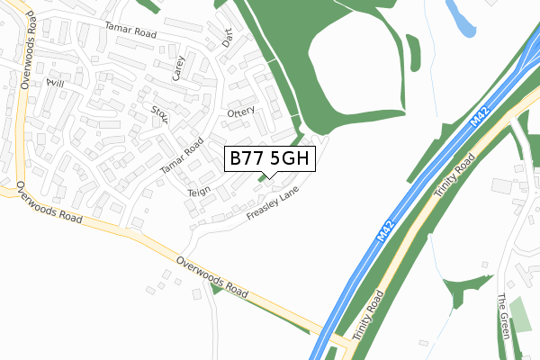
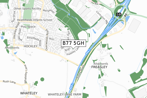
B77 5GH is located in the Wilnecote electoral ward, within the local authority district of Tamworth and the English Parliamentary constituency of Tamworth. The Sub Integrated Care Board (ICB) Location is NHS Staffordshire and Stoke-on-Trent ICB - 05Q and the police force is Staffordshire. This postcode has been in use since February 2016.


GetTheData
Source: OS Open Zoomstack (Ordnance Survey)
Licence: Open Government Licence (requires attribution)
Attribution: Contains OS data © Crown copyright and database right 2024
Source: Open Postcode Geo
Licence: Open Government Licence (requires attribution)
Attribution: Contains OS data © Crown copyright and database right 2024; Contains Royal Mail data © Royal Mail copyright and database right 2024; Source: Office for National Statistics licensed under the Open Government Licence v.3.0
| Easting | 423570 |
| Northing | 300034 |
| Latitude | 52.597609 |
| Longitude | -1.653449 |
GetTheData
Source: Open Postcode Geo
Licence: Open Government Licence
| Country | England |
| Postcode District | B77 |
➜ See where B77 is on a map ➜ Where is Tamworth? | |
GetTheData
Source: Land Registry Price Paid Data
Licence: Open Government Licence
Elevation or altitude of B77 5GH as distance above sea level:
| Metres | Feet | |
|---|---|---|
| Elevation | 100m | 328ft |
Elevation is measured from the approximate centre of the postcode, to the nearest point on an OS contour line from OS Terrain 50, which has contour spacing of ten vertical metres.
➜ How high above sea level am I? Find the elevation of your current position using your device's GPS.
GetTheData
Source: Open Postcode Elevation
Licence: Open Government Licence
| Ward | Wilnecote |
| Constituency | Tamworth |
GetTheData
Source: ONS Postcode Database
Licence: Open Government Licence
2022 23 SEP £350,000 |
2021 10 AUG £255,500 |
2020 9 OCT £260,000 |
2019 28 JUN £420,000 |
22, SWALLOWHURST, HOCKLEY, TAMWORTH, B77 5GH 2017 31 MAR £200,000 |
12, SWALLOWHURST, HOCKLEY, TAMWORTH, B77 5GH 2017 29 MAR £395,000 |
2017 16 MAR £395,000 |
2017 14 MAR £252,000 |
1, SWALLOWHURST, HOCKLEY, TAMWORTH, B77 5GH 2017 24 FEB £265,000 |
16, SWALLOWHURST, HOCKLEY, TAMWORTH, B77 5GH 2016 9 DEC £244,950 |
GetTheData
Source: HM Land Registry Price Paid Data
Licence: Contains HM Land Registry data © Crown copyright and database right 2024. This data is licensed under the Open Government Licence v3.0.
| Stour (Tamar Road) | Hockley | 153m |
| Torridge (Tamar Rd) | Hockley | 258m |
| Torridge (Tamar Road) | Hockley | 278m |
| Avon (Tamar Rd) | Hockley | 382m |
| Avon (Tamar Road) | Hockley | 394m |
| Wilnecote (Staffs) Station | 2.3km |
| Polesworth Station | 4.3km |
| Tamworth High Level Station | 5km |
GetTheData
Source: NaPTAN
Licence: Open Government Licence
| Percentage of properties with Next Generation Access | 100.0% |
| Percentage of properties with Superfast Broadband | 0.0% |
| Percentage of properties with Ultrafast Broadband | 0.0% |
| Percentage of properties with Full Fibre Broadband | 0.0% |
Superfast Broadband is between 30Mbps and 300Mbps
Ultrafast Broadband is > 300Mbps
| Median download speed | 19.3Mbps |
| Average download speed | 17.4Mbps |
| Maximum download speed | 28.95Mbps |
| Median upload speed | 1.5Mbps |
| Average upload speed | 2.4Mbps |
| Maximum upload speed | 6.84Mbps |
| Percentage of properties unable to receive 2Mbps | 0.0% |
| Percentage of properties unable to receive 5Mbps | 0.0% |
| Percentage of properties unable to receive 10Mbps | 0.0% |
| Percentage of properties unable to receive 30Mbps | 100.0% |
GetTheData
Source: Ofcom
Licence: Ofcom Terms of Use (requires attribution)
GetTheData
Source: ONS Postcode Database
Licence: Open Government Licence


➜ Get more ratings from the Food Standards Agency
GetTheData
Source: Food Standards Agency
Licence: FSA terms & conditions
| Last Collection | |||
|---|---|---|---|
| Location | Mon-Fri | Sat | Distance |
| Granada Services | 17:30 | 11:00 | 1,393m |
| Wood End Post Office | 18:00 | 10:45 | 1,925m |
| Malham Road / Lowforce | 18:00 | 11:30 | 2,091m |
GetTheData
Source: Dracos
Licence: Creative Commons Attribution-ShareAlike
The below table lists the International Territorial Level (ITL) codes (formerly Nomenclature of Territorial Units for Statistics (NUTS) codes) and Local Administrative Units (LAU) codes for B77 5GH:
| ITL 1 Code | Name |
|---|---|
| TLG | West Midlands (England) |
| ITL 2 Code | Name |
| TLG2 | Shropshire and Staffordshire |
| ITL 3 Code | Name |
| TLG24 | Staffordshire CC |
| LAU 1 Code | Name |
| E07000199 | Tamworth |
GetTheData
Source: ONS Postcode Directory
Licence: Open Government Licence
The below table lists the Census Output Area (OA), Lower Layer Super Output Area (LSOA), and Middle Layer Super Output Area (MSOA) for B77 5GH:
| Code | Name | |
|---|---|---|
| OA | E00152175 | |
| LSOA | E01029868 | Tamworth 010D |
| MSOA | E02006226 | Tamworth 010 |
GetTheData
Source: ONS Postcode Directory
Licence: Open Government Licence
| B77 5QP | Teign | 91m |
| B77 5QH | Ottery | 157m |
| B77 5QQ | Tamar Road | 179m |
| B77 5QJ | Stour | 233m |
| B77 5QB | Carey | 248m |
| B77 5NG | Overwoods Road | 255m |
| B77 5QD | Dart | 279m |
| B77 5QG | Tamar Road | 353m |
| B77 5QE | Avill | 358m |
| B77 5QL | Torridge | 360m |
GetTheData
Source: Open Postcode Geo; Land Registry Price Paid Data
Licence: Open Government Licence