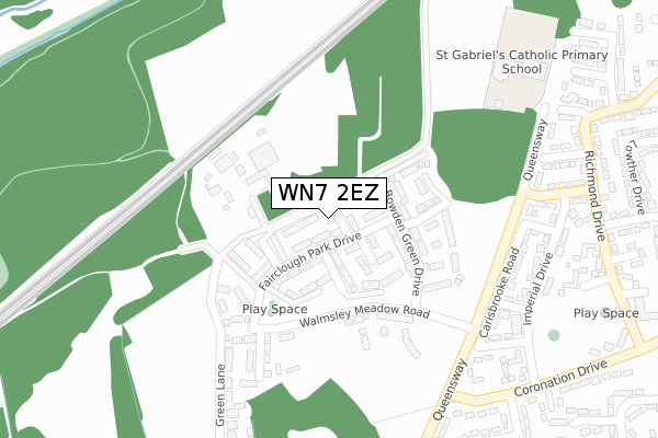
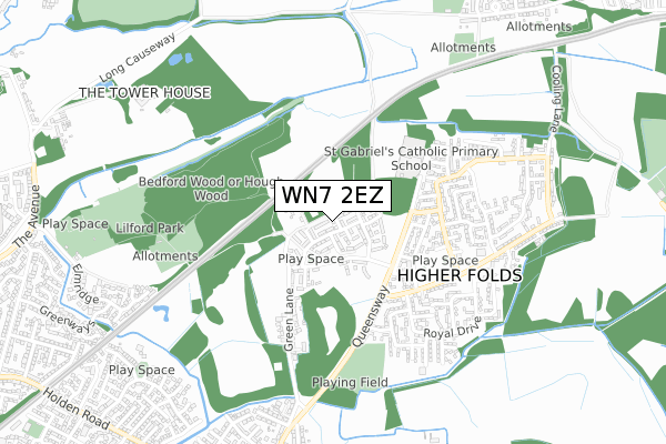
WN7 2EZ is located in the Leigh Central & Higher Folds electoral ward, within the metropolitan district of Wigan and the English Parliamentary constituency of Leigh. The Sub Integrated Care Board (ICB) Location is NHS Greater Manchester ICB - 02H and the police force is Greater Manchester. This postcode has been in use since June 2018.


GetTheData
Source: OS Open Zoomstack (Ordnance Survey)
Licence: Open Government Licence (requires attribution)
Attribution: Contains OS data © Crown copyright and database right 2025
Source: Open Postcode Geo
Licence: Open Government Licence (requires attribution)
Attribution: Contains OS data © Crown copyright and database right 2025; Contains Royal Mail data © Royal Mail copyright and database right 2025; Source: Office for National Statistics licensed under the Open Government Licence v.3.0
| Easting | 367558 |
| Northing | 401048 |
| Latitude | 53.505130 |
| Longitude | -2.490596 |
GetTheData
Source: Open Postcode Geo
Licence: Open Government Licence
| Country | England |
| Postcode District | WN7 |
➜ See where WN7 is on a map ➜ Where is Leigh? | |
GetTheData
Source: Land Registry Price Paid Data
Licence: Open Government Licence
| Ward | Leigh Central & Higher Folds |
| Constituency | Leigh |
GetTheData
Source: ONS Postcode Database
Licence: Open Government Licence
2022 14 OCT £295,000 |
2022 7 FEB £230,000 |
2019 23 AUG £210,000 |
2018 21 DEC £187,995 |
2, COOKE CLOSE, LEIGH, WN7 2EZ 2018 21 DEC £242,995 |
2018 30 NOV £187,995 |
16, COOKE CLOSE, LEIGH, WN7 2EZ 2018 30 NOV £183,995 |
15, COOKE CLOSE, LEIGH, WN7 2EZ 2018 29 JUN £239,995 |
2018 8 JUN £183,995 |
11, COOKE CLOSE, LEIGH, WN7 2EZ 2018 31 MAY £229,995 |
GetTheData
Source: HM Land Registry Price Paid Data
Licence: Contains HM Land Registry data © Crown copyright and database right 2025. This data is licensed under the Open Government Licence v3.0.
| Queensway/Coronation Dr (Queensway) | Higher Folds | 344m |
| Coronation Dr/Royal Dr (Coronation Dr) | Higher Folds | 373m |
| Richmond Dr/Regent Dr (Richmond Dr) | Higher Folds | 400m |
| Queensway/Osborne Gr (Queensway) | Higher Folds | 411m |
| Richmond Drive (East Bound) (Richmond Drive) | Higher Folds | 434m |
| Atherton Station | 2.8km |
| Hag Fold Station | 3.2km |
| Daisy Hill Station | 4.2km |
GetTheData
Source: NaPTAN
Licence: Open Government Licence
| Percentage of properties with Next Generation Access | 100.0% |
| Percentage of properties with Superfast Broadband | 100.0% |
| Percentage of properties with Ultrafast Broadband | 46.7% |
| Percentage of properties with Full Fibre Broadband | 46.7% |
Superfast Broadband is between 30Mbps and 300Mbps
Ultrafast Broadband is > 300Mbps
| Percentage of properties unable to receive 2Mbps | 0.0% |
| Percentage of properties unable to receive 5Mbps | 0.0% |
| Percentage of properties unable to receive 10Mbps | 0.0% |
| Percentage of properties unable to receive 30Mbps | 0.0% |
GetTheData
Source: Ofcom
Licence: Ofcom Terms of Use (requires attribution)
GetTheData
Source: ONS Postcode Database
Licence: Open Government Licence


➜ Get more ratings from the Food Standards Agency
GetTheData
Source: Food Standards Agency
Licence: FSA terms & conditions
| Last Collection | |||
|---|---|---|---|
| Location | Mon-Fri | Sat | Distance |
| Wensleydale | 18:25 | 11:45 | 1,091m |
| Richmonds Drive | 17:25 | 12:00 | 1,385m |
| Romford Avenue | 18:15 | 11:30 | 1,889m |
GetTheData
Source: Dracos
Licence: Creative Commons Attribution-ShareAlike
The below table lists the International Territorial Level (ITL) codes (formerly Nomenclature of Territorial Units for Statistics (NUTS) codes) and Local Administrative Units (LAU) codes for WN7 2EZ:
| ITL 1 Code | Name |
|---|---|
| TLD | North West (England) |
| ITL 2 Code | Name |
| TLD3 | Greater Manchester |
| ITL 3 Code | Name |
| TLD36 | Greater Manchester North West |
| LAU 1 Code | Name |
| E08000010 | Wigan |
GetTheData
Source: ONS Postcode Directory
Licence: Open Government Licence
The below table lists the Census Output Area (OA), Lower Layer Super Output Area (LSOA), and Middle Layer Super Output Area (MSOA) for WN7 2EZ:
| Code | Name | |
|---|---|---|
| OA | E00031673 | |
| LSOA | E01006248 | Wigan 031A |
| MSOA | E02001317 | Wigan 031 |
GetTheData
Source: ONS Postcode Directory
Licence: Open Government Licence
| WN7 2XA | Carisbrooke Road | 296m |
| WN7 2XD | Waverley Grove | 307m |
| WN7 2XF | Imperial Drive | 325m |
| WN7 2TW | Green Lane | 330m |
| WN7 2XE | Regent Drive | 356m |
| WN7 2XQ | Sunningdale Grove | 365m |
| WN7 2UZ | Queensway | 378m |
| WN7 2XU | Richmond Drive | 412m |
| WN7 2TS | Osborne Grove | 429m |
| WN7 2XS | Richmond Drive | 430m |
GetTheData
Source: Open Postcode Geo; Land Registry Price Paid Data
Licence: Open Government Licence