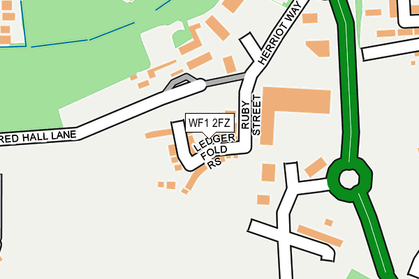
WF1 2FZ is located in the Wrenthorpe and Outwood West electoral ward, within the metropolitan district of Wakefield and the English Parliamentary constituency of Morley and Outwood. The Sub Integrated Care Board (ICB) Location is NHS West Yorkshire ICB - 03R and the police force is West Yorkshire. This postcode has been in use since March 2017.


GetTheData
Source: OS OpenMap – Local (Ordnance Survey)
Source: OS VectorMap District (Ordnance Survey)
Licence: Open Government Licence (requires attribution)
| Easting | 432536 |
| Northing | 422350 |
| Latitude | 53.696600 |
| Longitude | -1.508711 |
GetTheData
Source: Open Postcode Geo
Licence: Open Government Licence
| Country | England |
| Postcode District | WF1 |
➜ See where WF1 is on a map ➜ Where is Wakefield? | |
GetTheData
Source: Land Registry Price Paid Data
Licence: Open Government Licence
| Ward | Wrenthorpe And Outwood West |
| Constituency | Morley And Outwood |
GetTheData
Source: ONS Postcode Database
Licence: Open Government Licence
2021 16 APR £247,000 |
2018 7 NOV £202,500 |
2018 29 JUN £215,000 |
23, LEDGER FOLD RISE, WAKEFIELD, WF1 2FZ 2018 25 APR £260,000 |
7, LEDGER FOLD RISE, WAKEFIELD, WF1 2FZ 2018 2 FEB £259,950 |
31, LEDGER FOLD RISE, WAKEFIELD, WF1 2FZ 2017 20 DEC £274,950 |
15, LEDGER FOLD RISE, WAKEFIELD, WF1 2FZ 2017 30 NOV £259,950 |
2, LEDGER FOLD RISE, WAKEFIELD, WF1 2FZ 2017 29 SEP £259,950 |
11, LEDGER FOLD RISE, WAKEFIELD, WF1 2FZ 2017 18 AUG £289,950 |
9, LEDGER FOLD RISE, WAKEFIELD, WF1 2FZ 2017 13 JUL £289,950 |
GetTheData
Source: HM Land Registry Price Paid Data
Licence: Contains HM Land Registry data © Crown copyright and database right 2025. This data is licensed under the Open Government Licence v3.0.
| Paragon Business Village Paragon Way (Paragon Way) | Newton Hill | 355m |
| Bradford Road Fox Ln (Bradford Road) | Newton Bar | 374m |
| Leeds Road Newton Hill (Leeds Road) | Newton Hill | 375m |
| Leeds Rd Newton Close (Leeds Road) | Newton Hill | 376m |
| Bradford Road Fox Ln (Bradford Road) | Newton Bar | 383m |
| Wakefield Westgate Station | 1.5km |
| Outwood Station | 2.1km |
| Wakefield Kirkgate Station | 2.4km |
GetTheData
Source: NaPTAN
Licence: Open Government Licence
| Percentage of properties with Next Generation Access | 100.0% |
| Percentage of properties with Superfast Broadband | 100.0% |
| Percentage of properties with Ultrafast Broadband | 100.0% |
| Percentage of properties with Full Fibre Broadband | 0.0% |
Superfast Broadband is between 30Mbps and 300Mbps
Ultrafast Broadband is > 300Mbps
| Median download speed | 58.3Mbps |
| Average download speed | 58.5Mbps |
| Maximum download speed | 200.00Mbps |
| Median upload speed | 13.5Mbps |
| Average upload speed | 12.2Mbps |
| Maximum upload speed | 20.00Mbps |
| Percentage of properties unable to receive 2Mbps | 0.0% |
| Percentage of properties unable to receive 5Mbps | 0.0% |
| Percentage of properties unable to receive 10Mbps | 0.0% |
| Percentage of properties unable to receive 30Mbps | 0.0% |
GetTheData
Source: Ofcom
Licence: Ofcom Terms of Use (requires attribution)
GetTheData
Source: ONS Postcode Database
Licence: Open Government Licence


➜ Get more ratings from the Food Standards Agency
GetTheData
Source: Food Standards Agency
Licence: FSA terms & conditions
| Last Collection | |||
|---|---|---|---|
| Location | Mon-Fri | Sat | Distance |
| Leeds Road | 18:00 | 12:15 | 396m |
| Snowhill | 17:30 | 11:00 | 476m |
| Cypruss Street | 17:30 | 11:00 | 580m |
GetTheData
Source: Dracos
Licence: Creative Commons Attribution-ShareAlike
The below table lists the International Territorial Level (ITL) codes (formerly Nomenclature of Territorial Units for Statistics (NUTS) codes) and Local Administrative Units (LAU) codes for WF1 2FZ:
| ITL 1 Code | Name |
|---|---|
| TLE | Yorkshire and The Humber |
| ITL 2 Code | Name |
| TLE4 | West Yorkshire |
| ITL 3 Code | Name |
| TLE45 | Wakefield |
| LAU 1 Code | Name |
| E08000036 | Wakefield |
GetTheData
Source: ONS Postcode Directory
Licence: Open Government Licence
The below table lists the Census Output Area (OA), Lower Layer Super Output Area (LSOA), and Middle Layer Super Output Area (MSOA) for WF1 2FZ:
| Code | Name | |
|---|---|---|
| OA | E00059987 | |
| LSOA | E01011887 | Wakefield 008B |
| MSOA | E02002445 | Wakefield 008 |
GetTheData
Source: ONS Postcode Directory
Licence: Open Government Licence
| WF1 2AD | Bradford Road | 295m |
| WF1 2AW | Bradford Road | 301m |
| WF1 2UB | Snow Hill Close | 301m |
| WF1 2UF | Paragon Avenue | 307m |
| WF1 2AG | Whitehall Avenue | 318m |
| WF1 2AF | Whitehall Crescent | 324m |
| WF1 2UQ | Butterfield Way | 336m |
| WF1 2PS | Leeds Road | 336m |
| WF1 2UA | Snow Hill Rise | 342m |
| WF1 2AN | Bradford Road | 351m |
GetTheData
Source: Open Postcode Geo; Land Registry Price Paid Data
Licence: Open Government Licence