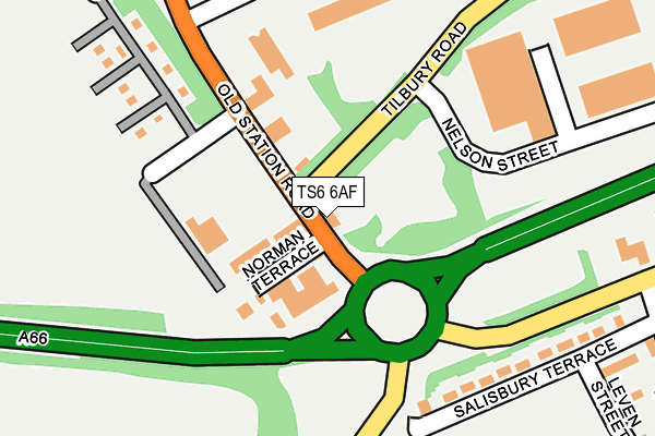
TS6 6AF is located in the South Bank electoral ward, within the unitary authority of Redcar and Cleveland and the English Parliamentary constituency of Redcar. The Sub Integrated Care Board (ICB) Location is NHS North East and North Cumbria ICB - 16C and the police force is Cleveland. This postcode has been in use since March 2017.


GetTheData
Source: OS OpenMap – Local (Ordnance Survey)
Source: OS VectorMap District (Ordnance Survey)
Licence: Open Government Licence (requires attribution)
| Easting | 454338 |
| Northing | 523134 |
| Latitude | 54.600481 |
| Longitude | -1.160433 |
GetTheData
Source: Open Postcode Geo
Licence: Open Government Licence
| Country | England |
| Postcode District | TS6 |
➜ See where TS6 is on a map | |
GetTheData
Source: Land Registry Price Paid Data
Licence: Open Government Licence
| Ward | South Bank |
| Constituency | Redcar |
GetTheData
Source: ONS Postcode Database
Licence: Open Government Licence
| Tesco Distribution Centre (Dabholm Road) | Teesport | 1,371m |
| Asda Distribution Centre (Dabholm Road) | Teesport | 1,485m |
| South Bank Station | 2.1km |
| British Steel Redcar Station | 3.3km |
| Middlesbrough Station | 5.4km |
GetTheData
Source: NaPTAN
Licence: Open Government Licence
GetTheData
Source: ONS Postcode Database
Licence: Open Government Licence


➜ Get more ratings from the Food Standards Agency
GetTheData
Source: Food Standards Agency
Licence: FSA terms & conditions
| Last Collection | |||
|---|---|---|---|
| Location | Mon-Fri | Sat | Distance |
| Lowfield Post Office | 18:00 | 11:30 | 2,847m |
| The Fleet | 16:30 | 11:30 | 3,764m |
| Ennis Square | 17:00 | 11:45 | 4,033m |
GetTheData
Source: Dracos
Licence: Creative Commons Attribution-ShareAlike
The below table lists the International Territorial Level (ITL) codes (formerly Nomenclature of Territorial Units for Statistics (NUTS) codes) and Local Administrative Units (LAU) codes for TS6 6AF:
| ITL 1 Code | Name |
|---|---|
| TLC | North East (England) |
| ITL 2 Code | Name |
| TLC1 | Tees Valley and Durham |
| ITL 3 Code | Name |
| TLC12 | South Teesside |
| LAU 1 Code | Name |
| E06000003 | Redcar and Cleveland |
GetTheData
Source: ONS Postcode Directory
Licence: Open Government Licence
The below table lists the Census Output Area (OA), Lower Layer Super Output Area (LSOA), and Middle Layer Super Output Area (MSOA) for TS6 6AF:
| Code | Name | |
|---|---|---|
| OA | E00061064 | |
| LSOA | E01012107 | Redcar and Cleveland 003D |
| MSOA | E02002517 | Redcar and Cleveland 003 |
GetTheData
Source: ONS Postcode Directory
Licence: Open Government Licence
| TS6 6TY | John Boyle Road | 1996m |
| TS6 7BL | Stapylton Court | 2247m |
| TS6 7AT | Pochin Road | 2295m |
| TS6 6US | Eston Road | 2347m |
| TS6 6QG | Strauss Road | 2428m |
| TS6 7EG | Bolckow Road | 2452m |
| TS6 7EJ | Bolckow Road | 2459m |
| TS6 6NR | Middlesbrough Road | 2466m |
| TS6 6PY | Redcar Road East | 2467m |
| TS6 6NS | Middlesbrough Road | 2469m |
GetTheData
Source: Open Postcode Geo; Land Registry Price Paid Data
Licence: Open Government Licence