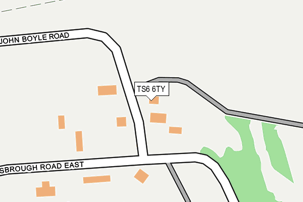
TS6 6TY lies on John Boyle Road in Middlesbrough. TS6 6TY is located in the South Bank electoral ward, within the unitary authority of Redcar and Cleveland and the English Parliamentary constituency of Redcar. The Sub Integrated Care Board (ICB) Location is NHS North East and North Cumbria ICB - 16C and the police force is Cleveland. This postcode has been in use since December 2005.


GetTheData
Source: OS OpenMap – Local (Ordnance Survey)
Source: OS VectorMap District (Ordnance Survey)
Licence: Open Government Licence (requires attribution)
| Easting | 454144 |
| Northing | 521147 |
| Latitude | 54.582648 |
| Longitude | -1.163801 |
GetTheData
Source: Open Postcode Geo
Licence: Open Government Licence
| Street | John Boyle Road |
| Town/City | Middlesbrough |
| Country | England |
| Postcode District | TS6 |
➜ See where TS6 is on a map | |
GetTheData
Source: Land Registry Price Paid Data
Licence: Open Government Licence
Elevation or altitude of TS6 6TY as distance above sea level:
| Metres | Feet | |
|---|---|---|
| Elevation | 10m | 33ft |
Elevation is measured from the approximate centre of the postcode, to the nearest point on an OS contour line from OS Terrain 50, which has contour spacing of ten vertical metres.
➜ How high above sea level am I? Find the elevation of your current position using your device's GPS.
GetTheData
Source: Open Postcode Elevation
Licence: Open Government Licence
| Ward | South Bank |
| Constituency | Redcar |
GetTheData
Source: ONS Postcode Database
Licence: Open Government Licence
| Old Fire Station (Middlesbrough Road East) | South Bank | 76m |
| Clay Lane (Middlesbrough Road East) | South Bank | 195m |
| Clay Lane (Middlesbrough Road East) | South Bank | 275m |
| Teesside Laboratories (Eston Road) | Grangetown | 558m |
| Bennetts Corner (Normanby Road) | South Bank | 760m |
| South Bank Station | 0.8km |
| James Cook University Hospital Station | 4.5km |
| British Steel Redcar Station | 4.5km |
GetTheData
Source: NaPTAN
Licence: Open Government Licence
GetTheData
Source: ONS Postcode Database
Licence: Open Government Licence


➜ Get more ratings from the Food Standards Agency
GetTheData
Source: Food Standards Agency
Licence: FSA terms & conditions
| Last Collection | |||
|---|---|---|---|
| Location | Mon-Fri | Sat | Distance |
| Lowfield Post Office | 18:00 | 11:30 | 1,323m |
| Nightingale Road | 17:15 | 12:15 | 2,213m |
| Birchington Avenue P.o. | 17:00 | 12:15 | 2,281m |
GetTheData
Source: Dracos
Licence: Creative Commons Attribution-ShareAlike
The below table lists the International Territorial Level (ITL) codes (formerly Nomenclature of Territorial Units for Statistics (NUTS) codes) and Local Administrative Units (LAU) codes for TS6 6TY:
| ITL 1 Code | Name |
|---|---|
| TLC | North East (England) |
| ITL 2 Code | Name |
| TLC1 | Tees Valley and Durham |
| ITL 3 Code | Name |
| TLC12 | South Teesside |
| LAU 1 Code | Name |
| E06000003 | Redcar and Cleveland |
GetTheData
Source: ONS Postcode Directory
Licence: Open Government Licence
The below table lists the Census Output Area (OA), Lower Layer Super Output Area (LSOA), and Middle Layer Super Output Area (MSOA) for TS6 6TY:
| Code | Name | |
|---|---|---|
| OA | E00061365 | |
| LSOA | E01012170 | Redcar and Cleveland 022D |
| MSOA | E02006910 | Redcar and Cleveland 022 |
GetTheData
Source: ONS Postcode Directory
Licence: Open Government Licence
| TS6 6US | Eston Road | 404m |
| TS6 6QG | Strauss Road | 551m |
| TS6 6RL | Passfield Crescent | 565m |
| TS6 6QH | Steele Crescent | 625m |
| TS6 6RN | Strauss Road | 637m |
| TS6 6PY | Redcar Road East | 644m |
| TS6 7BL | Stapylton Court | 652m |
| TS6 6QJ | 734m | |
| TS6 6SH | Stephens Road | 740m |
| TS6 6TP | Elgin Avenue | 754m |
GetTheData
Source: Open Postcode Geo; Land Registry Price Paid Data
Licence: Open Government Licence