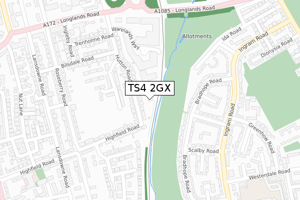
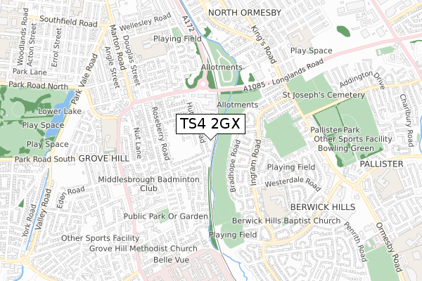
TS4 2GX is located in the Longlands & Beechwood electoral ward, within the unitary authority of Middlesbrough and the English Parliamentary constituency of Middlesbrough. The Sub Integrated Care Board (ICB) Location is NHS North East and North Cumbria ICB - 16C and the police force is Cleveland. This postcode has been in use since September 2019.


GetTheData
Source: OS Open Zoomstack (Ordnance Survey)
Licence: Open Government Licence (requires attribution)
Attribution: Contains OS data © Crown copyright and database right 2025
Source: Open Postcode Geo
Licence: Open Government Licence (requires attribution)
Attribution: Contains OS data © Crown copyright and database right 2025; Contains Royal Mail data © Royal Mail copyright and database right 2025; Source: Office for National Statistics licensed under the Open Government Licence v.3.0
| Easting | 450663 |
| Northing | 519036 |
| Latitude | 54.564038 |
| Longitude | -1.218017 |
GetTheData
Source: Open Postcode Geo
Licence: Open Government Licence
| Country | England |
| Postcode District | TS4 |
➜ See where TS4 is on a map ➜ Where is Middlesbrough? | |
GetTheData
Source: Land Registry Price Paid Data
Licence: Open Government Licence
| Ward | Longlands & Beechwood |
| Constituency | Middlesbrough |
GetTheData
Source: ONS Postcode Database
Licence: Open Government Licence
2023 13 MAR £148,000 |
2023 22 FEB £150,000 |
38, SIMON HUNTER WAY, MIDDLESBROUGH, TS4 2GX 2022 31 MAY £166,995 |
46, SIMON HUNTER WAY, MIDDLESBROUGH, TS4 2GX 2022 27 MAY £203,995 |
40, SIMON HUNTER WAY, MIDDLESBROUGH, TS4 2GX 2022 17 MAY £194,995 |
2021 1 OCT £145,000 |
29, SIMON HUNTER WAY, MIDDLESBROUGH, TS4 2GX 2020 11 DEC £135,995 |
16, SIMON HUNTER WAY, MIDDLESBROUGH, TS4 2GX 2020 23 JUL £146,995 |
27, SIMON HUNTER WAY, MIDDLESBROUGH, TS4 2GX 2020 16 JUL £139,995 |
2019 20 DEC £139,995 |
GetTheData
Source: HM Land Registry Price Paid Data
Licence: Contains HM Land Registry data © Crown copyright and database right 2025. This data is licensed under the Open Government Licence v3.0.
| Hutton Road (Longlands Road) | Grove Hill | 261m |
| Longlands (Longlands Road) | Grove Hill | 281m |
| Longlands (Longlands Road) | Grove Hill | 296m |
| Longlands (Marton Road) | Grove Hill | 396m |
| Greenhow Road (Ingram Road) | Berwick Hills | 406m |
| James Cook University Hospital Station | 1.5km |
| Middlesbrough Station | 2km |
| Marton Station | 2.5km |
GetTheData
Source: NaPTAN
Licence: Open Government Licence
GetTheData
Source: ONS Postcode Database
Licence: Open Government Licence


➜ Get more ratings from the Food Standards Agency
GetTheData
Source: Food Standards Agency
Licence: FSA terms & conditions
| Last Collection | |||
|---|---|---|---|
| Location | Mon-Fri | Sat | Distance |
| North Ormesby Post Office | 18:00 | 12:15 | 859m |
| Norfolk Place Post Office | 17:00 | 11:45 | 871m |
| Victoria Road | 17:15 | 12:45 | 911m |
GetTheData
Source: Dracos
Licence: Creative Commons Attribution-ShareAlike
The below table lists the International Territorial Level (ITL) codes (formerly Nomenclature of Territorial Units for Statistics (NUTS) codes) and Local Administrative Units (LAU) codes for TS4 2GX:
| ITL 1 Code | Name |
|---|---|
| TLC | North East (England) |
| ITL 2 Code | Name |
| TLC1 | Tees Valley and Durham |
| ITL 3 Code | Name |
| TLC12 | South Teesside |
| LAU 1 Code | Name |
| E06000002 | Middlesbrough |
GetTheData
Source: ONS Postcode Directory
Licence: Open Government Licence
The below table lists the Census Output Area (OA), Lower Layer Super Output Area (LSOA), and Middle Layer Super Output Area (MSOA) for TS4 2GX:
| Code | Name | |
|---|---|---|
| OA | E00060661 | |
| LSOA | E01012026 | Middlesbrough 006A |
| MSOA | E02002501 | Middlesbrough 006 |
GetTheData
Source: ONS Postcode Directory
Licence: Open Government Licence
| TS4 2LE | Hutton Road | 66m |
| TS4 2LG | Hutton Road | 99m |
| TS4 2LQ | Bilsdale Road | 111m |
| TS4 2JY | Warelands Way | 130m |
| TS4 2LJ | Roseberry Road | 149m |
| TS4 2LD | Hutton Road | 149m |
| TS4 2QP | Highfield Road | 157m |
| TS4 2QN | Highfield Road | 173m |
| TS4 2JX | Trenholme Road | 186m |
| TS4 2LL | Roseberry Road | 191m |
GetTheData
Source: Open Postcode Geo; Land Registry Price Paid Data
Licence: Open Government Licence