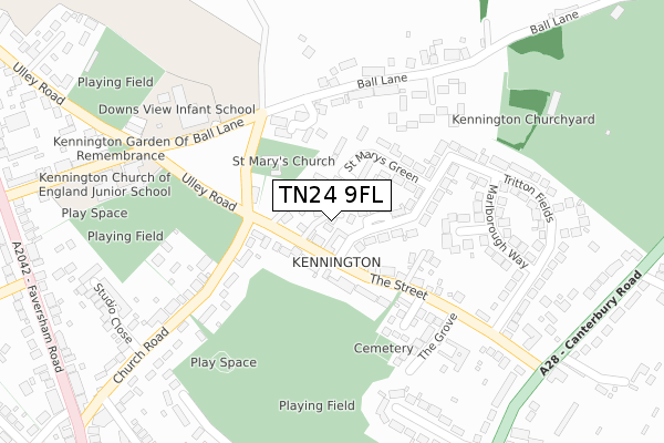
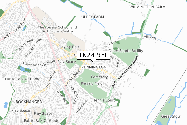
TN24 9FL is located in the Kennington electoral ward, within the local authority district of Ashford and the English Parliamentary constituency of Ashford. The Sub Integrated Care Board (ICB) Location is NHS Kent and Medway ICB - 91Q and the police force is Kent. This postcode has been in use since April 2019.


GetTheData
Source: OS Open Zoomstack (Ordnance Survey)
Licence: Open Government Licence (requires attribution)
Attribution: Contains OS data © Crown copyright and database right 2025
Source: Open Postcode Geo
Licence: Open Government Licence (requires attribution)
Attribution: Contains OS data © Crown copyright and database right 2025; Contains Royal Mail data © Royal Mail copyright and database right 2025; Source: Office for National Statistics licensed under the Open Government Licence v.3.0
| Easting | 602312 |
| Northing | 145088 |
| Latitude | 51.169242 |
| Longitude | 0.892553 |
GetTheData
Source: Open Postcode Geo
Licence: Open Government Licence
| Country | England |
| Postcode District | TN24 |
➜ See where TN24 is on a map ➜ Where is Ashford? | |
GetTheData
Source: Land Registry Price Paid Data
Licence: Open Government Licence
| Ward | Kennington |
| Constituency | Ashford |
GetTheData
Source: ONS Postcode Database
Licence: Open Government Licence
2023 20 DEC £390,000 |
1, KINGSLEY GATE, KENNINGTON, ASHFORD, TN24 9FL 2021 18 FEB £375,000 |
2020 7 SEP £415,000 |
2, KINGSLEY GATE, KENNINGTON, ASHFORD, TN24 9FL 2020 23 JUL £395,000 |
2020 27 MAR £343,500 |
6, KINGSLEY GATE, KENNINGTON, ASHFORD, TN24 9FL 2020 27 MAR £425,000 |
2018 1 FEB £900,000 |
GetTheData
Source: HM Land Registry Price Paid Data
Licence: Contains HM Land Registry data © Crown copyright and database right 2025. This data is licensed under the Open Government Licence v3.0.
| The Street | Kennington | 58m |
| The Street | Kennington | 84m |
| Tritton Fields Green (Tritton Fields) | Kennington | 88m |
| Tritton Fields (The Street) | Kennington | 300m |
| Tritton Fields | Kennington | 323m |
| Ashford International Station | 3.1km |
| Wye Station | 3.1km |
GetTheData
Source: NaPTAN
Licence: Open Government Licence
GetTheData
Source: ONS Postcode Database
Licence: Open Government Licence


➜ Get more ratings from the Food Standards Agency
GetTheData
Source: Food Standards Agency
Licence: FSA terms & conditions
| Last Collection | |||
|---|---|---|---|
| Location | Mon-Fri | Sat | Distance |
| Tritton Fields | 17:45 | 12:15 | 55m |
| Kennington Post Office | 17:15 | 12:15 | 471m |
| Spearpoint | 17:30 | 12:15 | 599m |
GetTheData
Source: Dracos
Licence: Creative Commons Attribution-ShareAlike
The below table lists the International Territorial Level (ITL) codes (formerly Nomenclature of Territorial Units for Statistics (NUTS) codes) and Local Administrative Units (LAU) codes for TN24 9FL:
| ITL 1 Code | Name |
|---|---|
| TLJ | South East (England) |
| ITL 2 Code | Name |
| TLJ4 | Kent |
| ITL 3 Code | Name |
| TLJ45 | Mid Kent |
| LAU 1 Code | Name |
| E07000105 | Ashford |
GetTheData
Source: ONS Postcode Directory
Licence: Open Government Licence
The below table lists the Census Output Area (OA), Lower Layer Super Output Area (LSOA), and Middle Layer Super Output Area (MSOA) for TN24 9FL:
| Code | Name | |
|---|---|---|
| OA | E00121840 | |
| LSOA | E01023999 | Ashford 003B |
| MSOA | E02004998 | Ashford 003 |
GetTheData
Source: ONS Postcode Directory
Licence: Open Government Licence
| TN24 9HS | The Street | 41m |
| TN24 9HP | St Marys Green | 88m |
| TN24 9HG | Tritton Fields | 111m |
| TN24 9HD | The Street | 123m |
| TN25 4PL | The Osier Field | 144m |
| TN24 9HJ | Okehampton Close | 193m |
| TN24 9HB | The Street | 204m |
| TN25 4PS | Kings Meadow | 208m |
| TN24 9HE | Tritton Fields | 208m |
| TN24 9DQ | Church Road | 216m |
GetTheData
Source: Open Postcode Geo; Land Registry Price Paid Data
Licence: Open Government Licence