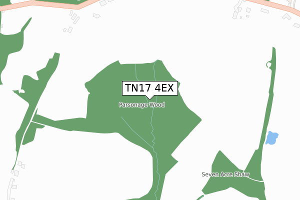
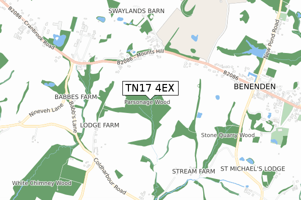
TN17 4EX is located in the Benenden and Cranbrook electoral ward, within the local authority district of Tunbridge Wells and the English Parliamentary constituency of Maidstone and The Weald. The Sub Integrated Care Board (ICB) Location is NHS Kent and Medway ICB - 91Q and the police force is Kent. This postcode has been in use since February 2020.


GetTheData
Source: OS Open Zoomstack (Ordnance Survey)
Licence: Open Government Licence (requires attribution)
Attribution: Contains OS data © Crown copyright and database right 2024
Source: Open Postcode Geo
Licence: Open Government Licence (requires attribution)
Attribution: Contains OS data © Crown copyright and database right 2024; Contains Royal Mail data © Royal Mail copyright and database right 2024; Source: Office for National Statistics licensed under the Open Government Licence v.3.0
| Easting | 581091 |
| Northing | 133012 |
| Latitude | 51.067870 |
| Longitude | 0.583295 |
GetTheData
Source: Open Postcode Geo
Licence: Open Government Licence
| Country | England |
| Postcode District | TN17 |
➜ See where TN17 is on a map ➜ Where is Benenden? | |
GetTheData
Source: Land Registry Price Paid Data
Licence: Open Government Licence
| Ward | Benenden And Cranbrook |
| Constituency | Maidstone And The Weald |
GetTheData
Source: ONS Postcode Database
Licence: Open Government Licence
2023 2 JUN £740,000 |
2022 26 APR £710,000 |
2021 3 FEB £510,000 |
6, VERE MEADOWS, BENENDEN, CRANBROOK, TN17 4EX 2021 21 JAN £850,000 |
2020 9 OCT £540,000 |
7, VERE MEADOWS, BENENDEN, CRANBROOK, TN17 4EX 2020 8 SEP £790,000 |
2020 4 SEP £550,000 |
GetTheData
Source: HM Land Registry Price Paid Data
Licence: Contains HM Land Registry data © Crown copyright and database right 2024. This data is licensed under the Open Government Licence v3.0.
| Village Hall (The Street) | Benenden | 180m |
| King William Iv (The Street) | Benenden | 265m |
| Leybourne Dell (Benenden Road) | Benenden | 276m |
| Leybourne Dell (Benenden Road) | Benenden | 292m |
| King William Iv (The Street) | Benenden | 307m |
GetTheData
Source: NaPTAN
Licence: Open Government Licence
GetTheData
Source: ONS Postcode Database
Licence: Open Government Licence


➜ Get more ratings from the Food Standards Agency
GetTheData
Source: Food Standards Agency
Licence: FSA terms & conditions
| Last Collection | |||
|---|---|---|---|
| Location | Mon-Fri | Sat | Distance |
| Village Hall | 16:30 | 09:30 | 181m |
| Benenden Post Office | 17:00 | 10:45 | 279m |
| New Pond Road | 16:00 | 09:00 | 600m |
GetTheData
Source: Dracos
Licence: Creative Commons Attribution-ShareAlike
The below table lists the International Territorial Level (ITL) codes (formerly Nomenclature of Territorial Units for Statistics (NUTS) codes) and Local Administrative Units (LAU) codes for TN17 4EX:
| ITL 1 Code | Name |
|---|---|
| TLJ | South East (England) |
| ITL 2 Code | Name |
| TLJ4 | Kent |
| ITL 3 Code | Name |
| TLJ46 | West Kent |
| LAU 1 Code | Name |
| E07000116 | Tunbridge Wells |
GetTheData
Source: ONS Postcode Directory
Licence: Open Government Licence
The below table lists the Census Output Area (OA), Lower Layer Super Output Area (LSOA), and Middle Layer Super Output Area (MSOA) for TN17 4EX:
| Code | Name | |
|---|---|---|
| OA | E00125812 | |
| LSOA | E01024789 | Tunbridge Wells 014A |
| MSOA | E02005175 | Tunbridge Wells 014 |
GetTheData
Source: ONS Postcode Directory
Licence: Open Government Licence
| TN17 4DW | Rothermere Close | 106m |
| TN17 4DR | Walkhurst Road | 128m |
| TN17 4DD | The Street | 178m |
| TN17 4DU | Rolvenden Road | 180m |
| TN17 4DE | The Street | 202m |
| TN17 4DX | Grants Hill | 202m |
| TN17 4DY | Chequer Tree Cottages | 214m |
| TN17 4EA | Leybourne Dell | 234m |
| TN17 4DB | The Street | 270m |
| TN17 4EE | Rolvenden Road | 299m |
GetTheData
Source: Open Postcode Geo; Land Registry Price Paid Data
Licence: Open Government Licence