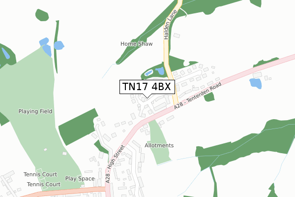
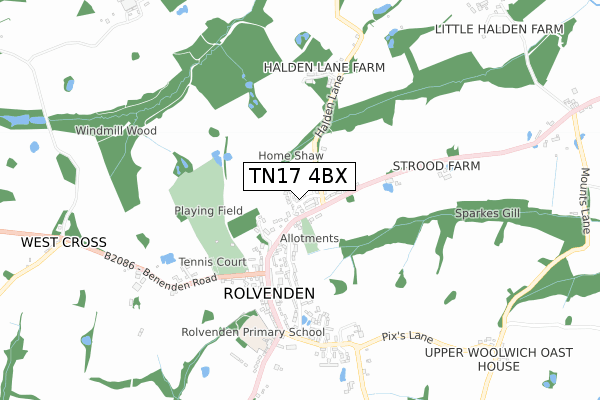
TN17 4BX is located in the Rolvenden & Tenterden West electoral ward, within the local authority district of Ashford and the English Parliamentary constituency of Ashford. The Sub Integrated Care Board (ICB) Location is NHS Kent and Medway ICB - 91Q and the police force is Kent. This postcode has been in use since December 2018.


GetTheData
Source: OS Open Zoomstack (Ordnance Survey)
Licence: Open Government Licence (requires attribution)
Attribution: Contains OS data © Crown copyright and database right 2025
Source: Open Postcode Geo
Licence: Open Government Licence (requires attribution)
Attribution: Contains OS data © Crown copyright and database right 2025; Contains Royal Mail data © Royal Mail copyright and database right 2025; Source: Office for National Statistics licensed under the Open Government Licence v.3.0
| Easting | 584545 |
| Northing | 131831 |
| Latitude | 51.056161 |
| Longitude | 0.631936 |
GetTheData
Source: Open Postcode Geo
Licence: Open Government Licence
| Country | England |
| Postcode District | TN17 |
➜ See where TN17 is on a map ➜ Where is Rolvenden? | |
GetTheData
Source: Land Registry Price Paid Data
Licence: Open Government Licence
| Ward | Rolvenden & Tenterden West |
| Constituency | Ashford |
GetTheData
Source: ONS Postcode Database
Licence: Open Government Licence
2022 27 SEP £730,000 |
3, HALDEN FIELD, ROLVENDEN, CRANBROOK, TN17 4BX 2020 15 DEC £585,000 |
2, HALDEN FIELD, ROLVENDEN, CRANBROOK, TN17 4BX 2020 17 NOV £495,000 |
37, HALDEN FIELD, ROLVENDEN, CRANBROOK, TN17 4BX 2020 16 NOV £490,000 |
1, HALDEN FIELD, ROLVENDEN, CRANBROOK, TN17 4BX 2020 12 NOV £485,000 |
28, HALDEN FIELD, ROLVENDEN, CRANBROOK, TN17 4BX 2020 12 AUG £450,000 |
40, HALDEN FIELD, ROLVENDEN, CRANBROOK, TN17 4BX 2020 31 JUL £370,000 |
27, HALDEN FIELD, ROLVENDEN, CRANBROOK, TN17 4BX 2020 31 JUL £447,500 |
17, HALDEN FIELD, ROLVENDEN, CRANBROOK, TN17 4BX 2020 31 JUL £368,500 |
29, HALDEN FIELD, ROLVENDEN, CRANBROOK, TN17 4BX 2020 28 JUL £589,995 |
GetTheData
Source: HM Land Registry Price Paid Data
Licence: Contains HM Land Registry data © Crown copyright and database right 2025. This data is licensed under the Open Government Licence v3.0.
| Halden Lane (Tenterden Road) | Rolvenden | 107m |
| Halden Lane (Tenterden Road) | Rolvenden | 136m |
| Sparkeswood Avenue (Tenterden Road) | Rolvenden | 163m |
| Sparkeswood Avenue (Tenterden Road) | Rolvenden | 164m |
| The Bull (Regent Street) | Rolvenden | 356m |
GetTheData
Source: NaPTAN
Licence: Open Government Licence
| Percentage of properties with Next Generation Access | 100.0% |
| Percentage of properties with Superfast Broadband | 100.0% |
| Percentage of properties with Ultrafast Broadband | 100.0% |
| Percentage of properties with Full Fibre Broadband | 100.0% |
Superfast Broadband is between 30Mbps and 300Mbps
Ultrafast Broadband is > 300Mbps
| Percentage of properties unable to receive 2Mbps | 0.0% |
| Percentage of properties unable to receive 5Mbps | 0.0% |
| Percentage of properties unable to receive 10Mbps | 0.0% |
| Percentage of properties unable to receive 30Mbps | 0.0% |
GetTheData
Source: Ofcom
Licence: Ofcom Terms of Use (requires attribution)
GetTheData
Source: ONS Postcode Database
Licence: Open Government Licence


➜ Get more ratings from the Food Standards Agency
GetTheData
Source: Food Standards Agency
Licence: FSA terms & conditions
| Last Collection | |||
|---|---|---|---|
| Location | Mon-Fri | Sat | Distance |
| Rolvenden Post Office | 16:30 | 10:15 | 445m |
| Gybbons Road | 16:00 | 09:00 | 605m |
| The Hill | 16:15 | 10:00 | 1,647m |
GetTheData
Source: Dracos
Licence: Creative Commons Attribution-ShareAlike
The below table lists the International Territorial Level (ITL) codes (formerly Nomenclature of Territorial Units for Statistics (NUTS) codes) and Local Administrative Units (LAU) codes for TN17 4BX:
| ITL 1 Code | Name |
|---|---|
| TLJ | South East (England) |
| ITL 2 Code | Name |
| TLJ4 | Kent |
| ITL 3 Code | Name |
| TLJ45 | Mid Kent |
| LAU 1 Code | Name |
| E07000105 | Ashford |
GetTheData
Source: ONS Postcode Directory
Licence: Open Government Licence
The below table lists the Census Output Area (OA), Lower Layer Super Output Area (LSOA), and Middle Layer Super Output Area (MSOA) for TN17 4BX:
| Code | Name | |
|---|---|---|
| OA | E00121894 | |
| LSOA | E01024010 | Ashford 013B |
| MSOA | E02005008 | Ashford 013 |
GetTheData
Source: ONS Postcode Directory
Licence: Open Government Licence
| TN17 4NB | Tenterden Road | 93m |
| TN17 4JH | Gatefield Cottages | 165m |
| TN17 4LZ | Sparkeswood Avenue | 216m |
| TN17 4LR | High Street | 232m |
| TN17 4LW | High Street | 251m |
| TN17 4LX | Sparkeswood Avenue | 321m |
| TN17 4PD | Old Regent Drive | 403m |
| TN17 4PE | Regent Street | 408m |
| TN17 4LP | High Street | 408m |
| TN17 4NA | Sparkes Wood Close | 408m |
GetTheData
Source: Open Postcode Geo; Land Registry Price Paid Data
Licence: Open Government Licence