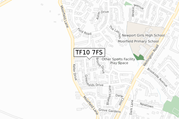
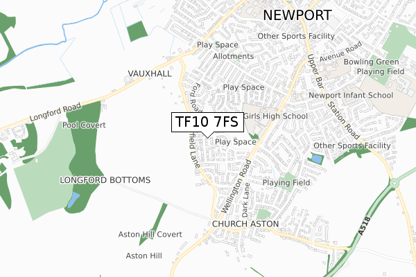
TF10 7FS is located in the Newport West electoral ward, within the unitary authority of Telford and Wrekin and the English Parliamentary constituency of The Wrekin. The Sub Integrated Care Board (ICB) Location is NHS Shropshire, Telford and Wrekin ICB - M2L0M and the police force is West Mercia. This postcode has been in use since August 2017.


GetTheData
Source: OS Open Zoomstack (Ordnance Survey)
Licence: Open Government Licence (requires attribution)
Attribution: Contains OS data © Crown copyright and database right 2025
Source: Open Postcode Geo
Licence: Open Government Licence (requires attribution)
Attribution: Contains OS data © Crown copyright and database right 2025; Contains Royal Mail data © Royal Mail copyright and database right 2025; Source: Office for National Statistics licensed under the Open Government Licence v.3.0
| Easting | 374024 |
| Northing | 318347 |
| Latitude | 52.762110 |
| Longitude | -2.386379 |
GetTheData
Source: Open Postcode Geo
Licence: Open Government Licence
| Country | England |
| Postcode District | TF10 |
➜ See where TF10 is on a map ➜ Where is Newport? | |
GetTheData
Source: Land Registry Price Paid Data
Licence: Open Government Licence
| Ward | Newport West |
| Constituency | The Wrekin |
GetTheData
Source: ONS Postcode Database
Licence: Open Government Licence
2019 20 DEC £220,000 |
2019 29 NOV £225,000 |
73, GREENFIELDS DRIVE, NEWPORT, TF10 7FS 2019 25 FEB £384,950 |
69, GREENFIELDS DRIVE, NEWPORT, TF10 7FS 2018 26 OCT £404,950 |
71, GREENFIELDS DRIVE, NEWPORT, TF10 7FS 2018 29 JUN £374,950 |
80, GREENFIELDS DRIVE, NEWPORT, TF10 7FS 2017 20 DEC £209,950 |
84, GREENFIELDS DRIVE, NEWPORT, TF10 7FS 2017 30 NOV £249,950 |
86, GREENFIELDS DRIVE, NEWPORT, TF10 7FS 2017 30 NOV £269,950 |
2017 30 NOV £209,950 |
92, GREENFIELDS DRIVE, NEWPORT, TF10 7FS 2017 22 SEP £245,000 |
GetTheData
Source: HM Land Registry Price Paid Data
Licence: Contains HM Land Registry data © Crown copyright and database right 2025. This data is licensed under the Open Government Licence v3.0.
| Dark Lane (Wellington Road) | Newport | 287m |
| Elkington Close | Newport | 346m |
| Elkington Close (Ford Road) | Newport | 353m |
| Elkington Close (Ford Road) | Newport | 362m |
| Shrewsbury Way (Heathwood Road) | Newport | 370m |
GetTheData
Source: NaPTAN
Licence: Open Government Licence
| Percentage of properties with Next Generation Access | 100.0% |
| Percentage of properties with Superfast Broadband | 100.0% |
| Percentage of properties with Ultrafast Broadband | 100.0% |
| Percentage of properties with Full Fibre Broadband | 0.0% |
Superfast Broadband is between 30Mbps and 300Mbps
Ultrafast Broadband is > 300Mbps
| Median download speed | 53.7Mbps |
| Average download speed | 66.2Mbps |
| Maximum download speed | 200.00Mbps |
| Median upload speed | 1.3Mbps |
| Average upload speed | 7.6Mbps |
| Maximum upload speed | 20.00Mbps |
| Percentage of properties unable to receive 2Mbps | 0.0% |
| Percentage of properties unable to receive 5Mbps | 0.0% |
| Percentage of properties unable to receive 10Mbps | 0.0% |
| Percentage of properties unable to receive 30Mbps | 0.0% |
GetTheData
Source: Ofcom
Licence: Ofcom Terms of Use (requires attribution)
GetTheData
Source: ONS Postcode Database
Licence: Open Government Licence


➜ Get more ratings from the Food Standards Agency
GetTheData
Source: Food Standards Agency
Licence: FSA terms & conditions
| Last Collection | |||
|---|---|---|---|
| Location | Mon-Fri | Sat | Distance |
| Upper Bar | 17:30 | 11:30 | 848m |
| Somerfields | 17:30 | 11:00 | 871m |
| Audley Avenue | 17:30 | 11:30 | 1,042m |
GetTheData
Source: Dracos
Licence: Creative Commons Attribution-ShareAlike
The below table lists the International Territorial Level (ITL) codes (formerly Nomenclature of Territorial Units for Statistics (NUTS) codes) and Local Administrative Units (LAU) codes for TF10 7FS:
| ITL 1 Code | Name |
|---|---|
| TLG | West Midlands (England) |
| ITL 2 Code | Name |
| TLG2 | Shropshire and Staffordshire |
| ITL 3 Code | Name |
| TLG21 | Telford and Wrekin |
| LAU 1 Code | Name |
| E06000020 | Telford and Wrekin |
GetTheData
Source: ONS Postcode Directory
Licence: Open Government Licence
The below table lists the Census Output Area (OA), Lower Layer Super Output Area (LSOA), and Middle Layer Super Output Area (MSOA) for TF10 7FS:
| Code | Name | |
|---|---|---|
| OA | E00071585 | |
| LSOA | E01014177 | Telford and Wrekin 003C |
| MSOA | E02002930 | Telford and Wrekin 003 |
GetTheData
Source: ONS Postcode Directory
Licence: Open Government Licence
| TF10 7UG | Waterford Drive | 64m |
| TF10 7FH | St George Way | 122m |
| TF10 7UH | Ford Road | 133m |
| TF10 7UF | Alton Grove | 137m |
| TF10 7UQ | Talbot Close | 141m |
| TF10 7FF | Greenfields Drive | 142m |
| TF10 7FG | Farmers Gate | 192m |
| TF10 7SQ | The Larches | 201m |
| TF10 7SH | The Larches | 236m |
| TF10 7UA | Aston Drive | 246m |
GetTheData
Source: Open Postcode Geo; Land Registry Price Paid Data
Licence: Open Government Licence