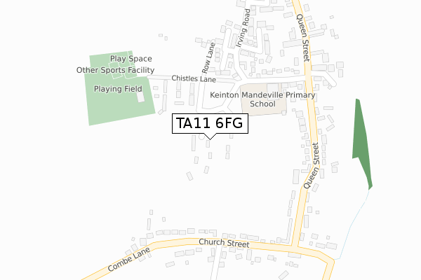
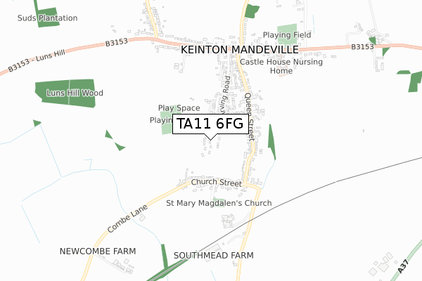
TA11 6FG is located in the Somerton electoral ward, within the unitary authority of Somerset and the English Parliamentary constituency of Somerton and Frome. The Sub Integrated Care Board (ICB) Location is NHS Somerset ICB - 11X and the police force is Avon and Somerset. This postcode has been in use since October 2019.


GetTheData
Source: OS Open Zoomstack (Ordnance Survey)
Licence: Open Government Licence (requires attribution)
Attribution: Contains OS data © Crown copyright and database right 2025
Source: Open Postcode Geo
Licence: Open Government Licence (requires attribution)
Attribution: Contains OS data © Crown copyright and database right 2025; Contains Royal Mail data © Royal Mail copyright and database right 2025; Source: Office for National Statistics licensed under the Open Government Licence v.3.0
| Easting | 354721 |
| Northing | 130384 |
| Latitude | 51.070982 |
| Longitude | -2.647631 |
GetTheData
Source: Open Postcode Geo
Licence: Open Government Licence
| Country | England |
| Postcode District | TA11 |
➜ See where TA11 is on a map ➜ Where is Keinton Mandeville? | |
GetTheData
Source: Land Registry Price Paid Data
Licence: Open Government Licence
| Ward | Somerton |
| Constituency | Somerton And Frome |
GetTheData
Source: ONS Postcode Database
Licence: Open Government Licence
2023 15 NOV £575,000 |
2021 2 DEC £740,000 |
17, LUNS CLOSE, KEINTON MANDEVILLE, SOMERTON, TA11 6FG 2021 30 SEP £902,000 |
21, LUNS CLOSE, KEINTON MANDEVILLE, SOMERTON, TA11 6FG 2021 30 SEP £1,050,000 |
19, LUNS CLOSE, KEINTON MANDEVILLE, SOMERTON, TA11 6FG 2021 30 SEP £1,025,000 |
12, LUNS CLOSE, KEINTON MANDEVILLE, SOMERTON, TA11 6FG 2021 27 AUG £1,185,000 |
2021 30 MAR £641,000 |
9, LUNS CLOSE, KEINTON MANDEVILLE, SOMERTON, TA11 6FG 2021 15 JAN £521,000 |
15, LUNS CLOSE, KEINTON MANDEVILLE, SOMERTON, TA11 6FG 2020 18 DEC £832,500 |
4, LUNS CLOSE, KEINTON MANDEVILLE, SOMERTON, TA11 6FG 2020 27 NOV £445,000 |
➜ Keinton Mandeville house prices
GetTheData
Source: HM Land Registry Price Paid Data
Licence: Contains HM Land Registry data © Crown copyright and database right 2025. This data is licensed under the Open Government Licence v3.0.
| Chistles Lane (Queen Street) | Keinton Mandeville | 288m |
| Manor Park (Queen Street) | Keinton Mandeville | 315m |
| Mills Butchers Shop (High Street) | Keinton Mandeville | 585m |
| Mills Butchers Shop (High Street) | Keinton Mandeville | 598m |
| Barton Road | Keinton Mandeville | 734m |
GetTheData
Source: NaPTAN
Licence: Open Government Licence
GetTheData
Source: ONS Postcode Database
Licence: Open Government Licence


➜ Get more ratings from the Food Standards Agency
GetTheData
Source: Food Standards Agency
Licence: FSA terms & conditions
| Last Collection | |||
|---|---|---|---|
| Location | Mon-Fri | Sat | Distance |
| Charlton Adam Post Office | 16:30 | 10:30 | 1,888m |
| West Charlton | 16:15 | 07:15 | 2,756m |
| Lower Foddington | 11:15 | 11:15 | 3,049m |
GetTheData
Source: Dracos
Licence: Creative Commons Attribution-ShareAlike
The below table lists the International Territorial Level (ITL) codes (formerly Nomenclature of Territorial Units for Statistics (NUTS) codes) and Local Administrative Units (LAU) codes for TA11 6FG:
| ITL 1 Code | Name |
|---|---|
| TLK | South West (England) |
| ITL 2 Code | Name |
| TLK2 | Dorset and Somerset |
| ITL 3 Code | Name |
| TLK23 | Somerset CC |
| LAU 1 Code | Name |
| E07000189 | South Somerset |
GetTheData
Source: ONS Postcode Directory
Licence: Open Government Licence
The below table lists the Census Output Area (OA), Lower Layer Super Output Area (LSOA), and Middle Layer Super Output Area (MSOA) for TA11 6FG:
| Code | Name | |
|---|---|---|
| OA | E00148801 | |
| LSOA | E01029210 | South Somerset 002D |
| MSOA | E02006076 | South Somerset 002 |
GetTheData
Source: ONS Postcode Directory
Licence: Open Government Licence
| TA11 6ES | Chistles Lane | 221m |
| TA11 6ER | Church Street | 229m |
| TA11 6EQ | Queen Street | 232m |
| TA11 6EH | Queen Street | 233m |
| TA11 6EX | Orchard Way | 243m |
| TA11 6DP | Chistles Lane | 249m |
| TA11 6EL | Queen Street | 269m |
| TA11 6EU | Amberley Close | 284m |
| TA11 6EJ | Manor Place | 297m |
| TA11 6EP | Manor Park | 349m |
GetTheData
Source: Open Postcode Geo; Land Registry Price Paid Data
Licence: Open Government Licence