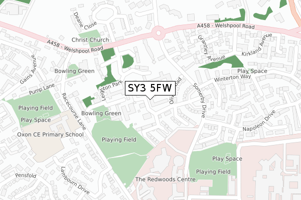
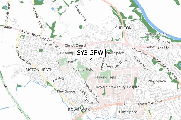
SY3 5FW is located in the Bowbrook electoral ward, within the unitary authority of Shropshire and the English Parliamentary constituency of Shrewsbury and Atcham. The Sub Integrated Care Board (ICB) Location is NHS Shropshire, Telford and Wrekin ICB - M2L0M and the police force is West Mercia. This postcode has been in use since April 2018.


GetTheData
Source: OS Open Zoomstack (Ordnance Survey)
Licence: Open Government Licence (requires attribution)
Attribution: Contains OS data © Crown copyright and database right 2025
Source: Open Postcode Geo
Licence: Open Government Licence (requires attribution)
Attribution: Contains OS data © Crown copyright and database right 2025; Contains Royal Mail data © Royal Mail copyright and database right 2025; Source: Office for National Statistics licensed under the Open Government Licence v.3.0
| Easting | 346102 |
| Northing | 313026 |
| Latitude | 52.712212 |
| Longitude | -2.799249 |
GetTheData
Source: Open Postcode Geo
Licence: Open Government Licence
| Country | England |
| Postcode District | SY3 |
➜ See where SY3 is on a map ➜ Where is Shrewsbury? | |
GetTheData
Source: Land Registry Price Paid Data
Licence: Open Government Licence
| Ward | Bowbrook |
| Constituency | Shrewsbury And Atcham |
GetTheData
Source: ONS Postcode Database
Licence: Open Government Licence
2023 9 NOV £365,000 |
2023 24 MAR £374,813 |
2023 14 FEB £442,500 |
2022 27 MAY £440,000 |
2018 28 SEP £284,950 |
2018 3 SEP £339,950 |
8, THE FURLONGS, BICTON HEATH, SHREWSBURY, SY3 5FW 2018 31 AUG £279,950 |
2018 10 AUG £339,950 |
6, THE FURLONGS, BICTON HEATH, SHREWSBURY, SY3 5FW 2018 31 JUL £279,950 |
GetTheData
Source: HM Land Registry Price Paid Data
Licence: Contains HM Land Registry data © Crown copyright and database right 2025. This data is licensed under the Open Government Licence v3.0.
| Shelton Hospital (Welshpool Road) | Shelton | 203m |
| Shelton Hospital (Welshpool Road) | Shelton | 217m |
| Oxon Business Park (Welshpool Road) | Shelton | 286m |
| The Oxon Priory (Welshpool Road) | Shelton | 419m |
| The Oxon Priory (Welshpool Road) | Shelton | 439m |
| Shrewsbury Station | 3.3km |
GetTheData
Source: NaPTAN
Licence: Open Government Licence
| Percentage of properties with Next Generation Access | 100.0% |
| Percentage of properties with Superfast Broadband | 100.0% |
| Percentage of properties with Ultrafast Broadband | 0.0% |
| Percentage of properties with Full Fibre Broadband | 0.0% |
Superfast Broadband is between 30Mbps and 300Mbps
Ultrafast Broadband is > 300Mbps
| Median download speed | 27.8Mbps |
| Average download speed | 26.9Mbps |
| Maximum download speed | 38.10Mbps |
| Median upload speed | 5.9Mbps |
| Average upload speed | 5.9Mbps |
| Maximum upload speed | 11.74Mbps |
| Percentage of properties unable to receive 2Mbps | 0.0% |
| Percentage of properties unable to receive 5Mbps | 0.0% |
| Percentage of properties unable to receive 10Mbps | 0.0% |
| Percentage of properties unable to receive 30Mbps | 0.0% |
GetTheData
Source: Ofcom
Licence: Ofcom Terms of Use (requires attribution)
GetTheData
Source: ONS Postcode Database
Licence: Open Government Licence


➜ Get more ratings from the Food Standards Agency
GetTheData
Source: Food Standards Agency
Licence: FSA terms & conditions
| Last Collection | |||
|---|---|---|---|
| Location | Mon-Fri | Sat | Distance |
| Shelton Gardens | 17:15 | 12:15 | 239m |
| Clayton Way | 19:30 | 12:15 | 261m |
| Lambourne Drive | 19:00 | 12:00 | 307m |
GetTheData
Source: Dracos
Licence: Creative Commons Attribution-ShareAlike
The below table lists the International Territorial Level (ITL) codes (formerly Nomenclature of Territorial Units for Statistics (NUTS) codes) and Local Administrative Units (LAU) codes for SY3 5FW:
| ITL 1 Code | Name |
|---|---|
| TLG | West Midlands (England) |
| ITL 2 Code | Name |
| TLG2 | Shropshire and Staffordshire |
| ITL 3 Code | Name |
| TLG22 | Shropshire |
| LAU 1 Code | Name |
| E06000051 | Shropshire |
GetTheData
Source: ONS Postcode Directory
Licence: Open Government Licence
The below table lists the Census Output Area (OA), Lower Layer Super Output Area (LSOA), and Middle Layer Super Output Area (MSOA) for SY3 5FW:
| Code | Name | |
|---|---|---|
| OA | E00147372 | |
| LSOA | E01028942 | Shropshire 020B |
| MSOA | E02006034 | Shropshire 020 |
GetTheData
Source: ONS Postcode Directory
Licence: Open Government Licence
| SY3 5PD | Florence Close | 157m |
| SY3 5PE | Haresfield | 179m |
| SY3 5LD | Farfield Close | 202m |
| SY3 5PG | Cavendish Close | 206m |
| SY3 5PB | Douglas Way | 218m |
| SY3 5AA | Welshpool Road | 237m |
| SY3 5LA | Grantley Avenue | 248m |
| SY3 5PS | Keelton Close | 252m |
| SY3 5BH | Tythe Cottages | 253m |
| SY3 5NP | The Bridleway | 261m |
GetTheData
Source: Open Postcode Geo; Land Registry Price Paid Data
Licence: Open Government Licence