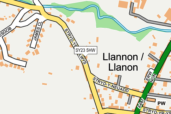
SY23 5HW is in Llanon. SY23 5HW is located in the Llansanffraid electoral ward, within the unitary authority of Ceredigion and the Welsh Parliamentary constituency of Ceredigion. The Local Health Board is Hywel Dda University and the police force is Dyfed-Powys. This postcode has been in use since January 1980.


GetTheData
Source: OS OpenMap – Local (Ordnance Survey)
Source: OS VectorMap District (Ordnance Survey)
Licence: Open Government Licence (requires attribution)
| Easting | 251397 |
| Northing | 267274 |
| Latitude | 52.283459 |
| Longitude | -4.179904 |
GetTheData
Source: Open Postcode Geo
Licence: Open Government Licence
| Town/City | Llanon |
| Country | Wales |
| Postcode District | SY23 |
➜ See where SY23 is on a map ➜ Where is Llanon? | |
GetTheData
Source: Land Registry Price Paid Data
Licence: Open Government Licence
Elevation or altitude of SY23 5HW as distance above sea level:
| Metres | Feet | |
|---|---|---|
| Elevation | 20m | 66ft |
Elevation is measured from the approximate centre of the postcode, to the nearest point on an OS contour line from OS Terrain 50, which has contour spacing of ten vertical metres.
➜ How high above sea level am I? Find the elevation of your current position using your device's GPS.
GetTheData
Source: Open Postcode Elevation
Licence: Open Government Licence
| Ward | Llansanffraid |
| Constituency | Ceredigion |
GetTheData
Source: ONS Postcode Database
Licence: Open Government Licence
MARION VILLA, LLANON, SY23 5HW 2023 15 DEC £315,000 |
2021 30 JUL £290,000 |
CAE GLAS, LLANON, SY23 5HW 2020 11 AUG £240,000 |
CRUDYRAWEL, LLANON, SY23 5HW 2017 10 MAY £135,000 |
SEA WINDS, LLANON, SY23 5HW 2010 29 JUN £160,000 |
PLOT 3, STAD CRAIG DDU, HEOL Y MOR, LLANON, SY23 5HW 2009 19 NOV £191,000 |
BEDWEN, LLANON, SY23 5HW 2009 22 APR £172,500 |
2000 25 MAY £80,000 |
WINDYCOTT, LLANON, SY23 5HW 1999 7 JUL £77,000 |
1998 27 OCT £76,000 |
GetTheData
Source: HM Land Registry Price Paid Data
Licence: Contains HM Land Registry data © Crown copyright and database right 2024. This data is licensed under the Open Government Licence v3.0.
| Central Hotel (High Street) | Llanon | 258m |
| Central Hotel (High Street) | Llanon | 271m |
| Cylch Peris (High Street) | Llanon | 359m |
| Penlon Bridge (High Street) | Llanon | 382m |
| Old Post Office (Bridge Street) | Llanon | 416m |
GetTheData
Source: NaPTAN
Licence: Open Government Licence
| Percentage of properties with Next Generation Access | 100.0% |
| Percentage of properties with Superfast Broadband | 100.0% |
| Percentage of properties with Ultrafast Broadband | 0.0% |
| Percentage of properties with Full Fibre Broadband | 0.0% |
Superfast Broadband is between 30Mbps and 300Mbps
Ultrafast Broadband is > 300Mbps
| Median download speed | 40.0Mbps |
| Average download speed | 39.0Mbps |
| Maximum download speed | 80.00Mbps |
| Median upload speed | 10.0Mbps |
| Average upload speed | 9.1Mbps |
| Maximum upload speed | 19.53Mbps |
| Percentage of properties unable to receive 2Mbps | 0.0% |
| Percentage of properties unable to receive 5Mbps | 0.0% |
| Percentage of properties unable to receive 10Mbps | 0.0% |
| Percentage of properties unable to receive 30Mbps | 0.0% |
GetTheData
Source: Ofcom
Licence: Ofcom Terms of Use (requires attribution)
Estimated total energy consumption in SY23 5HW by fuel type, 2015.
| Consumption (kWh) | 157,323 |
|---|---|
| Meter count | 31 |
| Mean (kWh/meter) | 5,075 |
| Median (kWh/meter) | 3,239 |
GetTheData
Source: Postcode level gas estimates: 2015 (experimental)
Source: Postcode level electricity estimates: 2015 (experimental)
Licence: Open Government Licence
GetTheData
Source: ONS Postcode Database
Licence: Open Government Licence


➜ Get more ratings from the Food Standards Agency
GetTheData
Source: Food Standards Agency
Licence: FSA terms & conditions
| Last Collection | |||
|---|---|---|---|
| Location | Mon-Fri | Sat | Distance |
| Llansantffraid | 15:45 | 11:00 | 231m |
| Llanon Post Office | 16:00 | 11:00 | 238m |
| Llanon Village | 15:45 | 11:00 | 252m |
GetTheData
Source: Dracos
Licence: Creative Commons Attribution-ShareAlike
The below table lists the International Territorial Level (ITL) codes (formerly Nomenclature of Territorial Units for Statistics (NUTS) codes) and Local Administrative Units (LAU) codes for SY23 5HW:
| ITL 1 Code | Name |
|---|---|
| TLL | Wales |
| ITL 2 Code | Name |
| TLL1 | West Wales and The Valleys |
| ITL 3 Code | Name |
| TLL14 | South West Wales |
| LAU 1 Code | Name |
| W06000008 | Ceredigion |
GetTheData
Source: ONS Postcode Directory
Licence: Open Government Licence
The below table lists the Census Output Area (OA), Lower Layer Super Output Area (LSOA), and Middle Layer Super Output Area (MSOA) for SY23 5HW:
| Code | Name | |
|---|---|---|
| OA | W00002885 | |
| LSOA | W01000540 | Ceredigion 005E |
| MSOA | W02000120 | Ceredigion 005 |
GetTheData
Source: ONS Postcode Directory
Licence: Open Government Licence
| SY23 5HP | James Close | 172m |
| SY23 5HT | 221m | |
| SY23 5AU | Erw Non | 221m |
| SY23 5HQ | 231m | |
| SY23 5HH | 265m | |
| SY23 5HR | 268m | |
| SY23 5HJ | 270m | |
| SY23 5HG | 281m | |
| SY23 5HS | 288m | |
| SY23 5HY | 348m |
GetTheData
Source: Open Postcode Geo; Land Registry Price Paid Data
Licence: Open Government Licence