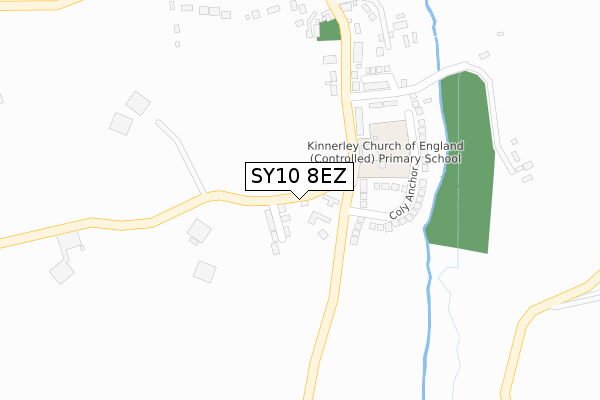
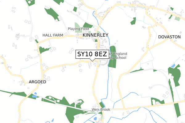
SY10 8EZ is located in the Llanymynech electoral ward, within the unitary authority of Shropshire and the English Parliamentary constituency of North Shropshire. The Sub Integrated Care Board (ICB) Location is NHS Shropshire, Telford and Wrekin ICB - M2L0M and the police force is West Mercia. This postcode has been in use since February 2020.


GetTheData
Source: OS Open Zoomstack (Ordnance Survey)
Licence: Open Government Licence (requires attribution)
Attribution: Contains OS data © Crown copyright and database right 2025
Source: Open Postcode Geo
Licence: Open Government Licence (requires attribution)
Attribution: Contains OS data © Crown copyright and database right 2025; Contains Royal Mail data © Royal Mail copyright and database right 2025; Source: Office for National Statistics licensed under the Open Government Licence v.3.0
| Easting | 333730 |
| Northing | 320527 |
| Latitude | 52.778256 |
| Longitude | -2.983873 |
GetTheData
Source: Open Postcode Geo
Licence: Open Government Licence
| Country | England |
| Postcode District | SY10 |
➜ See where SY10 is on a map ➜ Where is Kinnerley? | |
GetTheData
Source: Land Registry Price Paid Data
Licence: Open Government Licence
| Ward | Llanymynech |
| Constituency | North Shropshire |
GetTheData
Source: ONS Postcode Database
Licence: Open Government Licence
12, WILLOW GROVE, KINNERLEY, OSWESTRY, SY10 8EZ 2024 12 NOV £760,000 |
2024 5 JUL £622,500 |
3, WILLOW GROVE, KINNERLEY, OSWESTRY, SY10 8EZ 2023 4 OCT £495,000 |
6, WILLOW GROVE, KINNERLEY, OSWESTRY, SY10 8EZ 2023 15 SEP £535,000 |
CORNER COTTAGE, 1, WILLOW GROVE, KINNERLEY, OSWESTRY, SY10 8EZ 2023 23 AUG £500,000 |
2, WILLOW GROVE, KINNERLEY, OSWESTRY, SY10 8EZ 2023 26 JUL £475,000 |
5, WILLOW GROVE, KINNERLEY, OSWESTRY, SY10 8EZ 2023 21 JUL £695,000 |
FIELD HOUSE, 9, WILLOW GROVE, KINNERLEY, OSWESTRY, SY10 8EZ 2022 4 FEB £725,000 |
2021 29 JUN £500,000 |
14, WILLOW GROVE, KINNERLEY, OSWESTRY, SY10 8EZ 2021 23 JUN £475,000 |
GetTheData
Source: HM Land Registry Price Paid Data
Licence: Contains HM Land Registry data © Crown copyright and database right 2025. This data is licensed under the Open Government Licence v3.0.
| Cross Keys (Main Road) | Kinnerley | 429m |
| Cross Keys (Main Road) | Kinnerley | 430m |
| Mountainside (Main Road) | Kinnerley | 652m |
| Mountside (Main Road) | Kinnerley | 661m |
| Dovaston Jct (Main Road) | Dovaston | 1,086m |
GetTheData
Source: NaPTAN
Licence: Open Government Licence
GetTheData
Source: ONS Postcode Database
Licence: Open Government Licence


➜ Get more ratings from the Food Standards Agency
GetTheData
Source: Food Standards Agency
Licence: FSA terms & conditions
| Last Collection | |||
|---|---|---|---|
| Location | Mon-Fri | Sat | Distance |
| Shotatton | 16:45 | 11:00 | 3,675m |
GetTheData
Source: Dracos
Licence: Creative Commons Attribution-ShareAlike
The below table lists the International Territorial Level (ITL) codes (formerly Nomenclature of Territorial Units for Statistics (NUTS) codes) and Local Administrative Units (LAU) codes for SY10 8EZ:
| ITL 1 Code | Name |
|---|---|
| TLG | West Midlands (England) |
| ITL 2 Code | Name |
| TLG2 | Shropshire and Staffordshire |
| ITL 3 Code | Name |
| TLG22 | Shropshire |
| LAU 1 Code | Name |
| E06000051 | Shropshire |
GetTheData
Source: ONS Postcode Directory
Licence: Open Government Licence
The below table lists the Census Output Area (OA), Lower Layer Super Output Area (LSOA), and Middle Layer Super Output Area (MSOA) for SY10 8EZ:
| Code | Name | |
|---|---|---|
| OA | E00147236 | |
| LSOA | E01028913 | Shropshire 011A |
| MSOA | E02006026 | Shropshire 011 |
GetTheData
Source: ONS Postcode Directory
Licence: Open Government Licence
| SY10 8DQ | 214m | |
| SY10 8BY | Coly Anchor | 246m |
| SY10 8EQ | Centenary Close | 285m |
| SY10 8DF | 334m | |
| SY10 8DE | Vicarage Lane | 420m |
| SY10 8DH | 598m | |
| SY10 8EJ | 618m | |
| SY10 8EG | 669m | |
| SY10 8DD | Lady Ida | 679m |
| SY10 8DN | Lady Ida | 705m |
GetTheData
Source: Open Postcode Geo; Land Registry Price Paid Data
Licence: Open Government Licence