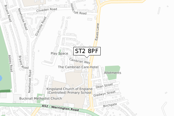
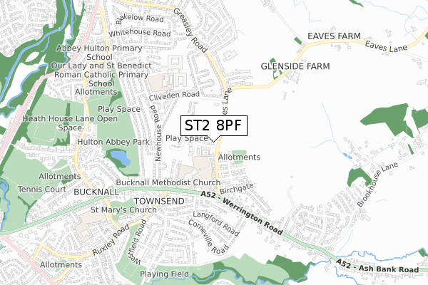
ST2 8PF is located in the Abbey Hulton electoral ward, within the unitary authority of Stoke-on-Trent and the English Parliamentary constituency of Stoke-on-Trent Central. The Sub Integrated Care Board (ICB) Location is NHS Staffordshire and Stoke-on-Trent ICB - 05W and the police force is Staffordshire. This postcode has been in use since January 2018.


GetTheData
Source: OS Open Zoomstack (Ordnance Survey)
Licence: Open Government Licence (requires attribution)
Attribution: Contains OS data © Crown copyright and database right 2025
Source: Open Postcode Geo
Licence: Open Government Licence (requires attribution)
Attribution: Contains OS data © Crown copyright and database right 2025; Contains Royal Mail data © Royal Mail copyright and database right 2025; Source: Office for National Statistics licensed under the Open Government Licence v.3.0
| Easting | 391105 |
| Northing | 348017 |
| Latitude | 53.029380 |
| Longitude | -2.134078 |
GetTheData
Source: Open Postcode Geo
Licence: Open Government Licence
| Country | England |
| Postcode District | ST2 |
➜ See where ST2 is on a map ➜ Where is Stoke-on-Trent? | |
GetTheData
Source: Land Registry Price Paid Data
Licence: Open Government Licence
| Ward | Abbey Hulton |
| Constituency | Stoke-on-trent Central |
GetTheData
Source: ONS Postcode Database
Licence: Open Government Licence
39, HENRY MASON PLACE, STOKE-ON-TRENT, ST2 8PF 2022 8 JUN £247,995 |
2022 31 MAY £253,000 |
22, HENRY MASON PLACE, STOKE-ON-TRENT, ST2 8PF 2022 20 MAY £284,995 |
41, HENRY MASON PLACE, STOKE-ON-TRENT, ST2 8PF 2022 29 APR £204,995 |
43, HENRY MASON PLACE, STOKE-ON-TRENT, ST2 8PF 2022 22 APR £204,995 |
26, HENRY MASON PLACE, STOKE-ON-TRENT, ST2 8PF 2022 31 MAR £276,995 |
45, HENRY MASON PLACE, STOKE-ON-TRENT, ST2 8PF 2022 25 MAR £204,995 |
24, HENRY MASON PLACE, STOKE-ON-TRENT, ST2 8PF 2022 31 JAN £265,995 |
33, HENRY MASON PLACE, STOKE-ON-TRENT, ST2 8PF 2022 28 JAN £192,995 |
18, HENRY MASON PLACE, STOKE-ON-TRENT, ST2 8PF 2021 23 DEC £243,995 |
GetTheData
Source: HM Land Registry Price Paid Data
Licence: Contains HM Land Registry data © Crown copyright and database right 2025. This data is licensed under the Open Government Licence v3.0.
| Bucknall Hospital (Eaves Lane) | Bucknall | 152m |
| Bucknall Hospital (Eaves Lane) | Bucknall | 166m |
| Granville Road (Newhouse Road) | Abbey Hulton | 339m |
| Cliveden Road (Newhouse Road) | Abbey Hulton | 348m |
| Bryant Road (Newhouse Road) | Abbey Hulton | 358m |
| Stoke-on-Trent Station | 3.9km |
| Longton Station | 4.4km |
GetTheData
Source: NaPTAN
Licence: Open Government Licence
GetTheData
Source: ONS Postcode Database
Licence: Open Government Licence


➜ Get more ratings from the Food Standards Agency
GetTheData
Source: Food Standards Agency
Licence: FSA terms & conditions
| Last Collection | |||
|---|---|---|---|
| Location | Mon-Fri | Sat | Distance |
| Wendling Close | 17:45 | 09:30 | 1,884m |
| Northwood Post Office | 17:30 | 11:45 | 2,171m |
| Leek Road | 18:15 | 09:00 | 2,210m |
GetTheData
Source: Dracos
Licence: Creative Commons Attribution-ShareAlike
The below table lists the International Territorial Level (ITL) codes (formerly Nomenclature of Territorial Units for Statistics (NUTS) codes) and Local Administrative Units (LAU) codes for ST2 8PF:
| ITL 1 Code | Name |
|---|---|
| TLG | West Midlands (England) |
| ITL 2 Code | Name |
| TLG2 | Shropshire and Staffordshire |
| ITL 3 Code | Name |
| TLG23 | Stoke-on-Trent |
| LAU 1 Code | Name |
| E06000021 | Stoke-on-Trent |
GetTheData
Source: ONS Postcode Directory
Licence: Open Government Licence
The below table lists the Census Output Area (OA), Lower Layer Super Output Area (LSOA), and Middle Layer Super Output Area (MSOA) for ST2 8PF:
| Code | Name | |
|---|---|---|
| OA | E00071768 | |
| LSOA | E01014212 | Stoke-on-Trent 012C |
| MSOA | E02002962 | Stoke-on-Trent 012 |
GetTheData
Source: ONS Postcode Directory
Licence: Open Government Licence
| ST2 8LW | Holdcroft Road | 100m |
| ST2 8LE | Eaves Lane | 121m |
| ST2 8LN | Welbeck Place | 182m |
| ST2 8LL | Haddon Place | 218m |
| ST2 8LP | Cliveden Road | 247m |
| ST2 8LF | Greasley Road | 247m |
| ST2 8LS | Granville Road | 257m |
| ST2 8LJ | Holdcroft Road | 259m |
| ST2 8LQ | Malcolm Drive | 264m |
| ST2 8LG | Greasley Road | 277m |
GetTheData
Source: Open Postcode Geo; Land Registry Price Paid Data
Licence: Open Government Licence