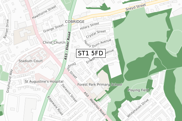
ST1 5FD is located in the Etruria & Hanley electoral ward, within the unitary authority of Stoke-on-Trent and the English Parliamentary constituency of Stoke-on-Trent North. The Sub Integrated Care Board (ICB) Location is NHS Staffordshire and Stoke-on-Trent ICB - 05W and the police force is Staffordshire. This postcode has been in use since December 2019.


GetTheData
Source: OS Open Zoomstack (Ordnance Survey)
Licence: Open Government Licence (requires attribution)
Attribution: Contains OS data © Crown copyright and database right 2025
Source: Open Postcode Geo
Licence: Open Government Licence (requires attribution)
Attribution: Contains OS data © Crown copyright and database right 2025; Contains Royal Mail data © Royal Mail copyright and database right 2025; Source: Office for National Statistics licensed under the Open Government Licence v.3.0
| Easting | 387856 |
| Northing | 348570 |
| Latitude | 53.034287 |
| Longitude | -2.182544 |
GetTheData
Source: Open Postcode Geo
Licence: Open Government Licence
| Country | England |
| Postcode District | ST1 |
➜ See where ST1 is on a map ➜ Where is Stoke-on-Trent? | |
GetTheData
Source: Land Registry Price Paid Data
Licence: Open Government Licence
| Ward | Etruria & Hanley |
| Constituency | Stoke-on-trent North |
GetTheData
Source: ONS Postcode Database
Licence: Open Government Licence
2023 31 MAR £250,000 |
27, HARRY EATON GROVE, STOKE-ON-TRENT, ST1 5FD 2020 16 DEC £245,000 |
25, HARRY EATON GROVE, STOKE-ON-TRENT, ST1 5FD 2020 16 DEC £245,000 |
42, HARRY EATON GROVE, STOKE-ON-TRENT, ST1 5FD 2020 2 DEC £245,000 |
34, HARRY EATON GROVE, STOKE-ON-TRENT, ST1 5FD 2020 30 OCT £235,000 |
36, HARRY EATON GROVE, STOKE-ON-TRENT, ST1 5FD 2020 25 SEP £226,850 |
32, HARRY EATON GROVE, STOKE-ON-TRENT, ST1 5FD 2020 18 SEP £235,000 |
30, HARRY EATON GROVE, STOKE-ON-TRENT, ST1 5FD 2020 28 AUG £200,000 |
17, HARRY EATON GROVE, STOKE-ON-TRENT, ST1 5FD 2020 27 MAR £229,500 |
19, HARRY EATON GROVE, STOKE-ON-TRENT, ST1 5FD 2020 27 MAR £229,500 |
GetTheData
Source: HM Land Registry Price Paid Data
Licence: Contains HM Land Registry data © Crown copyright and database right 2025. This data is licensed under the Open Government Licence v3.0.
| Cobridge Lights (Waterloo Road) | Cobridge | 199m |
| Cobridge Lights (Waterloo Road) | Cobridge | 206m |
| Portland Street (Waterloo Road) | Hanley | 231m |
| Church Terrace (Elder Road) | Cobridge | 278m |
| Whitehaven Drive | Hanley | 286m |
| Longport Station | 2.4km |
| Stoke-on-Trent Station | 2.9km |
| Longton Station | 5.8km |
GetTheData
Source: NaPTAN
Licence: Open Government Licence
GetTheData
Source: ONS Postcode Database
Licence: Open Government Licence


➜ Get more ratings from the Food Standards Agency
GetTheData
Source: Food Standards Agency
Licence: FSA terms & conditions
| Last Collection | |||
|---|---|---|---|
| Location | Mon-Fri | Sat | Distance |
| Windermere Street | 17:45 | 09:00 | 228m |
| Cobridge Park | 18:15 | 11:00 | 353m |
| Union Street | 18:00 | 10:30 | 540m |
GetTheData
Source: Dracos
Licence: Creative Commons Attribution-ShareAlike
The below table lists the International Territorial Level (ITL) codes (formerly Nomenclature of Territorial Units for Statistics (NUTS) codes) and Local Administrative Units (LAU) codes for ST1 5FD:
| ITL 1 Code | Name |
|---|---|
| TLG | West Midlands (England) |
| ITL 2 Code | Name |
| TLG2 | Shropshire and Staffordshire |
| ITL 3 Code | Name |
| TLG23 | Stoke-on-Trent |
| LAU 1 Code | Name |
| E06000021 | Stoke-on-Trent |
GetTheData
Source: ONS Postcode Directory
Licence: Open Government Licence
The below table lists the Census Output Area (OA), Lower Layer Super Output Area (LSOA), and Middle Layer Super Output Area (MSOA) for ST1 5FD:
| Code | Name | |
|---|---|---|
| OA | E00071949 | |
| LSOA | E01014256 | Stoke-on-Trent 011D |
| MSOA | E02002961 | Stoke-on-Trent 011 |
GetTheData
Source: ONS Postcode Directory
Licence: Open Government Licence
| ST1 5EB | Holder Street | 98m |
| ST1 5ED | Woodall Street | 107m |
| ST6 2PF | Crystal Street | 178m |
| ST1 5DU | Wayte Street | 204m |
| ST6 2PG | Hillary Street | 223m |
| ST1 5EH | Waterloo Road | 226m |
| ST6 2PD | Furnival Street | 230m |
| ST1 5DT | Waterloo Road | 240m |
| ST1 5EJ | Waterloo Road | 253m |
| ST1 5QL | Hodnet Grove | 255m |
GetTheData
Source: Open Postcode Geo; Land Registry Price Paid Data
Licence: Open Government Licence