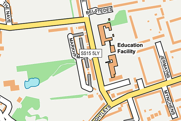
SS15 5LY is located in the Lee Chapel North electoral ward, within the local authority district of Basildon and the English Parliamentary constituency of Basildon and Billericay. The Sub Integrated Care Board (ICB) Location is NHS Mid and South Essex ICB - 99E and the police force is Essex. This postcode has been in use since April 2017.


GetTheData
Source: OS OpenMap – Local (Ordnance Survey)
Source: OS VectorMap District (Ordnance Survey)
Licence: Open Government Licence (requires attribution)
| Easting | 569226 |
| Northing | 189375 |
| Latitude | 51.577839 |
| Longitude | 0.440861 |
GetTheData
Source: Open Postcode Geo
Licence: Open Government Licence
| Country | England |
| Postcode District | SS15 |
➜ See where SS15 is on a map ➜ Where is Basildon? | |
GetTheData
Source: Land Registry Price Paid Data
Licence: Open Government Licence
| Ward | Lee Chapel North |
| Constituency | Basildon And Billericay |
GetTheData
Source: ONS Postcode Database
Licence: Open Government Licence
2024 6 DEC £592,500 |
2022 8 AUG £545,000 |
39, SELLARS WAY, BASILDON, SS15 5LY 2018 27 JUL £484,995 |
49, SELLARS WAY, BASILDON, SS15 5LY 2018 31 MAY £489,995 |
2018 25 MAY £429,995 |
53, SELLARS WAY, BASILDON, SS15 5LY 2018 25 MAY £479,995 |
55, SELLARS WAY, BASILDON, SS15 5LY 2017 18 DEC £469,995 |
67, SELLARS WAY, BASILDON, SS15 5LY 2017 15 DEC £469,995 |
65, SELLARS WAY, BASILDON, SS15 5LY 2017 17 NOV £474,995 |
69, SELLARS WAY, BASILDON, SS15 5LY 2017 26 OCT £469,995 |
GetTheData
Source: HM Land Registry Price Paid Data
Licence: Contains HM Land Registry data © Crown copyright and database right 2025. This data is licensed under the Open Government Licence v3.0.
| St. Nicholas Lane | Basildon | 82m |
| St. Nicholas Lane | Basildon | 87m |
| The Frame (Ballards Walk) | Basildon | 182m |
| The Frame (Ballards Walk) | Basildon | 183m |
| Upper Mayne | Basildon | 265m |
| Basildon Station | 1.5km |
| Laindon Station | 1.6km |
| Pitsea Station | 4.9km |
GetTheData
Source: NaPTAN
Licence: Open Government Licence
| Percentage of properties with Next Generation Access | 100.0% |
| Percentage of properties with Superfast Broadband | 100.0% |
| Percentage of properties with Ultrafast Broadband | 95.2% |
| Percentage of properties with Full Fibre Broadband | 0.0% |
Superfast Broadband is between 30Mbps and 300Mbps
Ultrafast Broadband is > 300Mbps
| Median download speed | 55.0Mbps |
| Average download speed | 116.3Mbps |
| Maximum download speed | 350.00Mbps |
| Median upload speed | 10.0Mbps |
| Average upload speed | 12.7Mbps |
| Maximum upload speed | 20.00Mbps |
| Percentage of properties unable to receive 2Mbps | 0.0% |
| Percentage of properties unable to receive 5Mbps | 0.0% |
| Percentage of properties unable to receive 10Mbps | 0.0% |
| Percentage of properties unable to receive 30Mbps | 0.0% |
GetTheData
Source: Ofcom
Licence: Ofcom Terms of Use (requires attribution)
GetTheData
Source: ONS Postcode Database
Licence: Open Government Licence


➜ Get more ratings from the Food Standards Agency
GetTheData
Source: Food Standards Agency
Licence: FSA terms & conditions
| Last Collection | |||
|---|---|---|---|
| Location | Mon-Fri | Sat | Distance |
| Noak Bridge Post Office | 17:30 | 11:45 | 1,024m |
| Somercotes | 17:30 | 11:45 | 1,049m |
| Wash Road | 17:30 | 11:45 | 1,193m |
GetTheData
Source: Dracos
Licence: Creative Commons Attribution-ShareAlike
The below table lists the International Territorial Level (ITL) codes (formerly Nomenclature of Territorial Units for Statistics (NUTS) codes) and Local Administrative Units (LAU) codes for SS15 5LY:
| ITL 1 Code | Name |
|---|---|
| TLH | East |
| ITL 2 Code | Name |
| TLH3 | Essex |
| ITL 3 Code | Name |
| TLH37 | Essex Thames Gateway |
| LAU 1 Code | Name |
| E07000066 | Basildon |
GetTheData
Source: ONS Postcode Directory
Licence: Open Government Licence
The below table lists the Census Output Area (OA), Lower Layer Super Output Area (LSOA), and Middle Layer Super Output Area (MSOA) for SS15 5LY:
| Code | Name | |
|---|---|---|
| OA | E00108160 | |
| LSOA | E01021291 | Basildon 016E |
| MSOA | E02004439 | Basildon 016 |
GetTheData
Source: ONS Postcode Directory
Licence: Open Government Licence
| SS15 5JS | Ballards Walk | 195m |
| SS15 5JD | Little Lullaway | 228m |
| SS15 5JU | Ballards Walk | 237m |
| SS15 5JZ | The Frame | 242m |
| SS15 5JG | Eldeland | 248m |
| SS15 5JX | Markhams Chase | 259m |
| SS15 5JY | Markhams Chase | 284m |
| SS15 5PB | Sains | 288m |
| SS15 5JB | Little Lullaway | 288m |
| SS15 5JQ | Eldeland | 297m |
GetTheData
Source: Open Postcode Geo; Land Registry Price Paid Data
Licence: Open Government Licence