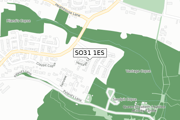
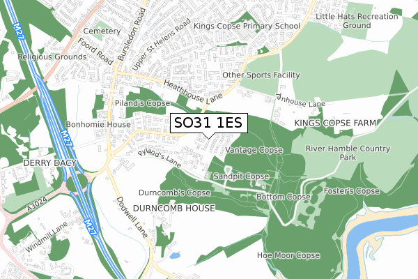
SO31 1ES is located in the Bursledon & Hound North electoral ward, within the local authority district of Eastleigh and the English Parliamentary constituency of Eastleigh. The Sub Integrated Care Board (ICB) Location is NHS Hampshire and Isle of Wight ICB - D9Y0V and the police force is Hampshire. This postcode has been in use since September 2018.


GetTheData
Source: OS Open Zoomstack (Ordnance Survey)
Licence: Open Government Licence (requires attribution)
Attribution: Contains OS data © Crown copyright and database right 2025
Source: Open Postcode Geo
Licence: Open Government Licence (requires attribution)
Attribution: Contains OS data © Crown copyright and database right 2025; Contains Royal Mail data © Royal Mail copyright and database right 2025; Source: Office for National Statistics licensed under the Open Government Licence v.3.0
| Easting | 449256 |
| Northing | 111476 |
| Latitude | 50.900658 |
| Longitude | -1.300915 |
GetTheData
Source: Open Postcode Geo
Licence: Open Government Licence
| Country | England |
| Postcode District | SO31 |
➜ See where SO31 is on a map ➜ Where is Hedge End? | |
GetTheData
Source: Land Registry Price Paid Data
Licence: Open Government Licence
| Ward | Bursledon & Hound North |
| Constituency | Eastleigh |
GetTheData
Source: ONS Postcode Database
Licence: Open Government Licence
2024 27 SEP £870,000 |
2023 26 JUL £910,000 |
2023 3 JAN £805,000 |
2022 14 NOV £957,000 |
2022 30 SEP £816,500 |
2021 8 APR £775,000 |
56, VANTAGE COPSE, BURSLEDON, SOUTHAMPTON, SO31 1ES 2021 21 JAN £737,000 |
2020 18 DEC £749,995 |
2020 17 DEC £548,000 |
52, VANTAGE COPSE, BURSLEDON, SOUTHAMPTON, SO31 1ES 2020 11 DEC £720,000 |
GetTheData
Source: HM Land Registry Price Paid Data
Licence: Contains HM Land Registry data © Crown copyright and database right 2025. This data is licensed under the Open Government Licence v3.0.
| Sherwood Avenue (Heathhouse Lane) | Hedge End | 328m |
| Sherwood Avenue (Heathhouse Lane) | Hedge End | 365m |
| Upper St Helens Road (Heathhouse Lane) | Hedge End | 564m |
| Cranbourne Park (Kings Copse Avenue) | Hedge End | 577m |
| Cranbourne Park (Kings Copse Avenue) | Hedge End | 585m |
| Bursledon Station | 1.9km |
| Botley Station | 3.4km |
| Hedge End Station | 3.5km |
GetTheData
Source: NaPTAN
Licence: Open Government Licence
| Percentage of properties with Next Generation Access | 100.0% |
| Percentage of properties with Superfast Broadband | 100.0% |
| Percentage of properties with Ultrafast Broadband | 63.8% |
| Percentage of properties with Full Fibre Broadband | 63.8% |
Superfast Broadband is between 30Mbps and 300Mbps
Ultrafast Broadband is > 300Mbps
| Percentage of properties unable to receive 2Mbps | 0.0% |
| Percentage of properties unable to receive 5Mbps | 0.0% |
| Percentage of properties unable to receive 10Mbps | 0.0% |
| Percentage of properties unable to receive 30Mbps | 0.0% |
GetTheData
Source: Ofcom
Licence: Ofcom Terms of Use (requires attribution)
GetTheData
Source: ONS Postcode Database
Licence: Open Government Licence


➜ Get more ratings from the Food Standards Agency
GetTheData
Source: Food Standards Agency
Licence: FSA terms & conditions
| Last Collection | |||
|---|---|---|---|
| Location | Mon-Fri | Sat | Distance |
| Bursledon Road | 16:45 | 08:30 | 671m |
| Lower St Helens Road | 16:45 | 09:00 | 988m |
| Alexandra Road | 16:45 | 08:00 | 1,055m |
GetTheData
Source: Dracos
Licence: Creative Commons Attribution-ShareAlike
The below table lists the International Territorial Level (ITL) codes (formerly Nomenclature of Territorial Units for Statistics (NUTS) codes) and Local Administrative Units (LAU) codes for SO31 1ES:
| ITL 1 Code | Name |
|---|---|
| TLJ | South East (England) |
| ITL 2 Code | Name |
| TLJ3 | Hampshire and Isle of Wight |
| ITL 3 Code | Name |
| TLJ35 | South Hampshire |
| LAU 1 Code | Name |
| E07000086 | Eastleigh |
GetTheData
Source: ONS Postcode Directory
Licence: Open Government Licence
The below table lists the Census Output Area (OA), Lower Layer Super Output Area (LSOA), and Middle Layer Super Output Area (MSOA) for SO31 1ES:
| Code | Name | |
|---|---|---|
| OA | E00115165 | |
| LSOA | E01022657 | Eastleigh 013D |
| MSOA | E02004724 | Eastleigh 013 |
GetTheData
Source: ONS Postcode Directory
Licence: Open Government Licence
| SO31 1BH | Pylands Lane | 229m |
| SO30 0PL | Thurmell Close | 273m |
| SO30 0PA | Cranbourne Park | 336m |
| SO30 0PN | Thurmell Walk | 344m |
| SO30 0JZ | Metuchen Way | 404m |
| SO30 0NY | Cranbourne Park | 418m |
| SO30 0LE | Heath House Lane | 428m |
| SO30 0JY | Sherwood Avenue | 471m |
| SO30 0NX | Cranbourne Park | 472m |
| SO30 0NZ | Cranbourne Park | 525m |
GetTheData
Source: Open Postcode Geo; Land Registry Price Paid Data
Licence: Open Government Licence