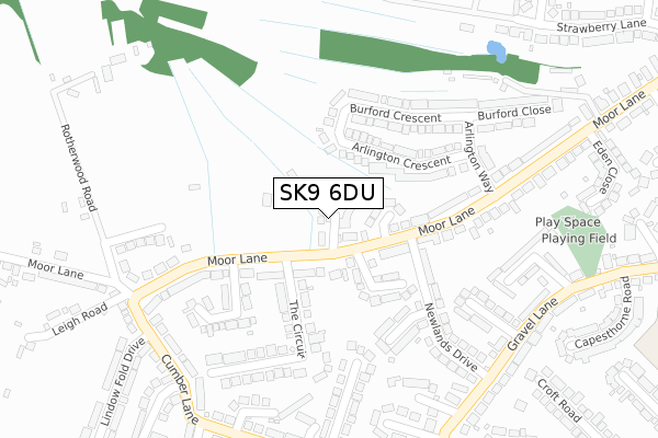
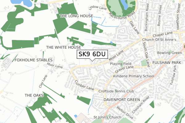
SK9 6DU is located in the Wilmslow West and Chorley electoral ward, within the unitary authority of Cheshire East and the English Parliamentary constituency of Tatton. The Sub Integrated Care Board (ICB) Location is NHS Cheshire and Merseyside ICB - 27D and the police force is Cheshire. This postcode has been in use since January 2020.


GetTheData
Source: OS Open Zoomstack (Ordnance Survey)
Licence: Open Government Licence (requires attribution)
Attribution: Contains OS data © Crown copyright and database right 2025
Source: Open Postcode Geo
Licence: Open Government Licence (requires attribution)
Attribution: Contains OS data © Crown copyright and database right 2025; Contains Royal Mail data © Royal Mail copyright and database right 2025; Source: Office for National Statistics licensed under the Open Government Licence v.3.0
| Easting | 383024 |
| Northing | 380261 |
| Latitude | 53.319017 |
| Longitude | -2.256292 |
GetTheData
Source: Open Postcode Geo
Licence: Open Government Licence
| Country | England |
| Postcode District | SK9 |
➜ See where SK9 is on a map ➜ Where is Wilmslow? | |
GetTheData
Source: Land Registry Price Paid Data
Licence: Open Government Licence
| Ward | Wilmslow West And Chorley |
| Constituency | Tatton |
GetTheData
Source: ONS Postcode Database
Licence: Open Government Licence
2024 21 AUG £775,000 |
2020 25 SEP £605,000 |
10, RIFLEMANS CLOSE, WILMSLOW, SK9 6DU 2020 28 AUG £714,995 |
8, RIFLEMANS CLOSE, WILMSLOW, SK9 6DU 2020 14 AUG £599,995 |
6, RIFLEMANS CLOSE, WILMSLOW, SK9 6DU 2020 26 JUN £505,495 |
11, RIFLEMANS CLOSE, WILMSLOW, SK9 6DU 2020 5 JUN £674,995 |
4, RIFLEMANS CLOSE, WILMSLOW, SK9 6DU 2020 27 MAR £699,995 |
9, RIFLEMANS CLOSE, WILMSLOW, SK9 6DU 2019 16 DEC £514,995 |
GetTheData
Source: HM Land Registry Price Paid Data
Licence: Contains HM Land Registry data © Crown copyright and database right 2025. This data is licensed under the Open Government Licence v3.0.
| Riflemans Arms Ph (Moor Lane) | Wilmslow | 96m |
| Riflemans Arms Ph (Moor Lane) | Wilmslow | 124m |
| Cumber Lane (Moor Lane) | Wilmslow | 258m |
| Cumber Lane (Moor Lane) | Wilmslow | 298m |
| Eden Close (Moor Lane) | Wilmslow | 302m |
| Alderley Edge Station | 2.1km |
| Wilmslow Station | 2.2km |
| Styal Station | 3.4km |
GetTheData
Source: NaPTAN
Licence: Open Government Licence
GetTheData
Source: ONS Postcode Database
Licence: Open Government Licence


➜ Get more ratings from the Food Standards Agency
GetTheData
Source: Food Standards Agency
Licence: FSA terms & conditions
| Last Collection | |||
|---|---|---|---|
| Location | Mon-Fri | Sat | Distance |
| New Street | 17:15 | 12:15 | 165m |
| Moor Lane | 17:15 | 12:15 | 333m |
| Gravel Lane | 17:15 | 12:15 | 668m |
GetTheData
Source: Dracos
Licence: Creative Commons Attribution-ShareAlike
The below table lists the International Territorial Level (ITL) codes (formerly Nomenclature of Territorial Units for Statistics (NUTS) codes) and Local Administrative Units (LAU) codes for SK9 6DU:
| ITL 1 Code | Name |
|---|---|
| TLD | North West (England) |
| ITL 2 Code | Name |
| TLD6 | Cheshire |
| ITL 3 Code | Name |
| TLD62 | Cheshire East |
| LAU 1 Code | Name |
| E06000049 | Cheshire East |
GetTheData
Source: ONS Postcode Directory
Licence: Open Government Licence
The below table lists the Census Output Area (OA), Lower Layer Super Output Area (LSOA), and Middle Layer Super Output Area (MSOA) for SK9 6DU:
| Code | Name | |
|---|---|---|
| OA | E00094146 | |
| LSOA | E01018653 | Cheshire East 008D |
| MSOA | E02003860 | Cheshire East 008 |
GetTheData
Source: ONS Postcode Directory
Licence: Open Government Licence
| SK9 6BZ | Winchester Close | 73m |
| SK9 6BH | Arlington Crescent | 117m |
| SK9 6DL | Moorfield Drive | 118m |
| SK9 6BY | Moor Lane | 138m |
| SK9 6BJ | Arlington Crescent | 149m |
| SK9 6BS | New Street | 164m |
| SK9 6BR | Moor Lane | 173m |
| SK9 6BL | Burford Crescent | 178m |
| SK9 6BN | Burford Crescent | 207m |
| SK9 6DE | Lyndhurst Close | 208m |
GetTheData
Source: Open Postcode Geo; Land Registry Price Paid Data
Licence: Open Government Licence