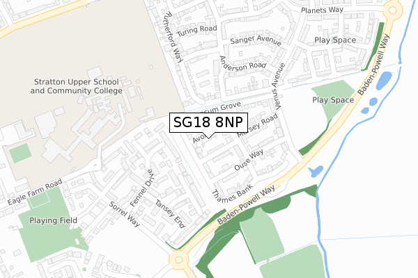
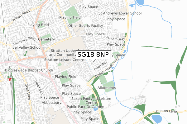
SG18 8NP is located in the Biggleswade East electoral ward, within the unitary authority of Central Bedfordshire and the English Parliamentary constituency of North East Bedfordshire. The Sub Integrated Care Board (ICB) Location is NHS Bedfordshire, Luton and Milton Keynes ICB - M1J4Y and the police force is Bedfordshire. This postcode has been in use since November 2017.


GetTheData
Source: OS Open Zoomstack (Ordnance Survey)
Licence: Open Government Licence (requires attribution)
Attribution: Contains OS data © Crown copyright and database right 2025
Source: Open Postcode Geo
Licence: Open Government Licence (requires attribution)
Attribution: Contains OS data © Crown copyright and database right 2025; Contains Royal Mail data © Royal Mail copyright and database right 2025; Source: Office for National Statistics licensed under the Open Government Licence v.3.0
| Easting | 520370 |
| Northing | 244607 |
| Latitude | 52.086746 |
| Longitude | -0.244604 |
GetTheData
Source: Open Postcode Geo
Licence: Open Government Licence
| Country | England |
| Postcode District | SG18 |
➜ See where SG18 is on a map ➜ Where is Biggleswade? | |
GetTheData
Source: Land Registry Price Paid Data
Licence: Open Government Licence
| Ward | Biggleswade East |
| Constituency | North East Bedfordshire |
GetTheData
Source: ONS Postcode Database
Licence: Open Government Licence
2023 12 DEC £450,000 |
2022 31 JAN £390,000 |
2017 30 NOV £349,950 |
8, AVON RISE, BIGGLESWADE, SG18 8NP 2017 27 NOV £347,950 |
2017 24 NOV £309,950 |
10, AVON RISE, BIGGLESWADE, SG18 8NP 2017 17 NOV £312,950 |
GetTheData
Source: HM Land Registry Price Paid Data
Licence: Contains HM Land Registry data © Crown copyright and database right 2025. This data is licensed under the Open Government Licence v3.0.
| Apollo Gardens (Venus Avenue) | Kings Reach | 332m |
| The Saxon Centre (Chambers Way) | Biggleswade | 344m |
| The Saxon Centre (Chambers Way) | Biggleswade | 421m |
| Hitchmead School (Stratton Way) | Stratton | 512m |
| Hitchmead School (Stratton Way) | Stratton | 513m |
| Biggleswade Station | 1.2km |
| Sandy Station | 4.9km |
GetTheData
Source: NaPTAN
Licence: Open Government Licence
| Percentage of properties with Next Generation Access | 100.0% |
| Percentage of properties with Superfast Broadband | 100.0% |
| Percentage of properties with Ultrafast Broadband | 100.0% |
| Percentage of properties with Full Fibre Broadband | 100.0% |
Superfast Broadband is between 30Mbps and 300Mbps
Ultrafast Broadband is > 300Mbps
| Percentage of properties unable to receive 2Mbps | 0.0% |
| Percentage of properties unable to receive 5Mbps | 0.0% |
| Percentage of properties unable to receive 10Mbps | 0.0% |
| Percentage of properties unable to receive 30Mbps | 0.0% |
GetTheData
Source: Ofcom
Licence: Ofcom Terms of Use (requires attribution)
GetTheData
Source: ONS Postcode Database
Licence: Open Government Licence


➜ Get more ratings from the Food Standards Agency
GetTheData
Source: Food Standards Agency
Licence: FSA terms & conditions
| Last Collection | |||
|---|---|---|---|
| Location | Mon-Fri | Sat | Distance |
| Swanbourne Close | 17:15 | 11:00 | 632m |
| Chambers Way | 17:30 | 11:00 | 685m |
| The Baulk | 17:15 | 11:00 | 737m |
GetTheData
Source: Dracos
Licence: Creative Commons Attribution-ShareAlike
The below table lists the International Territorial Level (ITL) codes (formerly Nomenclature of Territorial Units for Statistics (NUTS) codes) and Local Administrative Units (LAU) codes for SG18 8NP:
| ITL 1 Code | Name |
|---|---|
| TLH | East |
| ITL 2 Code | Name |
| TLH2 | Bedfordshire and Hertfordshire |
| ITL 3 Code | Name |
| TLH25 | Central Bedfordshire |
| LAU 1 Code | Name |
| E06000056 | Central Bedfordshire |
GetTheData
Source: ONS Postcode Directory
Licence: Open Government Licence
The below table lists the Census Output Area (OA), Lower Layer Super Output Area (LSOA), and Middle Layer Super Output Area (MSOA) for SG18 8NP:
| Code | Name | |
|---|---|---|
| OA | E00087828 | |
| LSOA | E01017389 | Central Bedfordshire 006C |
| MSOA | E02003604 | Central Bedfordshire 006 |
GetTheData
Source: ONS Postcode Directory
Licence: Open Government Licence
| SG18 8GF | Whittle Drive | 133m |
| SG18 8FZ | Gilbert Avenue | 136m |
| SG18 8WH | Sage Close | 141m |
| SG18 8WD | Fennel Drive | 148m |
| SG18 8FX | Anderson Road | 193m |
| SG18 8WL | Tansey End | 219m |
| SG18 8FJ | Venus Avenue | 244m |
| SG18 8WJ | Chervil Close | 247m |
| SG18 8GB | Turing Road | 257m |
| SG18 8FY | Sanger Avenue | 261m |
GetTheData
Source: Open Postcode Geo; Land Registry Price Paid Data
Licence: Open Government Licence