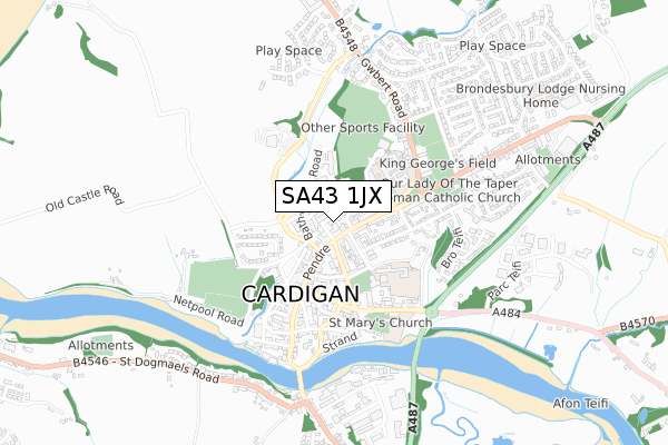
SA43 1JX is located in the Mwldan electoral ward, within the unitary authority of Ceredigion and the Welsh Parliamentary constituency of Ceredigion. The Local Health Board is Hywel Dda University and the police force is Dyfed-Powys. This postcode has been in use since July 2019.


GetTheData
Source: OS Open Zoomstack (Ordnance Survey)
Licence: Open Government Licence (requires attribution)
Attribution: Contains OS data © Crown copyright and database right 2024
Source: Open Postcode Geo
Licence: Open Government Licence (requires attribution)
Attribution: Contains OS data © Crown copyright and database right 2024; Contains Royal Mail data © Royal Mail copyright and database right 2024; Source: Office for National Statistics licensed under the Open Government Licence v.3.0
| Easting | 217671 |
| Northing | 246717 |
| Latitude | 52.088702 |
| Longitude | -4.662754 |
GetTheData
Source: Open Postcode Geo
Licence: Open Government Licence
| Country | Wales |
| Postcode District | SA43 |
➜ See where SA43 is on a map | |
GetTheData
Source: Land Registry Price Paid Data
Licence: Open Government Licence
| Ward | Mwldan |
| Constituency | Ceredigion |
GetTheData
Source: ONS Postcode Database
Licence: Open Government Licence
| Melin-y-dre (Gwbert Road) | Cardigan | 466m |
| Commercial Hotel (Pendre) | Cardigan | 506m |
| Ship Inn (Pendre) | Cardigan | 545m |
| Secondary School (Grounds) | Cardigan | 546m |
| Primary School (Williams Terrace) | Cardigan | 591m |
GetTheData
Source: NaPTAN
Licence: Open Government Licence
GetTheData
Source: ONS Postcode Database
Licence: Open Government Licence


➜ Get more ratings from the Food Standards Agency
GetTheData
Source: Food Standards Agency
Licence: FSA terms & conditions
| Last Collection | |||
|---|---|---|---|
| Location | Mon-Fri | Sat | Distance |
| Feidr Fair (Mapstone) | 16:30 | 12:30 | 444m |
| Cardigan Delivery Office | 17:15 | 13:00 | 935m |
| Cardigan P O | 17:00 | 12:15 | 941m |
GetTheData
Source: Dracos
Licence: Creative Commons Attribution-ShareAlike
The below table lists the International Territorial Level (ITL) codes (formerly Nomenclature of Territorial Units for Statistics (NUTS) codes) and Local Administrative Units (LAU) codes for SA43 1JX:
| ITL 1 Code | Name |
|---|---|
| TLL | Wales |
| ITL 2 Code | Name |
| TLL1 | West Wales and The Valleys |
| ITL 3 Code | Name |
| TLL14 | South West Wales |
| LAU 1 Code | Name |
| W06000008 | Ceredigion |
GetTheData
Source: ONS Postcode Directory
Licence: Open Government Licence
The below table lists the Census Output Area (OA), Lower Layer Super Output Area (LSOA), and Middle Layer Super Output Area (MSOA) for SA43 1JX:
| Code | Name | |
|---|---|---|
| OA | W00002719 | |
| LSOA | W01000509 | Ceredigion 009C |
| MSOA | W02000124 | Ceredigion 009 |
GetTheData
Source: ONS Postcode Directory
Licence: Open Government Licence
| SA43 1JY | Bath House Road | 344m |
| SA43 1EN | Clos Llyn Y Felin | 383m |
| SA43 1LD | Bron Y Dre | 391m |
| SA43 1PE | Maesydderwen | 418m |
| SA43 1JU | Pendre | 426m |
| SA43 1JT | Pendre | 428m |
| SA43 1AF | Gwbert Road | 448m |
| SA43 1LA | Pendre | 452m |
| SA43 1LB | Greenfield Row | 452m |
| SA43 1AA | North Road | 465m |
GetTheData
Source: Open Postcode Geo; Land Registry Price Paid Data
Licence: Open Government Licence