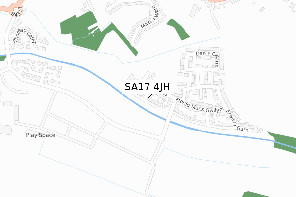
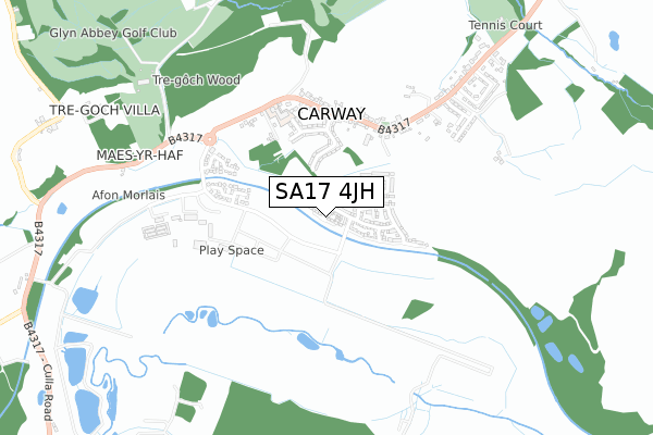
SA17 4JH is located in the Llangyndeyrn electoral ward, within the unitary authority of Carmarthenshire and the Welsh Parliamentary constituency of Carmarthen East and Dinefwr. The Local Health Board is Hywel Dda University and the police force is Dyfed-Powys. This postcode has been in use since February 2020.


GetTheData
Source: OS Open Zoomstack (Ordnance Survey)
Licence: Open Government Licence (requires attribution)
Attribution: Contains OS data © Crown copyright and database right 2025
Source: Open Postcode Geo
Licence: Open Government Licence (requires attribution)
Attribution: Contains OS data © Crown copyright and database right 2025; Contains Royal Mail data © Royal Mail copyright and database right 2025; Source: Office for National Statistics licensed under the Open Government Licence v.3.0
| Easting | 246194 |
| Northing | 206185 |
| Latitude | 51.733223 |
| Longitude | -4.228692 |
GetTheData
Source: Open Postcode Geo
Licence: Open Government Licence
| Country | Wales |
| Postcode District | SA17 |
➜ See where SA17 is on a map ➜ Where is Carway? | |
GetTheData
Source: Land Registry Price Paid Data
Licence: Open Government Licence
| Ward | Llangyndeyrn |
| Constituency | Carmarthen East And Dinefwr |
GetTheData
Source: ONS Postcode Database
Licence: Open Government Licence
2024 8 MAR £215,000 |
2023 23 AUG £223,750 |
2, CLOS Y NANT, CARWAY, KIDWELLY, SA17 4JH 2020 11 AUG £159,995 |
10, CLOS Y NANT, CARWAY, KIDWELLY, SA17 4JH 2020 24 JUL £159,995 |
12, CLOS Y NANT, CARWAY, KIDWELLY, SA17 4JH 2020 30 JUN £202,495 |
2020 26 JUN £159,995 |
5, CLOS Y NANT, CARWAY, KIDWELLY, SA17 4JH 2020 22 APR £201,995 |
2020 9 APR £156,500 |
1, CLOS Y NANT, CARWAY, KIDWELLY, SA17 4JH 2020 28 FEB £159,995 |
GetTheData
Source: HM Land Registry Price Paid Data
Licence: Contains HM Land Registry data © Crown copyright and database right 2025. This data is licensed under the Open Government Licence v3.0.
| Post Office (B4317) | Carway | 389m |
| Capel Bethel (B4317) | Carway | 396m |
| Post Office (B4317) | Carway | 406m |
| School (B4317) | Carway | 480m |
| School (B4317) | Carway | 488m |
GetTheData
Source: NaPTAN
Licence: Open Government Licence
GetTheData
Source: ONS Postcode Database
Licence: Open Government Licence


➜ Get more ratings from the Food Standards Agency
GetTheData
Source: Food Standards Agency
Licence: FSA terms & conditions
| Last Collection | |||
|---|---|---|---|
| Location | Mon-Fri | Sat | Distance |
| Five Roads Post Office | 15:45 | 11:30 | 2,779m |
| Horeb | 09:00 | 07:45 | 3,572m |
| Achddu Post Office | 17:00 | 11:30 | 4,949m |
GetTheData
Source: Dracos
Licence: Creative Commons Attribution-ShareAlike
The below table lists the International Territorial Level (ITL) codes (formerly Nomenclature of Territorial Units for Statistics (NUTS) codes) and Local Administrative Units (LAU) codes for SA17 4JH:
| ITL 1 Code | Name |
|---|---|
| TLL | Wales |
| ITL 2 Code | Name |
| TLL1 | West Wales and The Valleys |
| ITL 3 Code | Name |
| TLL14 | South West Wales |
| LAU 1 Code | Name |
| W06000010 | Carmarthenshire |
GetTheData
Source: ONS Postcode Directory
Licence: Open Government Licence
The below table lists the Census Output Area (OA), Lower Layer Super Output Area (LSOA), and Middle Layer Super Output Area (MSOA) for SA17 4JH:
| Code | Name | |
|---|---|---|
| OA | W00003740 | |
| LSOA | W01000695 | Carmarthenshire 012B |
| MSOA | W02000153 | Carmarthenshire 012 |
GetTheData
Source: ONS Postcode Directory
Licence: Open Government Licence
| SA17 4HJ | Heol Dyffryn Aur | 100m |
| SA17 4HY | Heol Waungron | 159m |
| SA17 4AX | Ffordd Maes Gwilym | 199m |
| SA17 4HX | Allt Y Sgrech | 225m |
| SA17 4HF | Maes Y Wern | 270m |
| SA17 4JB | Erwau'r Garn | 285m |
| SA17 4HG | Maes Y Wern | 355m |
| SA17 4GH | Heol Waunhir | 374m |
| SA17 4HH | 381m | |
| SA17 4HL | 390m |
GetTheData
Source: Open Postcode Geo; Land Registry Price Paid Data
Licence: Open Government Licence