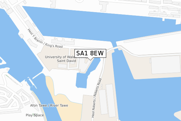
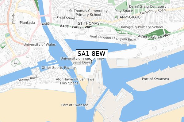
SA1 8EW is located in the Waterfront electoral ward, within the unitary authority of Swansea and the Welsh Parliamentary constituency of Swansea East. The Local Health Board is Swansea Bay University and the police force is South Wales. This postcode has been in use since August 2018.


GetTheData
Source: OS Open Zoomstack (Ordnance Survey)
Licence: Open Government Licence (requires attribution)
Attribution: Contains OS data © Crown copyright and database right 2025
Source: Open Postcode Geo
Licence: Open Government Licence (requires attribution)
Attribution: Contains OS data © Crown copyright and database right 2025; Contains Royal Mail data © Royal Mail copyright and database right 2025; Source: Office for National Statistics licensed under the Open Government Licence v.3.0
| Easting | 266789 |
| Northing | 192704 |
| Latitude | 51.617356 |
| Longitude | -3.925500 |
GetTheData
Source: Open Postcode Geo
Licence: Open Government Licence
| Country | Wales |
| Postcode District | SA1 |
➜ See where SA1 is on a map ➜ Where is Swansea? | |
GetTheData
Source: Land Registry Price Paid Data
Licence: Open Government Licence
| Ward | Waterfront |
| Constituency | Swansea East |
GetTheData
Source: ONS Postcode Database
Licence: Open Government Licence
| Sa1 (Heol Langdon) | St Thomas | 421m |
| Prince Of Wales Dock (Langdon Road) | Swansea Ferry Terminal | 475m |
| Sa1 (Langdon Road) | St Thomas | 486m |
| Old Police Station (Fabian Way) | Port Tennant | 491m |
| Swansea Marina (Trawler Road) | Pentre Guinea | 492m |
| Swansea Station | 1.4km |
| Llansamlet Station | 5.7km |
GetTheData
Source: NaPTAN
Licence: Open Government Licence
GetTheData
Source: ONS Postcode Database
Licence: Open Government Licence


➜ Get more ratings from the Food Standards Agency
GetTheData
Source: Food Standards Agency
Licence: FSA terms & conditions
| Last Collection | |||
|---|---|---|---|
| Location | Mon-Fri | Sat | Distance |
| Ferrara Quay | 18:00 | 10:15 | 644m |
| Cambrian Place | 18:15 | 10:30 | 790m |
| Danygraig Cemetery | 18:15 | 12:00 | 1,260m |
GetTheData
Source: Dracos
Licence: Creative Commons Attribution-ShareAlike
The below table lists the International Territorial Level (ITL) codes (formerly Nomenclature of Territorial Units for Statistics (NUTS) codes) and Local Administrative Units (LAU) codes for SA1 8EW:
| ITL 1 Code | Name |
|---|---|
| TLL | Wales |
| ITL 2 Code | Name |
| TLL1 | West Wales and The Valleys |
| ITL 3 Code | Name |
| TLL18 | Swansea |
| LAU 1 Code | Name |
| W06000011 | Swansea |
GetTheData
Source: ONS Postcode Directory
Licence: Open Government Licence
The below table lists the Census Output Area (OA), Lower Layer Super Output Area (LSOA), and Middle Layer Super Output Area (MSOA) for SA1 8EW:
| Code | Name | |
|---|---|---|
| OA | W00010245 | |
| LSOA | W01000850 | Swansea 021B |
| MSOA | W02000188 | Swansea 021 |
GetTheData
Source: ONS Postcode Directory
Licence: Open Government Licence
| SA1 8AL | Kings Road | 145m |
| SA1 8AJ | Kings Road | 182m |
| SA1 8AH | Kings Road | 221m |
| SA1 8QY | Langdon Road | 365m |
| SA1 8PP | Kings Road | 369m |
| SA1 8PY | Kings Road | 369m |
| SA1 1FY | Trawler Road | 399m |
| SA1 1FZ | Trawler Road | 425m |
| SA1 8QS | Lamberts Road | 428m |
| SA1 8RA | Emily Court | 445m |
GetTheData
Source: Open Postcode Geo; Land Registry Price Paid Data
Licence: Open Government Licence