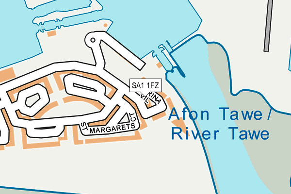
SA1 1FZ lies on Trawler Road in Maritime Quarter, Swansea. SA1 1FZ is located in the Waterfront electoral ward, within the unitary authority of Swansea and the Welsh Parliamentary constituency of Swansea West. The Local Health Board is Swansea Bay University and the police force is South Wales. This postcode has been in use since May 2010.


GetTheData
Source: OS OpenMap – Local (Ordnance Survey)
Source: OS VectorMap District (Ordnance Survey)
Licence: Open Government Licence (requires attribution)
| Easting | 266413 |
| Northing | 192505 |
| Latitude | 51.615474 |
| Longitude | -3.930834 |
GetTheData
Source: Open Postcode Geo
Licence: Open Government Licence
| Street | Trawler Road |
| Locality | Maritime Quarter |
| Town/City | Swansea |
| Country | Wales |
| Postcode District | SA1 |
➜ See where SA1 is on a map ➜ Where is Swansea? | |
GetTheData
Source: Land Registry Price Paid Data
Licence: Open Government Licence
Elevation or altitude of SA1 1FZ as distance above sea level:
| Metres | Feet | |
|---|---|---|
| Elevation | 10m | 33ft |
Elevation is measured from the approximate centre of the postcode, to the nearest point on an OS contour line from OS Terrain 50, which has contour spacing of ten vertical metres.
➜ How high above sea level am I? Find the elevation of your current position using your device's GPS.
GetTheData
Source: Open Postcode Elevation
Licence: Open Government Licence
| Ward | Waterfront |
| Constituency | Swansea West |
GetTheData
Source: ONS Postcode Database
Licence: Open Government Licence
2014 27 JUN £287,500 |
31, MARINA VILLAS, TRAWLER ROAD, MARITIME QUARTER, SWANSEA, SA1 1FZ 2011 31 MAR £350,000 |
2010 30 SEP £325,000 |
GetTheData
Source: HM Land Registry Price Paid Data
Licence: Contains HM Land Registry data © Crown copyright and database right 2024. This data is licensed under the Open Government Licence v3.0.
| Swansea Marina (Trawler Road) | Pentre Guinea | 137m |
| Ferrara Square (Trawler Road) | Swansea | 398m |
| Ferrara Square (Trawler Road) | Maritime Quarter And Marina | 457m |
| Environment Centre (Somerset Place) | Swansea | 524m |
| Prince Of Wales Dock (Langdon Road) | Swansea Ferry Terminal | 555m |
| Swansea Station | 1.3km |
GetTheData
Source: NaPTAN
Licence: Open Government Licence
| Percentage of properties with Next Generation Access | 100.0% |
| Percentage of properties with Superfast Broadband | 100.0% |
| Percentage of properties with Ultrafast Broadband | 100.0% |
| Percentage of properties with Full Fibre Broadband | 100.0% |
Superfast Broadband is between 30Mbps and 300Mbps
Ultrafast Broadband is > 300Mbps
| Median download speed | 40.0Mbps |
| Average download speed | 41.4Mbps |
| Maximum download speed | 80.00Mbps |
| Median upload speed | 10.0Mbps |
| Average upload speed | 10.7Mbps |
| Maximum upload speed | 20.00Mbps |
| Percentage of properties unable to receive 2Mbps | 0.0% |
| Percentage of properties unable to receive 5Mbps | 0.0% |
| Percentage of properties unable to receive 10Mbps | 0.0% |
| Percentage of properties unable to receive 30Mbps | 0.0% |
GetTheData
Source: Ofcom
Licence: Ofcom Terms of Use (requires attribution)
Estimated total energy consumption in SA1 1FZ by fuel type, 2015.
| Consumption (kWh) | 220,463 |
|---|---|
| Meter count | 23 |
| Mean (kWh/meter) | 9,585 |
| Median (kWh/meter) | 9,405 |
| Consumption (kWh) | 140,371 |
|---|---|
| Meter count | 43 |
| Mean (kWh/meter) | 3,264 |
| Median (kWh/meter) | 2,554 |
GetTheData
Source: Postcode level gas estimates: 2015 (experimental)
Source: Postcode level electricity estimates: 2015 (experimental)
Licence: Open Government Licence
GetTheData
Source: ONS Postcode Database
Licence: Open Government Licence


➜ Get more ratings from the Food Standards Agency
GetTheData
Source: Food Standards Agency
Licence: FSA terms & conditions
| Last Collection | |||
|---|---|---|---|
| Location | Mon-Fri | Sat | Distance |
| Ferrara Quay | 18:00 | 10:15 | 231m |
| Cambrian Place | 18:15 | 10:30 | 489m |
| Arethusa Quay | 18:00 | 10:15 | 940m |
GetTheData
Source: Dracos
Licence: Creative Commons Attribution-ShareAlike
The below table lists the International Territorial Level (ITL) codes (formerly Nomenclature of Territorial Units for Statistics (NUTS) codes) and Local Administrative Units (LAU) codes for SA1 1FZ:
| ITL 1 Code | Name |
|---|---|
| TLL | Wales |
| ITL 2 Code | Name |
| TLL1 | West Wales and The Valleys |
| ITL 3 Code | Name |
| TLL18 | Swansea |
| LAU 1 Code | Name |
| W06000011 | Swansea |
GetTheData
Source: ONS Postcode Directory
Licence: Open Government Licence
The below table lists the Census Output Area (OA), Lower Layer Super Output Area (LSOA), and Middle Layer Super Output Area (MSOA) for SA1 1FZ:
| Code | Name | |
|---|---|---|
| OA | W00010093 | |
| LSOA | W01001958 | Swansea 025H |
| MSOA | W02000192 | Swansea 025 |
GetTheData
Source: ONS Postcode Directory
Licence: Open Government Licence
| SA1 1FY | Trawler Road | 92m |
| SA1 1RZ | 95m | |
| SA1 1SG | St Stephens Court | 112m |
| SA1 1AZ | St Margaret's Court | 120m |
| SA1 1JZ | 168m | |
| SA1 1SA | St Stephens Court | 176m |
| SA1 1SU | Fishermans Way | 244m |
| SA1 1SD | St Catherines Court | 246m |
| SA1 3XL | Pocketts Wharf | 300m |
| SA1 1UD | St Christophers Court | 339m |
GetTheData
Source: Open Postcode Geo; Land Registry Price Paid Data
Licence: Open Government Licence